PTV releases urban mobility analysis tool

PTV Group has released a data analysis tool which it says will help planners to better understand how transport works in their city.
By Adam Hill May 1, 2020 Read time: 1 min
The PTV solution allows planners to visualise mobility use (© Ded Mityay | Dreamstime.com)

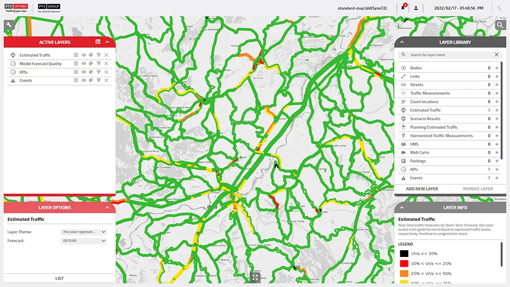
Different kind of questions and scenarios can be evaluated using City in Motion, PTV says, with relevant mobility parameters visualised on digital maps. 

For instance, heat maps can show traffic volume across an entire route network, while an illustration of trip numbers highlights shared mobility options, with parking availability and e-scooter locations.

It also shows how travel demand fluctuates at different times of day or in different areas.

PTV says that policymakers can easily model the effect of interventions such as clear-air zones, parking restritions or street closures, thus allowing them to better plan.

The solution uses artificial intelligence and historical data to forecast transport demand.

“Data-driven analysis and visualisation provide the transparency to identify mobility problems and develop appropriate measures,” says PTV CEO Christian Haas. 

“This is a strong tool that will support city initiatives on their way to a smart and sustainable mobility of the future.”

For more information on companies in this article

Related Content

  • Arup’s vision of urban mobility in 2050
    May 6, 2015
    Arup’s vision of the Future of Highways considers a wide range of factors that will impact on mobility towards the middle of the century. In its consideration of the Future of Highways through to 2050, international consultants Arup has taken a broad and pragmatic view of where society is heading and the effects that will have on the transport requirements. In terms of major drivers it not only cites
  • EarthSense Systems reveals cleaner air routes in city-wide project
    October 13, 2017
    A project has been launched to produce city-wide visualisations of air quality through combining EarthSense Systems' (ESS) ordnance survey (OS) geospatial data and real-time air quality data. The technology, a joint venture between Bluesky and University of Leicester, is being used to highlight areas of higher pollution and allows users to identify cleaner air routes such as parks or canal routes. ESS captures measurements on air quality through using a zephyr sensor and a city-wide network of sensors.
  • PTV helps cities improve flow
    March 7, 2022
    PTV, the market leader for mobility software will be presenting its latest solutions for analysing, evaluating, and visualising data and its state-of-the-art tools for shaping and operating sustainable, safe, and efficient mobility.
  • How technology is propelling the development of urban shared transport
    April 11, 2024
    Over 18 million people use ride-hailing apps in the UK alone, says Mariusz Zabrocki of Freenow