Indiana helps disabled bus riders plan ahead

Transit Map includes pavement measurements and kerb types for wheelchair access
By Ben Spencer June 2, 2021 Read time: 2 mins
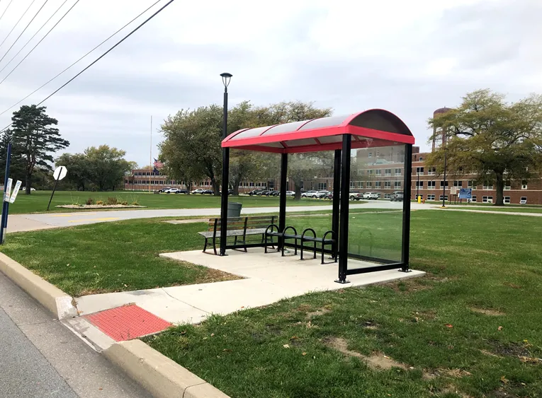
Online map will help disabled riders determine the accessibility of every bus stop in the region (image credit: NIRPC)

The Northwestern Indiana Regional Planning Commission (NIRPC) has released an online map to help disabled riders determine the accessibility of every bus stop in the region. 

The NIRPC recognises that small challenges for disabled riders like the size of a doorway or the softness of the gravel at a bus stop “can throw a wrench in their plans”.

The Northwest Indiana Transit Map provides Google Map directions to the location of a stop, photos and a physical description. It also includes pavement measurements, kerb types for wheelchair access, and amenities like covered or heated structures and the proximity to nearby bus routes in the counties of Lake, Porter and La Porte. 

The map also provides information on the presence of a shelter, the interior space available and the width of its entryway. 

Other details contained within the map include connections to adjacent transportation such as a bus route or train station within two blocks of the bus stop and connections like park and ride and transit facilities.

Kevin Polette, technical assistant with NIRPC, says: “The Northwest Indiana Transit Map is a place to view all bus stops from every transit agency in Northwest Indiana."

"We collected data on every stop, with pictures and the conditions of the bus stops. While collecting the data, we were also able to take public comments from the riders about the bus stops and routes.”

The NIRPC passed public feedback about the bus stops on to transit operators. 

The commission's urban planners hope the map will contribute to municipal and county transportation planning and will influence the decisions of municipal transit operators.

For more information on companies in this article

Related Content

  • Optibus optimises Poland buses 
    February 15, 2022
    Mobilis will use Optibus platform to modernise schedules and route planning in Polish cities
  • Intertraffic Amsterdam 2024: Smart, safe & sustainable mobility for all
    April 4, 2024
    Intertraffic Amsterdam 2024 is the place where the movers and shakers of the global ITS industry will gather from 16-19 April. With emphasis on climate, artificial intelligence – and even drones – this edition has something for everyone in the transportation sector…
  • After two decades of research, ITS is getting into its stride
    June 4, 2015
    Colin Sowman gets the global view on how ITS has shaped the way we travel today and what will shape the way we travel tomorrow. Over the past two decades the scope and spread of intelligent transport systems has grown and diversified to encompass all modes of travel while at the same time integrating and consolidating. Two decades ago the idea of detecting cyclists or pedestrians may have been considered impossible and why would you want to do that anyway? Today cyclists can account for a significant propor
  • ATS study finds school bus stop arm cameras effective in reducing violations
    July 4, 2014
    Analysis carried out by American Traffic Systems (ATS) on routes where its CrossingGuard school bus stop arm cameras are installed found that, while the number of violations on those routes fell by more than 15 per cent during the school year, customers have reported stop arm running violation decreases fleet wide, on all buses. The analysis also finds that less than one per cent of drivers who receive one ticket get a second citation. Both results indicate the camera safety programs are off to a quick