Indiana helps disabled bus riders plan ahead

Transit Map includes pavement measurements and kerb types for wheelchair access
By Ben Spencer June 2, 2021 Read time: 2 mins
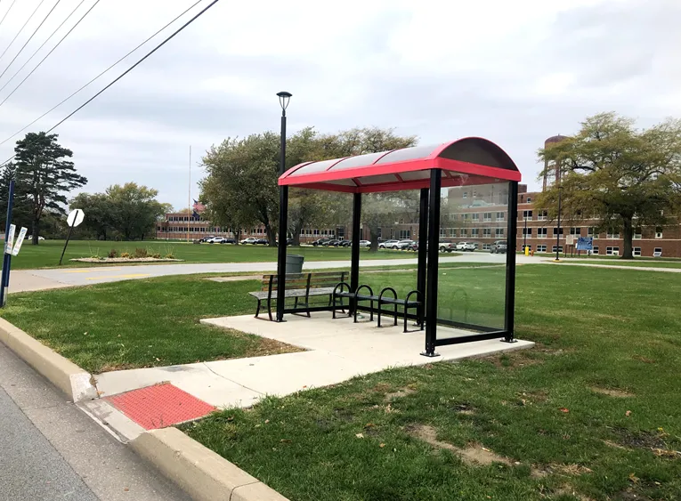
Online map will help disabled riders determine the accessibility of every bus stop in the region (image credit: NIRPC)

The Northwestern Indiana Regional Planning Commission (NIRPC) has released an online map to help disabled riders determine the accessibility of every bus stop in the region. 

The NIRPC recognises that small challenges for disabled riders like the size of a doorway or the softness of the gravel at a bus stop “can throw a wrench in their plans”.

The Northwest Indiana Transit Map provides Google Map directions to the location of a stop, photos and a physical description. It also includes pavement measurements, kerb types for wheelchair access, and amenities like covered or heated structures and the proximity to nearby bus routes in the counties of Lake, Porter and La Porte. 

The map also provides information on the presence of a shelter, the interior space available and the width of its entryway. 

Other details contained within the map include connections to adjacent transportation such as a bus route or train station within two blocks of the bus stop and connections like park and ride and transit facilities.

Kevin Polette, technical assistant with NIRPC, says: “The Northwest Indiana Transit Map is a place to view all bus stops from every transit agency in Northwest Indiana."

"We collected data on every stop, with pictures and the conditions of the bus stops. While collecting the data, we were also able to take public comments from the riders about the bus stops and routes.”

The NIRPC passed public feedback about the bus stops on to transit operators. 

The commission's urban planners hope the map will contribute to municipal and county transportation planning and will influence the decisions of municipal transit operators.

For more information on companies in this article

Related Content

  • AI is creating road maintenance savings
    July 30, 2021
    Artificial intelligence is starting to create savings for hard-pressed local authorities when it comes to road maintenance. David Crawford reviews recent advances in cost and performance control
  • West Midlands pilots the UK’s first MaaS
    November 14, 2017
    Mobility-as-a-Service is being piloted in the UK’s second largest metropolitan area and will shortly be opened to the travelling public. A fully operational Mobility-as-a-Service (MaaS) offering is being piloted in the West Midlands region of the UK. Covering seven local authorities which make up the West Midlands metropolitan area and population of 2.8 million, the service is being provided through a memorandum of understanding (MOU) between Transport for West Midlands (TfWM), Finnish company MaaS Global
  • OCTA launches on-demand microtransit service
    November 16, 2018
    The Orange County Transportation Authority (OCTA) has launched an on-demand microtransit programme to help better match public transit services with how commuters want to travel. The one-year pilot, called OC Flex, will allow riders to take an eight-person shuttle between two zones – one in Huntington Beach and the northern city of Westminster and the other in three cities: Mission Viejo, Aliso Viejo and Laguna Niguel. Lisa Bartlett, OCTA chairwoman, says: "We hope that this innovative alternative will h
  • Bolt cracks down on tandem riding in Berlin
    January 17, 2022
    Bird is also testing a skid braking prevention system in the German capital