Indiana helps disabled bus riders plan ahead

Transit Map includes pavement measurements and kerb types for wheelchair access
By Ben Spencer June 2, 2021 Read time: 2 mins
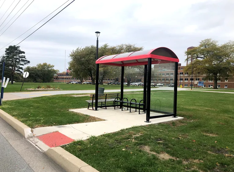
Online map will help disabled riders determine the accessibility of every bus stop in the region (image credit: NIRPC)

The Northwestern Indiana Regional Planning Commission (NIRPC) has released an online map to help disabled riders determine the accessibility of every bus stop in the region. 

The NIRPC recognises that small challenges for disabled riders like the size of a doorway or the softness of the gravel at a bus stop “can throw a wrench in their plans”.

The Northwest Indiana Transit Map provides Google Map directions to the location of a stop, photos and a physical description. It also includes pavement measurements, kerb types for wheelchair access, and amenities like covered or heated structures and the proximity to nearby bus routes in the counties of Lake, Porter and La Porte. 

The map also provides information on the presence of a shelter, the interior space available and the width of its entryway. 

Other details contained within the map include connections to adjacent transportation such as a bus route or train station within two blocks of the bus stop and connections like park and ride and transit facilities.

Kevin Polette, technical assistant with NIRPC, says: “The Northwest Indiana Transit Map is a place to view all bus stops from every transit agency in Northwest Indiana."

"We collected data on every stop, with pictures and the conditions of the bus stops. While collecting the data, we were also able to take public comments from the riders about the bus stops and routes.”

The NIRPC passed public feedback about the bus stops on to transit operators. 

The commission's urban planners hope the map will contribute to municipal and county transportation planning and will influence the decisions of municipal transit operators.

For more information on companies in this article

Related Content

  • Open data gives new lease of life to public travel information screens
    March 4, 2014
    David Crawford finds resurgent interest in travel information screens for buildings. With city governments worldwide increasingly opening up and sharing their public transport data for general use, attention is focusing on the potential financial benefits – to transit operators and businesses more widely. Professor Stephen Goldsmith, who directs the US’ Harvard University’s Data-Smart City Solutions Project says: “Amid nationwide public-sector budget cuts, open data is providing a road map for improving tra
  • Michigan to develop electrified roadway
    October 1, 2021
    MDoT has released RfP to implement the pilot along a one-mile stretch of roadway 
  • LiDAR sets its sights on future problems
    February 23, 2017
    AAdvances in LiDAR are helping transport authorities improve services and identify potential problem areas, as geospatial technology expert Dr Neil Slatcher explains. The effects of climate change on the transport infrastructure have long been a cause of concern within the transportation sector - and not only on the structures themselves but also on the surrounding areas. This year, those concerns have become reality with landslides, structural collapses and surfacing issues impacting services across the wo
  • Syracuse models post-industrial revival for US cities
    August 13, 2015
    A connective corridor in Syracuse, New York State, could be a model for other post-industrial cities, as David Crawford discovers. The aim of the city of Syracuse’ 5.6km-long Connective Corridor in Onandaga County in upstate New York is to create a model ‘complete street’ for use in wider regeneration schemes. Key transport-sector components are traffic calming, high-quality transit with accessible passenger information, plus walkability and bike-friendliness.