Indiana helps disabled bus riders plan ahead

Transit Map includes pavement measurements and kerb types for wheelchair access
By Ben Spencer June 2, 2021 Read time: 2 mins
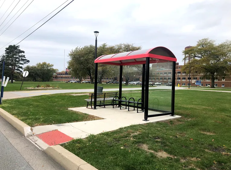
Online map will help disabled riders determine the accessibility of every bus stop in the region (image credit: NIRPC)

The Northwestern Indiana Regional Planning Commission (NIRPC) has released an online map to help disabled riders determine the accessibility of every bus stop in the region. 

The NIRPC recognises that small challenges for disabled riders like the size of a doorway or the softness of the gravel at a bus stop “can throw a wrench in their plans”.

The Northwest Indiana Transit Map provides Google Map directions to the location of a stop, photos and a physical description. It also includes pavement measurements, kerb types for wheelchair access, and amenities like covered or heated structures and the proximity to nearby bus routes in the counties of Lake, Porter and La Porte. 

The map also provides information on the presence of a shelter, the interior space available and the width of its entryway. 

Other details contained within the map include connections to adjacent transportation such as a bus route or train station within two blocks of the bus stop and connections like park and ride and transit facilities.

Kevin Polette, technical assistant with NIRPC, says: “The Northwest Indiana Transit Map is a place to view all bus stops from every transit agency in Northwest Indiana."

"We collected data on every stop, with pictures and the conditions of the bus stops. While collecting the data, we were also able to take public comments from the riders about the bus stops and routes.”

The NIRPC passed public feedback about the bus stops on to transit operators. 

The commission's urban planners hope the map will contribute to municipal and county transportation planning and will influence the decisions of municipal transit operators.

For more information on companies in this article

Related Content

  • Lime increases modal options with e-mopeds 
    February 4, 2021
    Micromobility provider says vehicles can travel up to 87 miles on a single charge
  • Countering truckers’ parking conundrum
    May 3, 2017
    Colin Sowman hears about a new truck parking information system being piloted across eight states. Legislation limits truck drivers’ hours with the result that they are often caught in a situation where they need to stop either for a break or an overnight rest. But as truck parking is in short supply, truck drivers spend an average of 56 minutes a day searching for available spaces and are often faced with the choice of driving beyond their permitted hours or parking illegally.
  • Florida’s Altamonte Springs uses Uber pilot program with Uber to expand transportation coverage
    April 5, 2017
    To Uber or Not to Uber, that is the question cities must answer as they consider the pros and cons of inviting private transportation service providers to fill transportation gaps. Back in 1999, Frank Martz, city manager of Altamonte Springs, Florida, had an idea to expand transportation services to areas not covered by the local bus company.
  • Google AV in collision with public transit bus
    March 1, 2016
    According to a report made by Google to the Department of Motor Vehicles (DMV), one of its autonomous vehicles (AV) has been in collision with a municipal bus in California. The crash happened on Valentine’s Day, when the Lexus RX-450H was travelling in autonomous mode in the right-hand lane approaching an intersection. It moved to the far right lane to make a right turn, but stopped when it detected sand bags sitting around a storm drain and blocking its path.