Indiana helps disabled bus riders plan ahead

Transit Map includes pavement measurements and kerb types for wheelchair access
By Ben Spencer June 2, 2021 Read time: 2 mins
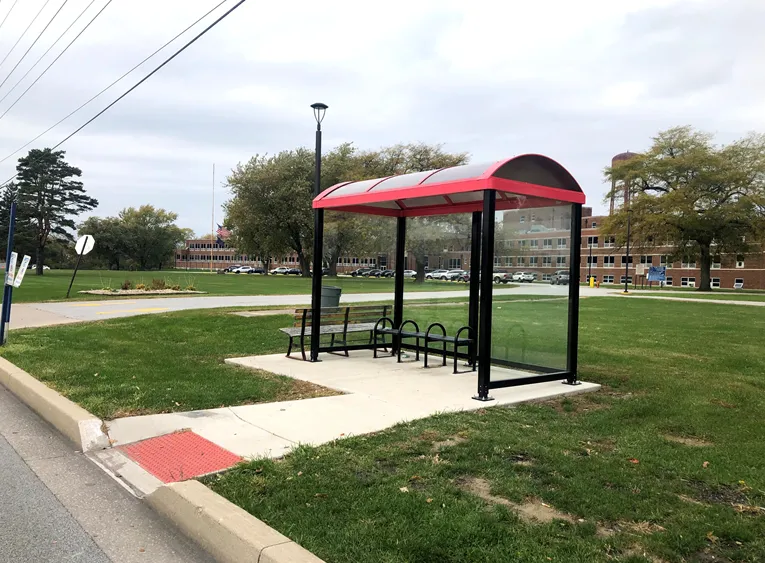
Online map will help disabled riders determine the accessibility of every bus stop in the region (image credit: NIRPC)

The Northwestern Indiana Regional Planning Commission (NIRPC) has released an online map to help disabled riders determine the accessibility of every bus stop in the region. 

The NIRPC recognises that small challenges for disabled riders like the size of a doorway or the softness of the gravel at a bus stop “can throw a wrench in their plans”.

The Northwest Indiana Transit Map provides Google Map directions to the location of a stop, photos and a physical description. It also includes pavement measurements, kerb types for wheelchair access, and amenities like covered or heated structures and the proximity to nearby bus routes in the counties of Lake, Porter and La Porte. 

The map also provides information on the presence of a shelter, the interior space available and the width of its entryway. 

Other details contained within the map include connections to adjacent transportation such as a bus route or train station within two blocks of the bus stop and connections like park and ride and transit facilities.

Kevin Polette, technical assistant with NIRPC, says: “The Northwest Indiana Transit Map is a place to view all bus stops from every transit agency in Northwest Indiana."

"We collected data on every stop, with pictures and the conditions of the bus stops. While collecting the data, we were also able to take public comments from the riders about the bus stops and routes.”

The NIRPC passed public feedback about the bus stops on to transit operators. 

The commission's urban planners hope the map will contribute to municipal and county transportation planning and will influence the decisions of municipal transit operators.

For more information on companies in this article

Related Content

  • Google maps the future of traffic and travel information?
    March 16, 2012
    Will the relentless growth of Google lead to it becoming the ultimate provider of travel information services? Huw Williams investigates Google’s strategy and David Crawford discovers what two principal rivals are doing to keep pace. In the first weeks of 2012 one company staked two divergent claims on the future of transport. One is the science fiction of only a decade ago, turned into reality: the driverless car. The other seems more prosaic, yet in its own way is just as significant a marker of the futur
  • TransLink installs screens at UBC Exchange 
    December 30, 2021
    Screens at University of British Columbia feature text to speed audio for the visually impaired 
  • CCAM innovation at ITS World Congress 2021
    September 27, 2021
    We live in an era of increasingly cooperative, connected and automated mobility (CCAM) but there’s still a huge way to go - visitors to ITS World Congress in Hamburg will be able to see projects, innovations and real-life solutions showcased in the city
  • Seleta Reynolds: 'Set a vision, listen to your people & then get out of their way'
    September 12, 2022
    Los Angeles, host of the 2022 ITS World Congress, is a city where the only constant is change, says Seleta Reynolds of LA Metro. Adam Hill finds out about leadership, dream jobs and the 2028 Olympics...