Indiana helps disabled bus riders plan ahead

Transit Map includes pavement measurements and kerb types for wheelchair access
By Ben Spencer June 2, 2021 Read time: 2 mins
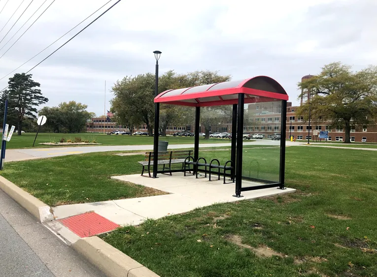
Online map will help disabled riders determine the accessibility of every bus stop in the region (image credit: NIRPC)

The Northwestern Indiana Regional Planning Commission (NIRPC) has released an online map to help disabled riders determine the accessibility of every bus stop in the region. 

The NIRPC recognises that small challenges for disabled riders like the size of a doorway or the softness of the gravel at a bus stop “can throw a wrench in their plans”.

The Northwest Indiana Transit Map provides Google Map directions to the location of a stop, photos and a physical description. It also includes pavement measurements, kerb types for wheelchair access, and amenities like covered or heated structures and the proximity to nearby bus routes in the counties of Lake, Porter and La Porte. 

The map also provides information on the presence of a shelter, the interior space available and the width of its entryway. 

Other details contained within the map include connections to adjacent transportation such as a bus route or train station within two blocks of the bus stop and connections like park and ride and transit facilities.

Kevin Polette, technical assistant with NIRPC, says: “The Northwest Indiana Transit Map is a place to view all bus stops from every transit agency in Northwest Indiana."

"We collected data on every stop, with pictures and the conditions of the bus stops. While collecting the data, we were also able to take public comments from the riders about the bus stops and routes.”

The NIRPC passed public feedback about the bus stops on to transit operators. 

The commission's urban planners hope the map will contribute to municipal and county transportation planning and will influence the decisions of municipal transit operators.

For more information on companies in this article

Related Content

  • Multi-modal’s long road into the transportation mainstream
    June 4, 2015
    Andrew Bardin Williams looks at 20 years of multimodal transport in the Sun Belt and beyond and the key requirement for user engagement. Phoenix residents will head to the polls in August to decide whether to implement a three-tenths of a cent sales tax to fund the city’s new multimodal transportation plan. It will be the second transportation-related sales tax hike in the past 15 years yet city officials and advocates expect the resolution to easily pass—despite the strong anti-tax environment that has dom
  • Detroit introduces unified bus payment system
    August 15, 2019
    Detroit authorities have launched a ticketing scheme to encourage bus ridership – a new venture which dovetails with existing initiatives to improve mobility, Ben Spencer reports The Detroit Department of Transportation (DDoT) has partnered with the Suburban Mobility Authority for Regional Transportation (SMART) to launch a unified payment system – called Dart - for the US region’s buses. Detroit’s mayor Mike Duggan says: “Dart will bring our two systems closer together with seamless transfers and more f
  • Jonathan Raper from TransportAPI is surfing the open data tidal wave
    August 13, 2015
    Jonathan Raper, managing director of the TransportAPI talks to Colin Sowman about the benefits open data can bring to the public transport sector. That the digital revolution would change the world, including transport, was never in doubt but the question has always been: how? Now, with the ‘Millennium Bug’ relegated to a question on quiz shows, the potential and challenges of digital technology are starting to take shape - and Jonathan Raper is in the vanguard. Raper is managing director of the open data t
  • Athens cracks down on illegal parking
    February 21, 2022
    More than 800 smart sensors have been installed at crossings and pedestrian ramps