Indiana helps disabled bus riders plan ahead

Transit Map includes pavement measurements and kerb types for wheelchair access
By Ben Spencer June 2, 2021 Read time: 2 mins
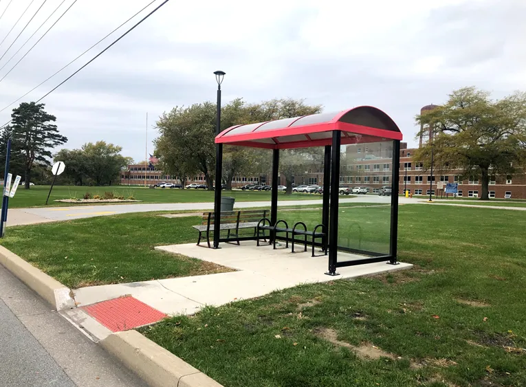
Online map will help disabled riders determine the accessibility of every bus stop in the region (image credit: NIRPC)

The Northwestern Indiana Regional Planning Commission (NIRPC) has released an online map to help disabled riders determine the accessibility of every bus stop in the region. 

The NIRPC recognises that small challenges for disabled riders like the size of a doorway or the softness of the gravel at a bus stop “can throw a wrench in their plans”.

The Northwest Indiana Transit Map provides Google Map directions to the location of a stop, photos and a physical description. It also includes pavement measurements, kerb types for wheelchair access, and amenities like covered or heated structures and the proximity to nearby bus routes in the counties of Lake, Porter and La Porte. 

The map also provides information on the presence of a shelter, the interior space available and the width of its entryway. 

Other details contained within the map include connections to adjacent transportation such as a bus route or train station within two blocks of the bus stop and connections like park and ride and transit facilities.

Kevin Polette, technical assistant with NIRPC, says: “The Northwest Indiana Transit Map is a place to view all bus stops from every transit agency in Northwest Indiana."

"We collected data on every stop, with pictures and the conditions of the bus stops. While collecting the data, we were also able to take public comments from the riders about the bus stops and routes.”

The NIRPC passed public feedback about the bus stops on to transit operators. 

The commission's urban planners hope the map will contribute to municipal and county transportation planning and will influence the decisions of municipal transit operators.

For more information on companies in this article

Related Content

  • US eyes European model for Illinois toll road upgrade
    May 30, 2014
    David Crawford welcomes the adoption of European-style ITS technology by the US. The Jane Addams Memorial Tollway in Illinois, US is well on the way towards becoming a ‘smart traffic corridor’, taking full advantage of active traffic management (ATM or ‘managed lanes’) technology that originated in Europe. It is one of the first American toll roads to do so; preliminary work began in 2014 and will continue through to 2016. Jane Addams is one of four toll roads operated by the publicly-owned Illinois State T
  • Hello Gen Z – our name’s ITS and we’d love to meet you
    November 17, 2023
    ITS is a life-changing, planet-saving industry. But how the sector can convince Gen Z that ITS is a good career option? Sharon Kindleysides has a few ideas – not least explaining what ITS actually is
  • New CEO for Aimsun as Gerodimos departs
    February 1, 2022
    Alex Torday takes over while predecessor moves to Siemens-owned AV platform Simulytic
  • European ITS Directive: From Minority Report to majority rapport
    December 1, 2023
    A 21-year old movie by Steven Spielberg appears to predict a C-ITS Day 3 use case. Richard Lax of Kapsch TrafficCom looks at the new European ITS Directive and idly wonders whether the great Hollywood movie director was once a European Commission intern in DG Move…