Indiana helps disabled bus riders plan ahead

Transit Map includes pavement measurements and kerb types for wheelchair access
By Ben Spencer June 2, 2021 Read time: 2 mins
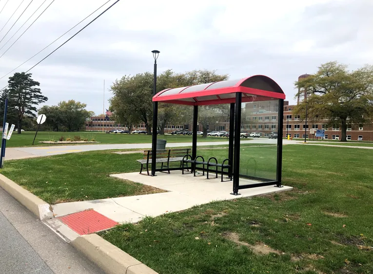
Online map will help disabled riders determine the accessibility of every bus stop in the region (image credit: NIRPC)

The Northwestern Indiana Regional Planning Commission (NIRPC) has released an online map to help disabled riders determine the accessibility of every bus stop in the region. 

The NIRPC recognises that small challenges for disabled riders like the size of a doorway or the softness of the gravel at a bus stop “can throw a wrench in their plans”.

The Northwest Indiana Transit Map provides Google Map directions to the location of a stop, photos and a physical description. It also includes pavement measurements, kerb types for wheelchair access, and amenities like covered or heated structures and the proximity to nearby bus routes in the counties of Lake, Porter and La Porte. 

The map also provides information on the presence of a shelter, the interior space available and the width of its entryway. 

Other details contained within the map include connections to adjacent transportation such as a bus route or train station within two blocks of the bus stop and connections like park and ride and transit facilities.

Kevin Polette, technical assistant with NIRPC, says: “The Northwest Indiana Transit Map is a place to view all bus stops from every transit agency in Northwest Indiana."

"We collected data on every stop, with pictures and the conditions of the bus stops. While collecting the data, we were also able to take public comments from the riders about the bus stops and routes.”

The NIRPC passed public feedback about the bus stops on to transit operators. 

The commission's urban planners hope the map will contribute to municipal and county transportation planning and will influence the decisions of municipal transit operators.

For more information on companies in this article

Related Content

  • #ITSDubai2024: Driving the future of mobility through ITS
    August 30, 2024
    The ITS World Congress 2024, set to take place in Dubai from September 16-20, promises to be a landmark event for the global ITS community. Here is an in-depth look at what visitors can expect from their time at the cutting edge of mobility technology...
  • Buses services benefit from seamless Wi-Fi data transfer
    April 9, 2014
    Ted Bowser explains how the almost total Wi-Fi coverage at Ride-On’s new bus garage is providing big benefits for the operator and passengers alike. The ability to download and upload data to and from the various systems on board buses has become central to mass transit operators’ business model. So when Ride-On, the public transportation system in Maryland’s Montgomery County, was moving one of its three depots into a bigger and purpose-built facility, connectivity was a key consideration.
  • Q-Free brings traffic tech to Indiana 
    April 13, 2021
    Indiana DoT will pair traffic signal controllers with Q-Free's Intelight Maxtime software 
  • When traffic data can get it totally wrong
    November 30, 2021
    How can a highway devoid of traffic provide data suggesting it is filled with vehicles crawling along? Michael Vardi of Valerann provides an insight into how data can easily be skewed - and what can be done to prevent it