Indiana helps disabled bus riders plan ahead

Transit Map includes pavement measurements and kerb types for wheelchair access
By Ben Spencer June 2, 2021 Read time: 2 mins
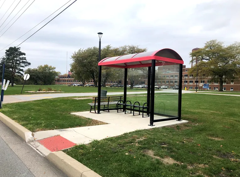
Online map will help disabled riders determine the accessibility of every bus stop in the region (image credit: NIRPC)

The Northwestern Indiana Regional Planning Commission (NIRPC) has released an online map to help disabled riders determine the accessibility of every bus stop in the region. 

The NIRPC recognises that small challenges for disabled riders like the size of a doorway or the softness of the gravel at a bus stop “can throw a wrench in their plans”.

The Northwest Indiana Transit Map provides Google Map directions to the location of a stop, photos and a physical description. It also includes pavement measurements, kerb types for wheelchair access, and amenities like covered or heated structures and the proximity to nearby bus routes in the counties of Lake, Porter and La Porte. 

The map also provides information on the presence of a shelter, the interior space available and the width of its entryway. 

Other details contained within the map include connections to adjacent transportation such as a bus route or train station within two blocks of the bus stop and connections like park and ride and transit facilities.

Kevin Polette, technical assistant with NIRPC, says: “The Northwest Indiana Transit Map is a place to view all bus stops from every transit agency in Northwest Indiana."

"We collected data on every stop, with pictures and the conditions of the bus stops. While collecting the data, we were also able to take public comments from the riders about the bus stops and routes.”

The NIRPC passed public feedback about the bus stops on to transit operators. 

The commission's urban planners hope the map will contribute to municipal and county transportation planning and will influence the decisions of municipal transit operators.

For more information on companies in this article

Related Content

  • Connecticut Transit uses web feedback to improve user experience
    May 27, 2014
    Connecticut champions open government and open data to help fostertransparency, accountability and citizen engagement – and that includes transportation matters as Andrew Bardin Williams discovers. The last thing anyone wanted was to inconvenience or displace others - least of all people who lived and worked in the neighbourhood. Yet, workers in an office building in downtown New Haven, Conn., were tired of shuffling through hoards of people who kept sitting on the stoop to the building while waiting for th
  • Prowag signals change to vision statement
    February 15, 2024
    New pedestrian signal requirements designed to make crossings safer for the visually impaired mean that accessible signals are no longer just an option for US cities and municipalities. They now have the backing of the law, explains Andrew Stone
  • Traffic Group: ‘Daily commute may never be the same’
    May 22, 2020
    The pandemic has taught us that our ideas about travel might need a rethink - Wes Guckert suggests a few ways in which change is coming
  • Learning from informal transit networks
    March 30, 2021
    When it comes to public transportation, the Minority World could take lessons in equity from the mobility infrastructure of emerging market cities, says Devin de Vries of WhereIsMyTransport