The condition of highways in the UK’s West Midlands is to be surveyed using the latest vehicle-based technology from Yotta DCL under a contract awarded by the consortium of West Midlands Local Authorities.
The highway technology and surveying company will use its new Tempest survey vehicle to capture road surface condition and forward facing video across the region’s road network, plus pavement images at normal traffic speeds.
Yotta DCL will survey a total of 1250 km of roads under the terms of the co
The condition of highways in the UK’s West Midlands is to be surveyed using the latest vehicle-based technology from 5956 Yotta DCL under a contract awarded by the consortium of West Midlands Local Authorities.
The highway technology and surveying company will use its new Tempest survey vehicle to capture road surface condition and forward facing video across the region’s road network, plus pavement images at normal traffic speeds.
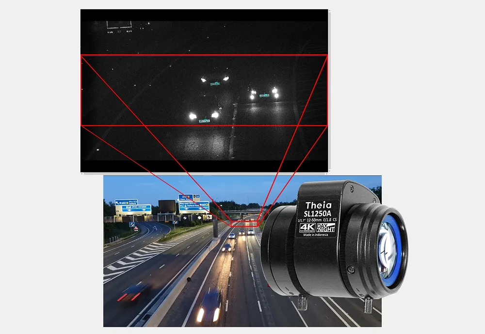
Yotta DCL will survey a total of 1250 km of roads under the terms of the contract, which could be extended by three years. By providing both scanner and forward facing video and pavement images, the Authorities will be able to cross reference road condition data against high quality images. The camera technology onboard the new Tempest vehicle is a major advance in quality, breaks new ground in high definition video, and is unique to Yotta DCL.
Tempest has been developed using new processing technologies to improve accuracy and the vehicles are equipped with forward facing cameras which can be used to provide street level images. The system is designed and built exclusively by Yotta DCL and is accredited by the UK’s Transport Research Laboratory (TRL) for UK scanner and Traffic Speed Condition Survey (TRACS) specifications.
“By overlaying the scanner data onto the video we can get a real life view of the data. The ability to cross reference the data against the video helps to guide our decision making as we can actually see the condition of the road surface on screen,” says Paul Price, senior engineer, Solihull Metropolitan Borough Council.
The highway technology and surveying company will use its new Tempest survey vehicle to capture road surface condition and forward facing video across the region’s road network, plus pavement images at normal traffic speeds.
Yotta DCL will survey a total of 1250 km of roads under the terms of the contract, which could be extended by three years. By providing both scanner and forward facing video and pavement images, the Authorities will be able to cross reference road condition data against high quality images. The camera technology onboard the new Tempest vehicle is a major advance in quality, breaks new ground in high definition video, and is unique to Yotta DCL.
Tempest has been developed using new processing technologies to improve accuracy and the vehicles are equipped with forward facing cameras which can be used to provide street level images. The system is designed and built exclusively by Yotta DCL and is accredited by the UK’s Transport Research Laboratory (TRL) for UK scanner and Traffic Speed Condition Survey (TRACS) specifications.
“By overlaying the scanner data onto the video we can get a real life view of the data. The ability to cross reference the data against the video helps to guide our decision making as we can actually see the condition of the road surface on screen,” says Paul Price, senior engineer, Solihull Metropolitan Borough Council.