GeoSLAM showcases 3D mobile mapping for GIS at ESRI User Conference 2017

3D mobile mapping specialist GeoSLAM, a Silver ESRI Business Partner, is participating in the international ESRI User Conference at San Diego Convention Centre on 10-14 July to demonstrate its live digital 3D modelling capability.
July 10, 2017 Read time: 1 min

3D mobile mapping specialist GeoSLAM, a Silver 50 ESRI Business Partner, is participating in the international ESRI User Conference at San Diego Convention Centre on 10-14 July to demonstrate its live digital 3D modelling capability.

GeoSLAM will be scanning the exhibition hall and the Convention Centre using its handheld laser scanning solution, the ZEB-REVO and turning it into a live digital 3D model, to show how the ZEB REVO enables users to rapidly generate and integrate 3D models into their ArcGIS workflows. The system is already in use around the world in a variety of industries such as facilities and asset management, forestry, mining, surveying and engineering.

GeoSLAM will be working with the ESRI Team at the ESRI 3D Island stand in the main hall of the Convention Center, providing live demonstrations of the handheld, mobile surveying system and showcasing how quickly and easily the captured 3D data can be imported into and used in ESRI’s ArcGIS and CityEngine software.

Related Content

  • April 28, 2025
    TomTom and Esri fusion transform urban mobility

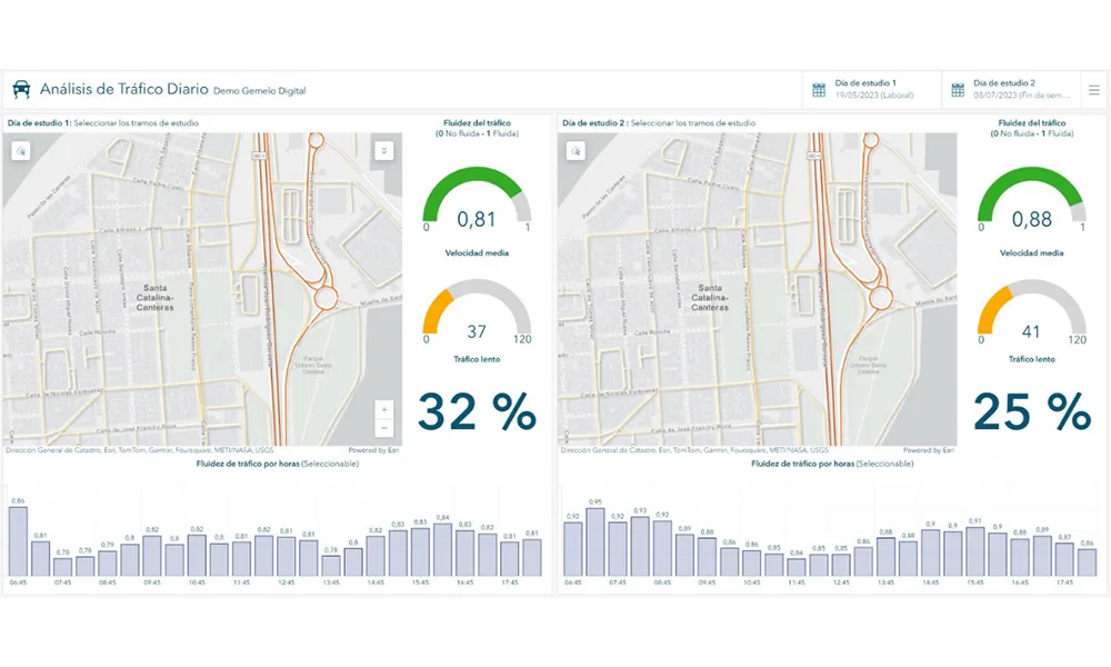
    A collaboration between TomTom and Esri will take centre stage at the upcoming Congress with a session titled "Driving Insights: Unlocking the Power of TomTom Historic Traffic Data in ArcGIS.” Led by industry experts Frans Keijzer from TomTom and Jaime Nieves from Esri Spain, this presentation will showcase how integrating TomTom's historical traffic data with the ArcGIS platform has transformed urban mobility in Gran Canaria, Spain.

  • January 3, 2023
    CES 2023: mobility solutions to the fore
    Equality, diversity and sustainable transport are among key themes of this week's tech show
  • November 26, 2013
    New name offers new solutions
    Pete Goldin examines Nokia’s rationale for combining its location services, digital mapping and other capabilities under the HERE brand. While it has divested itself of its mobile phone business to Microsoft, Nokia has kept hold of its HERE business unit and brand which incorporates the company’s location services with digital mapping and other capabilities. The creation of HERE is much more than rebranding as its services are heading off the map and into the cloud. “HERE offers the first location cloud
  • October 25, 2021
    The Ray maps ROW solar hot spots 
    Tool analyses how suitable ROW locations may be for solar placement