
ISS releases traffic data radar

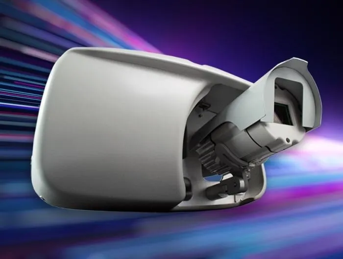
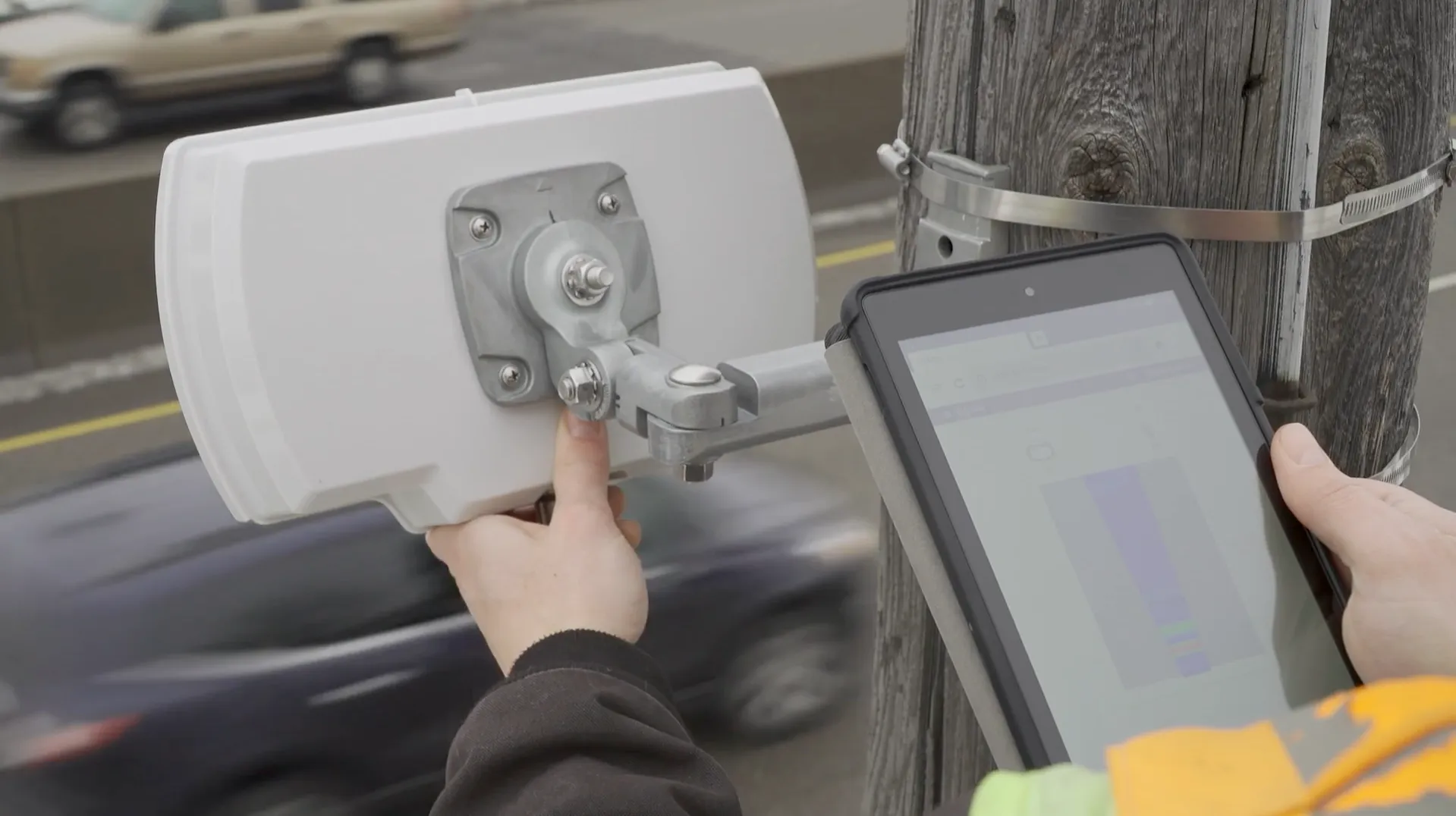
Image Sensing Systems (ISS) has unveiled a radar which it says provides drivers and transportation planners with traffic data about road conditions.
By Ben Spencer March 5, 2020 Read time: 1 min
ISS radar provides traffic data about road conditions (Source: ISS)

Seth Anderson, radar product manager at ISS, says: “Transportation professionals around the world make important decisions every day that impact the effectiveness of our complex, multi-modal transportations systems. With RTMS Echo, transportation professionals can be confident in the data-driven decisions they are making today, and into the future.”

ISS says the Internet of Things-ready device comes with built-in aiming guidance for installation, auto configuration of the sensor and wireless management via a smart device. The per-vehicle data accuracy of RTMS Echo can be formatted to deliver insights needed to meet agency objectives, the company adds. 


For more information on companies in this article

Related Content

  • NavFusion provides map updates via a smart phone app
    November 28, 2013
    A new app that connects a vehicle’s systems to the internet opens up a range of possibilities as Jon Masters discovers. Sometimes the most straightforward or simple of ideas can be the most significant. So it seems with the latest development from Hungarian navigation software supplier NNG. The company’s software features in-vehicle infotainment systems and has launched NavFusion – which connects a vehicles’ sat nav programs to smartphones. NavFusion is being incorporated into NNG’s iGO navigation s
  • DoTs can benefit from high fibre content
    January 14, 2020
    Existing fibre architecture may be one of the most important assets for DoTs going forward: Skyline’s Paul Lennon explains the importance of evaluating ITS network infrastructure maturity
  • Iteris unveils AI detection solution
    November 23, 2021
    Vantage Apex combines combines FHD video, radar and AI in hybrid traffic solution
  • Modelling could reduce traffic mayhem
    May 6, 2016
    A mathematical model that could significantly reduce traffic congestion by combining data from existing infrastructure, remote sensors, mobile devices and their communication systems has been developed by a research team from Australia’s Swinburne University of Technology. Swinburne‘s Congestion Breaker project utilises intelligent transport systems (ITS), a field of research that combines information and data from a range of sources for effective traffic control.