WhereIsMyTransport maps out urban future

Tech start-up says it will be emerging world's 'citymapper' by 2023
By Adam Hill September 17, 2020 Read time: 2 mins
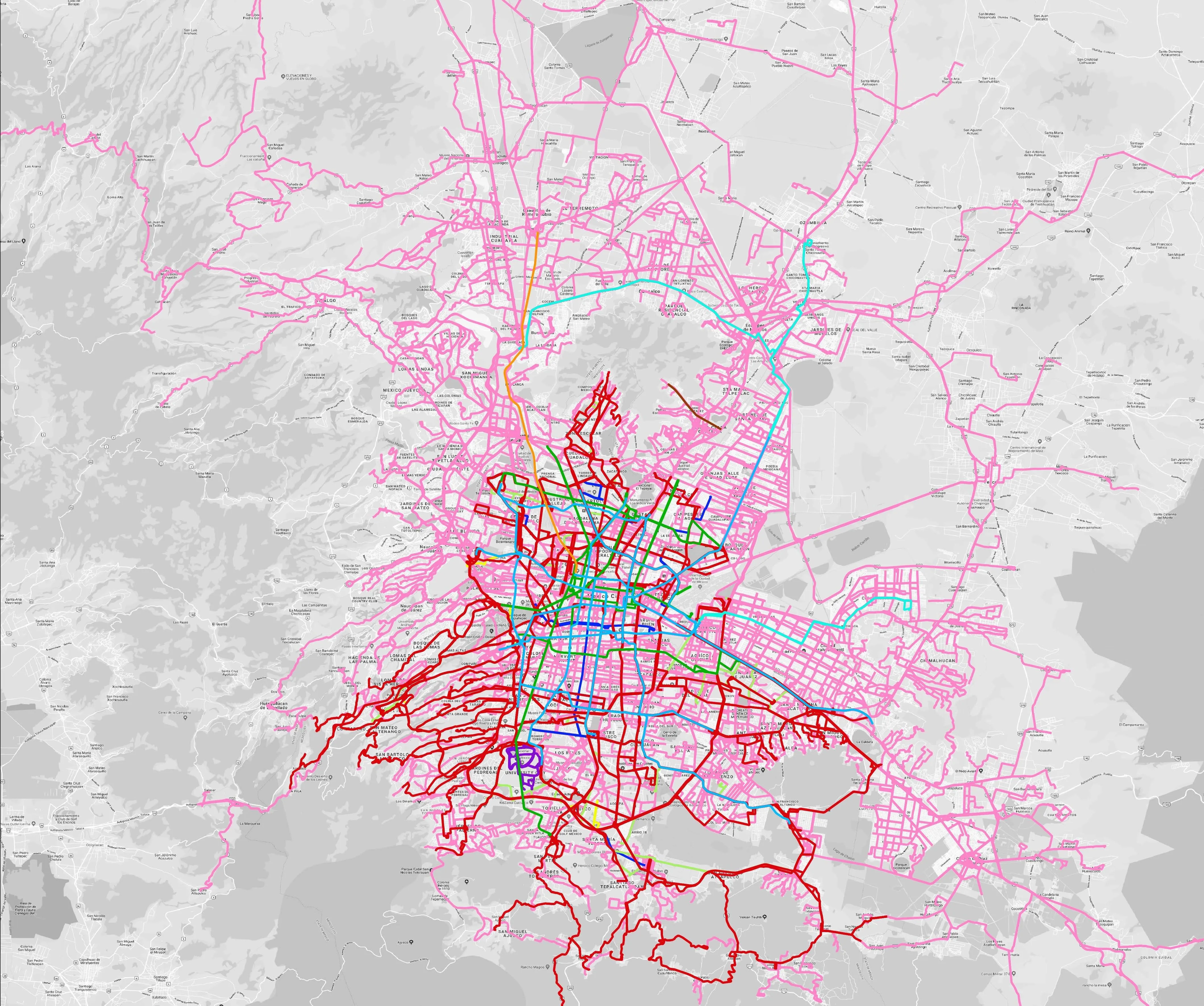
Mexico City is among the conurbations whose networks have been mapped (© WhereIsMyTransport)

WhereIsMyTransport says it is on course to map public transport networks in 30 of the world's biggest cities over the next three years.

The tech start-up, which received funding from both Google and Toyota Tsusho this year, has mapped one million kilometres of formal and informal networks worldwide so far.

Digitalising transport - particularly the 'informal' networks such as commuter minibuses which are vital in many cities - will be of considerable benefit to local economies.

CEO Devin de Vries says: "The production and maintenance of this mobility data is a fundamental first step towards transforming the public transport experience for hundreds of millions of people, and with it the social, cultural and economic landscape of these cities."

The firm began collecting public transport data in emerging markets in 2015, concentrating on the thousands of routes and vehicles owned and run by independent operators, which are effectively unmapped and offline. 

Most recently, WhereIsMyTransport mapped - and now maintains datasets for - the public transport networks in Mexico City, Dhaka (capital of Bangladesh), and the province of Gauteng in South Africa - metro areas with a combined population of more than 55 million. 

The company will collect public transport information in another 27 cities, of which 19 are megacities with populations greater than 10 million, including Bangkok and Rio de Janeiro.

To do this, it uses local teams of data collectors on the ground who map entrances, exits, stairs, gates and platforms at stations and interchanges. 

“We manage and maintain our data, updating it weekly, and integrating it with consumer products and planning tools that support a better public transport experience for everyone, everywhere," insists de Vries.

For more information on companies in this article

Related Content

  • Don’t look at the jigsaw pieces – see the whole puzzle, says CCTA
    February 19, 2024
    There are three main barriers to taking transport ideas from the pilot stage to real-life usage: incompatible technology, local control and limited funding. Tim Haile of California’s Contra Costa Transportation Authority has some thoughts on how to overcome them
  • ITS can reduce Bangkok’s congestion, improve safety
    August 24, 2015
    A new research report produced by the GSMA, Building Digital Societies in Asia: Making Transportation Smarter, indicates that the successful implementation of intelligent transport systems (ITS) in Thailand’s capital could reduce travel times, carbon dioxide (CO2) emissions and road accidents, driving social and economic benefits of up to US$1 billion per year. In addition, the case study on Bangkok’s transportation indicated that ITS can also potentially result in long-term positive changes in commuter hab
  • Asecap Days 2025: 'Vision Zero is not a number, it’s about a culture'
    May 29, 2025
    Saving lives and saving road infrastructure were two of the topics at the second and last day of the annual conference of Asecap, the European road tolling association, in Spanish capital Madrid
  • Canadian authorities convinced of enforcement safety benefits
    November 28, 2012
    Cost-benefit analysis invariably finds highly in favour of speed and red light enforcement, particularly so in Edmonton in the Alberta province of Canada, where authorities need no convincing of the merits of road safety engineering. Justification of enforcement efforts on economic grounds has been reinforced this year, by a study of the costs and benefits of red light enforcement. New York-based economic research firm John Dunham & Associates carried out this latest analysis for American Traffic Solutions