WhereIsMyTransport maps out urban future

Tech start-up says it will be emerging world's 'citymapper' by 2023
By Adam Hill September 17, 2020 Read time: 2 mins
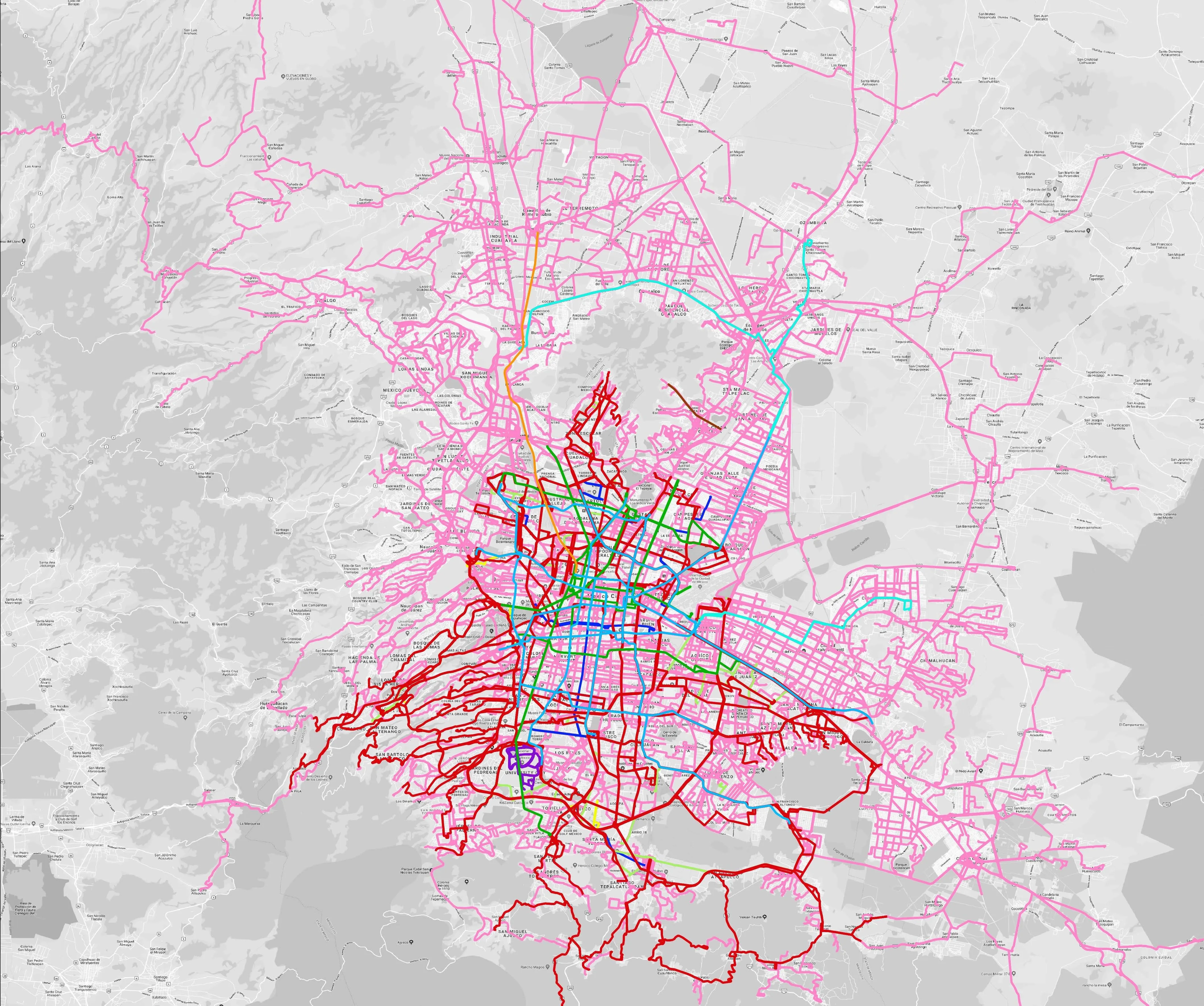
Mexico City is among the conurbations whose networks have been mapped (© WhereIsMyTransport)

WhereIsMyTransport says it is on course to map public transport networks in 30 of the world's biggest cities over the next three years.

The tech start-up, which received funding from both Google and Toyota Tsusho this year, has mapped one million kilometres of formal and informal networks worldwide so far.

Digitalising transport - particularly the 'informal' networks such as commuter minibuses which are vital in many cities - will be of considerable benefit to local economies.

CEO Devin de Vries says: "The production and maintenance of this mobility data is a fundamental first step towards transforming the public transport experience for hundreds of millions of people, and with it the social, cultural and economic landscape of these cities."

The firm began collecting public transport data in emerging markets in 2015, concentrating on the thousands of routes and vehicles owned and run by independent operators, which are effectively unmapped and offline. 

Most recently, WhereIsMyTransport mapped - and now maintains datasets for - the public transport networks in Mexico City, Dhaka (capital of Bangladesh), and the province of Gauteng in South Africa - metro areas with a combined population of more than 55 million. 

The company will collect public transport information in another 27 cities, of which 19 are megacities with populations greater than 10 million, including Bangkok and Rio de Janeiro.

To do this, it uses local teams of data collectors on the ground who map entrances, exits, stairs, gates and platforms at stations and interchanges. 

“We manage and maintain our data, updating it weekly, and integrating it with consumer products and planning tools that support a better public transport experience for everyone, everywhere," insists de Vries.

For more information on companies in this article

Related Content

  • TomTom to provide Uber with maps and traffic data
    November 16, 2015
    TomTom has signed a global, multi-year agreement to provide maps and traffic data for the Uber driver app. TomTom’s advanced map-making technology, combined with its world class traffic information, will ensure Uber has a seamless navigation experience, accurate arrival times and efficient journeys in more than 300 cities around the world. “We are excited to provide Uber with our best-in-class location data.” said Charles Cautley, managing director maps and licensing at TomTom. “TomTom is a truly in
  • Cost saving multi-agency transportation and emergency management
    May 3, 2012
    Although the recession had dramatically reduced traffic volumes in the past few years, the economy was on the brink of a recovery that portended well for jobs but poorly for traffic congestion. Leaders of four government agencies in Houston, Texas, got together to discuss how to collectively cope with the expected increase in vehicles on the road. "They knew they couldn't pour enough concrete to solve the problem, and they also knew the old model of working in a vacuum as standalone entities would fail," sa
  • Voi suspends Coventry e-scooter service
    September 23, 2020
    Firm will add ID plates and tweak geofencing in UK city after 'anti-social' behaviour
  • Joining old and new in Canada’s Highway 407
    June 17, 2016
    David Arminas visits Canada’s Highway 407 ETR to see how the concession is working and hear about new arrangements for the roadway’s extension. The Toronto region is North America’s eighth largest metropolitan area and its roads become notoriously congested. In 1997 Highway 407, a 68km concrete toll motorway which skirts the northern edge of Toronto, was opened and initially operated by the province and CHIC - a consortium of four leading Ontario-based companies. Finance came from the Ontario Financing Auth