WhereIsMyTransport maps out urban future

Tech start-up says it will be emerging world's 'citymapper' by 2023
By Adam Hill September 17, 2020 Read time: 2 mins
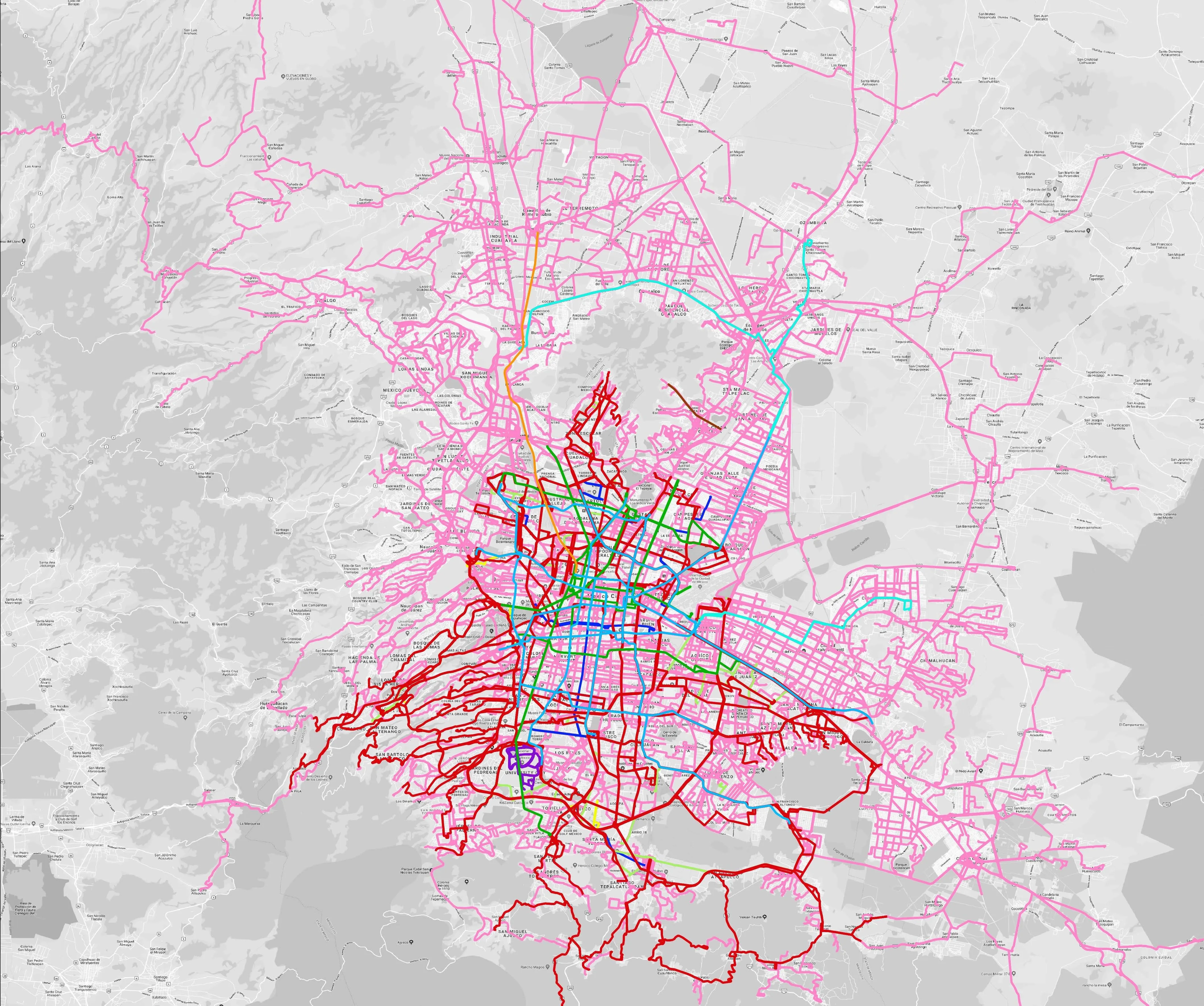
Mexico City is among the conurbations whose networks have been mapped (© WhereIsMyTransport)

WhereIsMyTransport says it is on course to map public transport networks in 30 of the world's biggest cities over the next three years.

The tech start-up, which received funding from both Google and Toyota Tsusho this year, has mapped one million kilometres of formal and informal networks worldwide so far.

Digitalising transport - particularly the 'informal' networks such as commuter minibuses which are vital in many cities - will be of considerable benefit to local economies.

CEO Devin de Vries says: "The production and maintenance of this mobility data is a fundamental first step towards transforming the public transport experience for hundreds of millions of people, and with it the social, cultural and economic landscape of these cities."

The firm began collecting public transport data in emerging markets in 2015, concentrating on the thousands of routes and vehicles owned and run by independent operators, which are effectively unmapped and offline. 

Most recently, WhereIsMyTransport mapped - and now maintains datasets for - the public transport networks in Mexico City, Dhaka (capital of Bangladesh), and the province of Gauteng in South Africa - metro areas with a combined population of more than 55 million. 

The company will collect public transport information in another 27 cities, of which 19 are megacities with populations greater than 10 million, including Bangkok and Rio de Janeiro.

To do this, it uses local teams of data collectors on the ground who map entrances, exits, stairs, gates and platforms at stations and interchanges. 

“We manage and maintain our data, updating it weekly, and integrating it with consumer products and planning tools that support a better public transport experience for everyone, everywhere," insists de Vries.

For more information on companies in this article

Related Content

  • Mexico’s Durango-Mazatlan highway sets tunnel safety standard
    August 26, 2016
    Mauro Nogarin looks at the management of the longer tunnels on Mexico’s Durango-Mazatlan highway. In recent years the National Infrastructure Fund of Mexico has increased investment in the installation of ITS systems on selected highways to increase road safety. One such major investment is the 230km long Durango-Mazatlan highway which is 12m in width and has an average speed of 110km/h.
  • Israel aspires to ITS-led future
    May 29, 2013
    Shay Soffer, Chief Scientist with the Israel National Road Safety Authority, talks to Jason Barnes about his country’s current ITS outlook and how he sees this developing in the future. Israel ranks alongside countries such as the US and France in the road safety stakes, with an average 7.1 deaths per billion kilometres driven. But at that point the similarities end, as the country’s overriding issue is pedestrian safety. This is driven by several factors, including being a relatively small country where pe
  • Houston hurricane prompts TranStar warning
    April 1, 2019
    Hurricane Harvey led to the creation of the Houston TranStar flood warning app
  • ITS Australia Global Summit 2023: super-sized
    December 2, 2022
    Four-day Global Summit will be held on 28-31 August, 2023 in Melbourne: accelerating smarter, safer, sustainable transport is focus of next year's expanded event for whole ITS community