WhereIsMyTransport maps out urban future

Tech start-up says it will be emerging world's 'citymapper' by 2023
By Adam Hill September 17, 2020 Read time: 2 mins
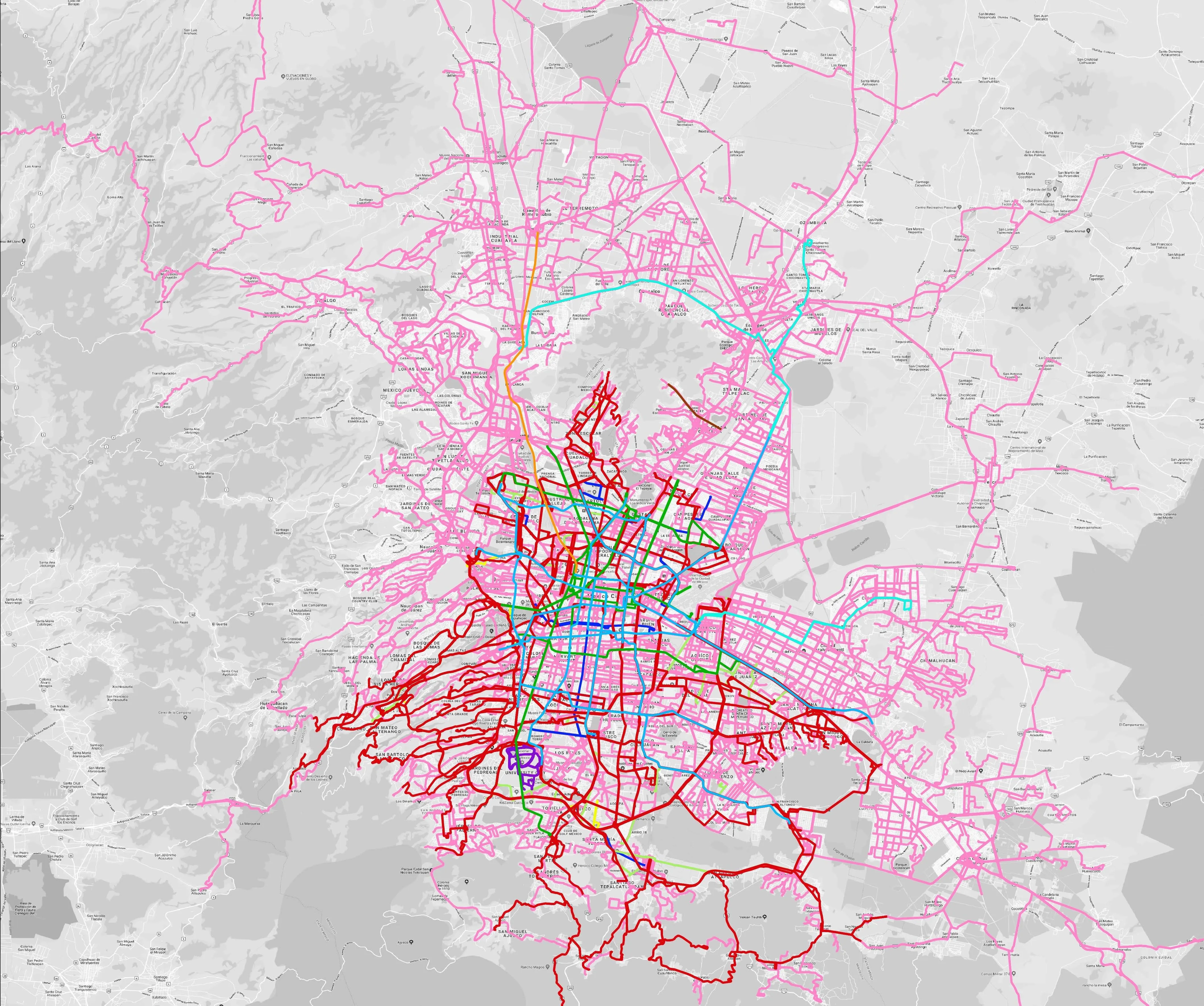
Mexico City is among the conurbations whose networks have been mapped (© WhereIsMyTransport)

WhereIsMyTransport says it is on course to map public transport networks in 30 of the world's biggest cities over the next three years.

The tech start-up, which received funding from both Google and Toyota Tsusho this year, has mapped one million kilometres of formal and informal networks worldwide so far.

Digitalising transport - particularly the 'informal' networks such as commuter minibuses which are vital in many cities - will be of considerable benefit to local economies.

CEO Devin de Vries says: "The production and maintenance of this mobility data is a fundamental first step towards transforming the public transport experience for hundreds of millions of people, and with it the social, cultural and economic landscape of these cities."

The firm began collecting public transport data in emerging markets in 2015, concentrating on the thousands of routes and vehicles owned and run by independent operators, which are effectively unmapped and offline. 

Most recently, WhereIsMyTransport mapped - and now maintains datasets for - the public transport networks in Mexico City, Dhaka (capital of Bangladesh), and the province of Gauteng in South Africa - metro areas with a combined population of more than 55 million. 

The company will collect public transport information in another 27 cities, of which 19 are megacities with populations greater than 10 million, including Bangkok and Rio de Janeiro.

To do this, it uses local teams of data collectors on the ground who map entrances, exits, stairs, gates and platforms at stations and interchanges. 

“We manage and maintain our data, updating it weekly, and integrating it with consumer products and planning tools that support a better public transport experience for everyone, everywhere," insists de Vries.

For more information on companies in this article

Related Content

  • Bangladesh - probably the most exciting infrastructure and ITS market in the world
    August 16, 2023
    The story of Bangladesh has been nothing short of a miracle, including ITS mega-projects and entrepreneurial flair, as contributing editor James Foster discovered.
  • Social media mooted for traffic management
    November 13, 2012
    SQLstream’s Ronnie Beggs discusses with Jason Barnes the potential and pitfalls of using social media for traffic monitoring and management. cataclysmic events such as hurricanes and tsunami have challenged perceptions of what constitutes robust traffic management infrastructure in recent times. Presumptions that only fixed systems could offer high levels of unbroken service, accuracy and communication bandwidth, have been taught some hard lessons by nature. In many respects wireless systems now represent t
  • Video analytics enhances urban rail safety
    December 16, 2016
    David Crawford explores some promising innovations for North American commuters. North America is experiencing a surge in commuter rail and metro development. The US now has 75 light rail and metro networks in operation; and California, in particular, is actively exploring ways of developing the state’s existing passenger rail operations into a fully integrated system.
  • Regulating rural road use
    June 20, 2016
    David Crawford looks at problems facing indigenous communities and those unfamiliar with driving in rural areas. While it is well known that the fatality rate for road crashes in rural areas is higher than in towns and cities, some groups suffer far more than others. For instance, the rates of death and serious injury from vehicle accidents is much higher for American Indian and Alaska Native (AI and AN) populations living in rural tribal lands than for any of the country’s other ethnic populations. Crashes