WhereIsMyTransport maps out urban future

Tech start-up says it will be emerging world's 'citymapper' by 2023
By Adam Hill September 17, 2020 Read time: 2 mins
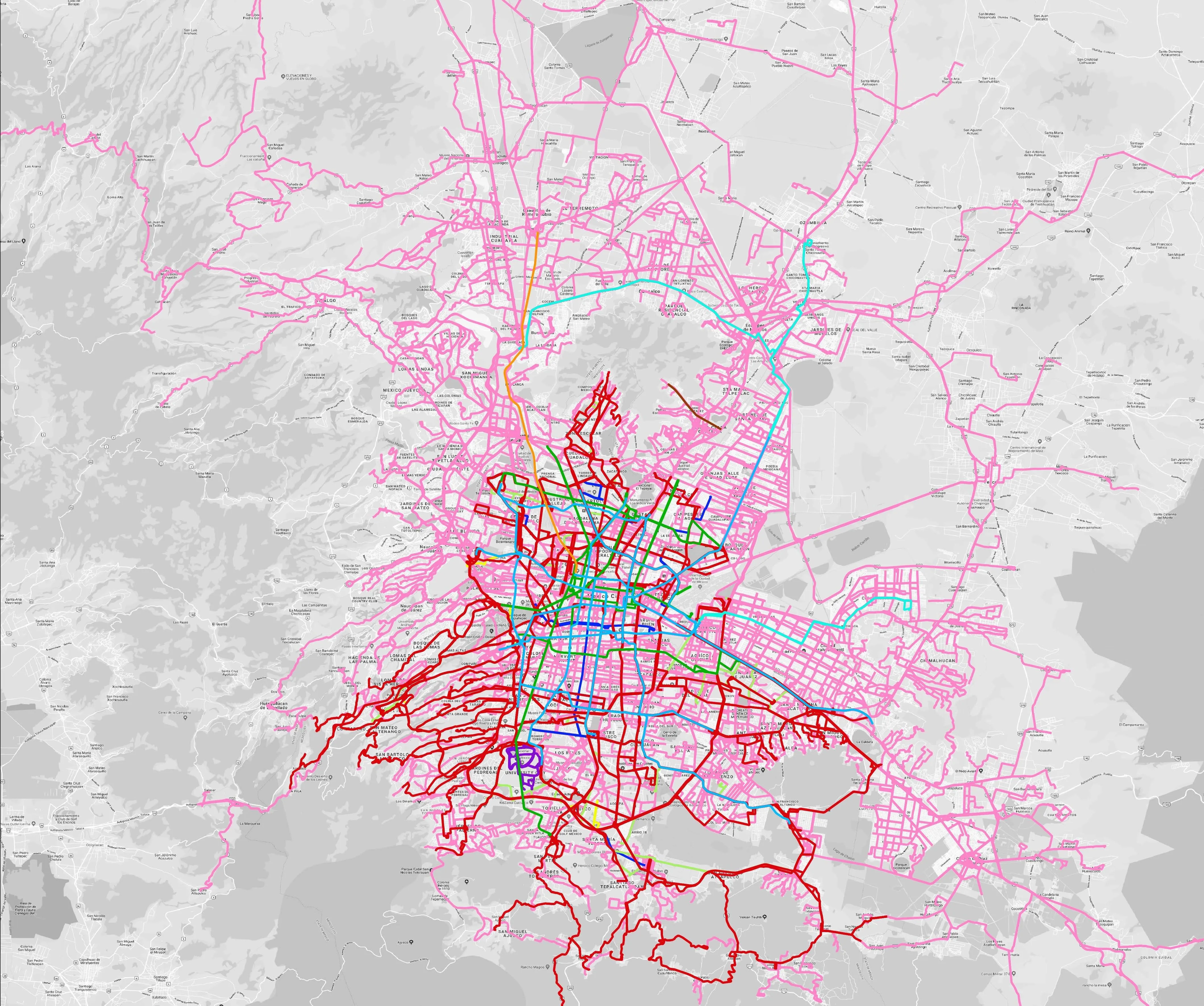
Mexico City is among the conurbations whose networks have been mapped (© WhereIsMyTransport)

WhereIsMyTransport says it is on course to map public transport networks in 30 of the world's biggest cities over the next three years.

The tech start-up, which received funding from both Google and Toyota Tsusho this year, has mapped one million kilometres of formal and informal networks worldwide so far.

Digitalising transport - particularly the 'informal' networks such as commuter minibuses which are vital in many cities - will be of considerable benefit to local economies.

CEO Devin de Vries says: "The production and maintenance of this mobility data is a fundamental first step towards transforming the public transport experience for hundreds of millions of people, and with it the social, cultural and economic landscape of these cities."

The firm began collecting public transport data in emerging markets in 2015, concentrating on the thousands of routes and vehicles owned and run by independent operators, which are effectively unmapped and offline. 

Most recently, WhereIsMyTransport mapped - and now maintains datasets for - the public transport networks in Mexico City, Dhaka (capital of Bangladesh), and the province of Gauteng in South Africa - metro areas with a combined population of more than 55 million. 

The company will collect public transport information in another 27 cities, of which 19 are megacities with populations greater than 10 million, including Bangkok and Rio de Janeiro.

To do this, it uses local teams of data collectors on the ground who map entrances, exits, stairs, gates and platforms at stations and interchanges. 

“We manage and maintain our data, updating it weekly, and integrating it with consumer products and planning tools that support a better public transport experience for everyone, everywhere," insists de Vries.

For more information on companies in this article

Related Content

  • Social media a one-stop shop for travel information
    January 20, 2012
    Exponentially widening mobile phone ownership is opening up the field to new ways of obtaining and disseminating better travel information from and to public transport users, via for example social media and tracking riders' phones. Over 50 US transit agencies, including major actors such as TriMet, in the metropolitan area of Portland, Oregon, Dallas Area Rapid Transit in Texas, and San Francisco's Bay Area Rapid Transit District (BART), as well as smaller operators, now have Facebook and/or Twitter accoun
  • StreetLight Data maps future
    February 20, 2019
    Laura Schewel of StreetLight Data talks to Adam Hill about the importance of measuring what you do – and about how paint will remain perhaps the most important piece of technology in the city planners’ armoury for a decade to come Transportation is dangerous, responsible for 30% of global cargo emissions today. Some experts believe that it will be responsible for 80% by 2050. And that’s before you even get on to the safety question - just ask tech entrepreneur Laura Schewel. “Transportation is getting wo
  • Platform announcement: public transport is running 10 years behind schedule
    March 10, 2023
    Public transport worldwide is under pressure on a variety of fronts. Jon Salmon of Snapper Services UK explains why the industry should look more at data – and pick up some tips from the retail sector
  • Mexico City seeks solutions to improve air quality
    December 6, 2017
    David Crawford ponders prospects for one of the world’s most congested and polluted cities. In 1992, the United Nations named Mexico City as the world’s most polluted urban centre. In the first half of 2016, following the updating of pollution alert limits to meet international standards, Mexico recorded 115 days where ozone concentrations exceeded the acute exposure health limit.