WhereIsMyTransport maps out urban future

Tech start-up says it will be emerging world's 'citymapper' by 2023
By Adam Hill September 17, 2020 Read time: 2 mins
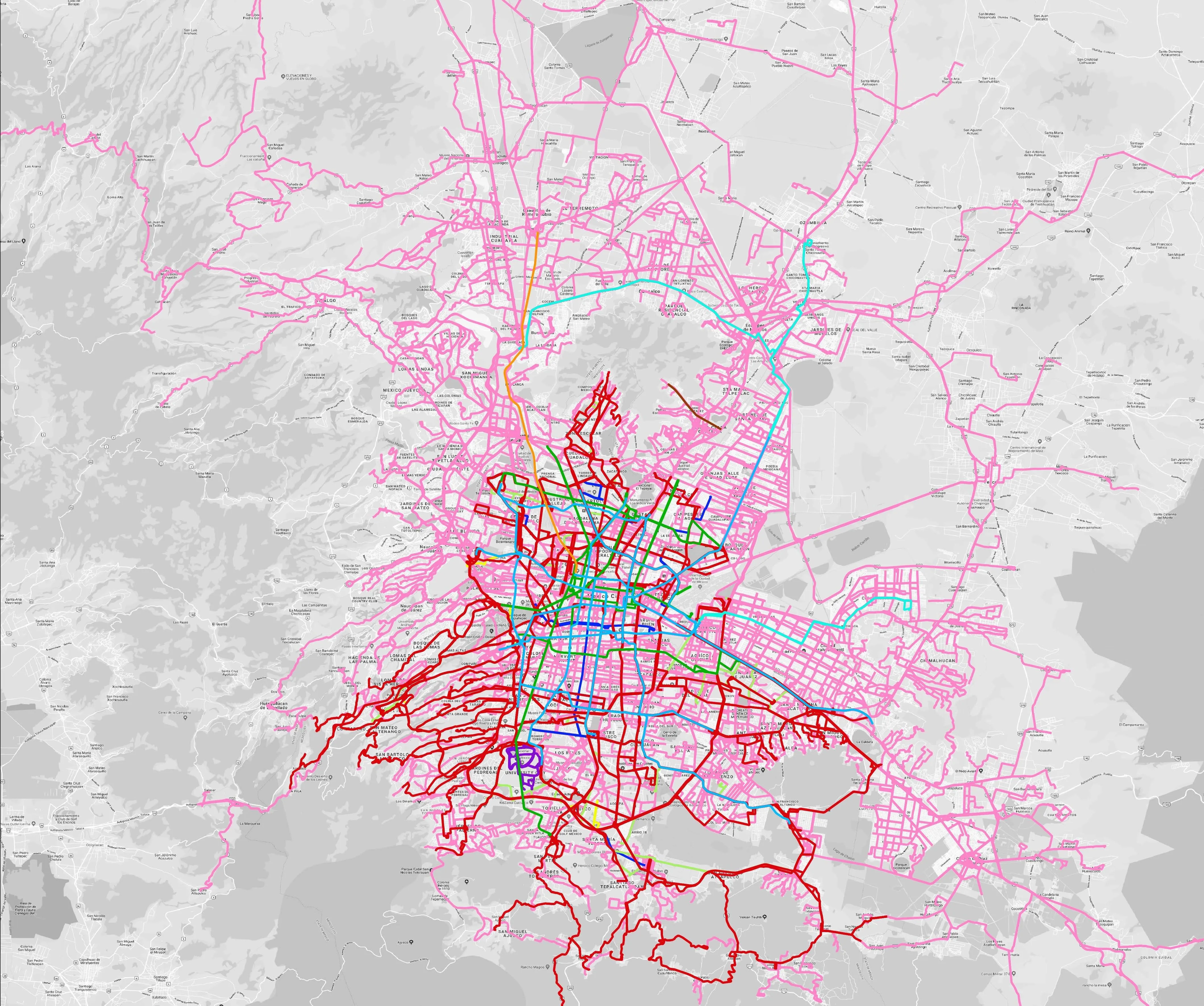
Mexico City is among the conurbations whose networks have been mapped (© WhereIsMyTransport)

WhereIsMyTransport says it is on course to map public transport networks in 30 of the world's biggest cities over the next three years.

The tech start-up, which received funding from both Google and Toyota Tsusho this year, has mapped one million kilometres of formal and informal networks worldwide so far.

Digitalising transport - particularly the 'informal' networks such as commuter minibuses which are vital in many cities - will be of considerable benefit to local economies.

CEO Devin de Vries says: "The production and maintenance of this mobility data is a fundamental first step towards transforming the public transport experience for hundreds of millions of people, and with it the social, cultural and economic landscape of these cities."

The firm began collecting public transport data in emerging markets in 2015, concentrating on the thousands of routes and vehicles owned and run by independent operators, which are effectively unmapped and offline. 

Most recently, WhereIsMyTransport mapped - and now maintains datasets for - the public transport networks in Mexico City, Dhaka (capital of Bangladesh), and the province of Gauteng in South Africa - metro areas with a combined population of more than 55 million. 

The company will collect public transport information in another 27 cities, of which 19 are megacities with populations greater than 10 million, including Bangkok and Rio de Janeiro.

To do this, it uses local teams of data collectors on the ground who map entrances, exits, stairs, gates and platforms at stations and interchanges. 

“We manage and maintain our data, updating it weekly, and integrating it with consumer products and planning tools that support a better public transport experience for everyone, everywhere," insists de Vries.

Related Content

  • June 29, 2016
    Sony helps Rio get a better view of the Olympics
    With the Olympics approaching, Sony’s Stephane Clauss examines how the latest camera technologies can help cities cope with the huge crowds attending major events. This August will see more than 10,000 athletes head to Rio de Janeiro for the Olympics Games. Alongside them will be their coaching staff, a hoard of logistics teams, thousands of volunteer marshals (London 2012 had 70,000) and millions of spectators. All such major events have nervous jitters on the way to the opening ceremony. This year has see
  • July 31, 2020
    Covid-19 cleared the air: ITS can keep it clean
    Covid-19 has created cleaner air: ITS can help keep it that way – but it’s not going to be straightforward, as Graham Anderson discovers
  • March 4, 2014
    Open data gives new lease of life to public travel information screens
    David Crawford finds resurgent interest in travel information screens for buildings. With city governments worldwide increasingly opening up and sharing their public transport data for general use, attention is focusing on the potential financial benefits – to transit operators and businesses more widely. Professor Stephen Goldsmith, who directs the US’ Harvard University’s Data-Smart City Solutions Project says: “Amid nationwide public-sector budget cuts, open data is providing a road map for improving tra
  • June 2, 2016
    Sorting myth from reality in vehicle automation
    Bob Denaro looks beyond the hype surrounding autonomous vehicles to the challenges that still need to be overcome. Automated vehicles (AVs) may be the perfect storm – in a positive way - with the automobile manufacturers, the government and consumers all embracing the emergence of a transformational new technology and product.