
WhereIsMyTransport maps out urban future

Tech start-up says it will be emerging world's 'citymapper' by 2023
By Adam Hill September 17, 2020 Read time: 2 mins
Mexico City is among the conurbations whose networks have been mapped (© WhereIsMyTransport)

WhereIsMyTransport says it is on course to map public transport networks in 30 of the world's biggest cities over the next three years.

The tech start-up, which received funding from both Google and Toyota Tsusho this year, has mapped one million kilometres of formal and informal networks worldwide so far.

Digitalising transport - particularly the 'informal' networks such as commuter minibuses which are vital in many cities - will be of considerable benefit to local economies.

CEO Devin de Vries says: "The production and maintenance of this mobility data is a fundamental first step towards transforming the public transport experience for hundreds of millions of people, and with it the social, cultural and economic landscape of these cities."

The firm began collecting public transport data in emerging markets in 2015, concentrating on the thousands of routes and vehicles owned and run by independent operators, which are effectively unmapped and offline. 

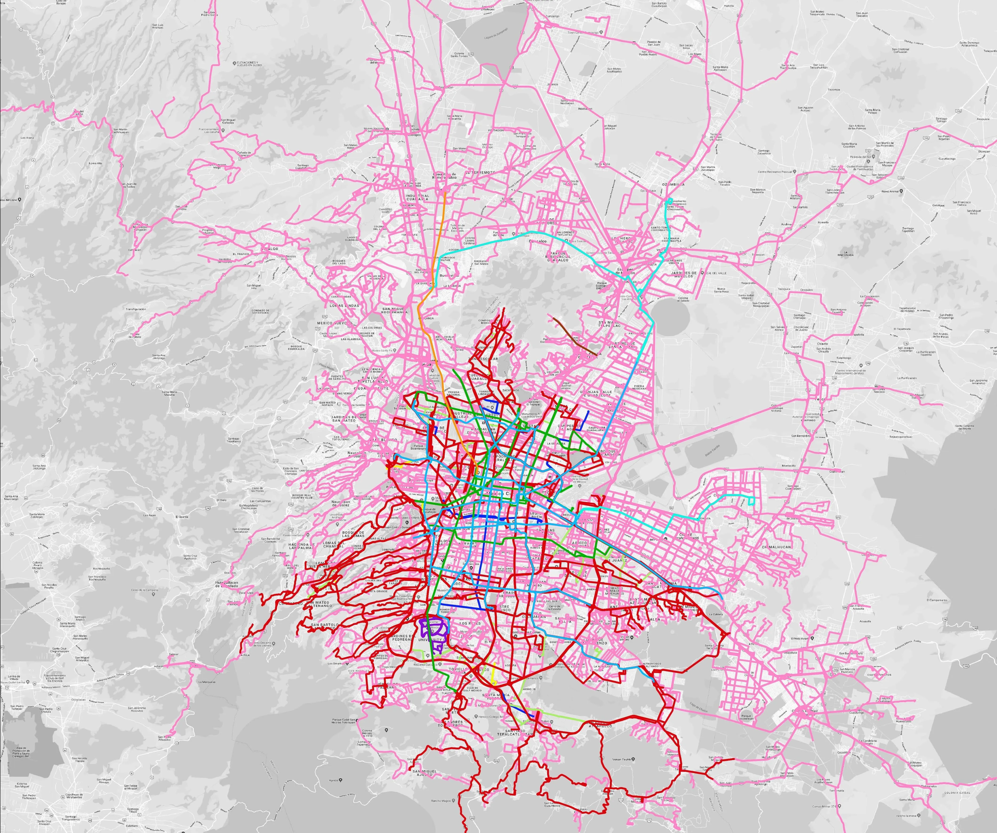
Most recently, WhereIsMyTransport mapped - and now maintains datasets for - the public transport networks in Mexico City, Dhaka (capital of Bangladesh), and the province of Gauteng in South Africa - metro areas with a combined population of more than 55 million. 

The company will collect public transport information in another 27 cities, of which 19 are megacities with populations greater than 10 million, including Bangkok and Rio de Janeiro.

To do this, it uses local teams of data collectors on the ground who map entrances, exits, stairs, gates and platforms at stations and interchanges. 

“We manage and maintain our data, updating it weekly, and integrating it with consumer products and planning tools that support a better public transport experience for everyone, everywhere," insists de Vries.

Related Content

  • April 22, 2020
    Visa and the power of mass transit transactions
    Contactless payment is the hidden power behind efficient public transportation. Visa’s Ana Reiley tells Adam Hill why buying a latte should be a model for frictionless ticketing 
  • May 15, 2014
    Public transport now on Google maps
    Millions of people rely on public transit to get around and since 2007 Google has worked to include public transit routes and schedules in Google Maps. In its latest blog, Google says it makes it even easier to get around on public transport with the addition of public transport information for Vancouver, Chicago and every 2016 Olympic Games host city in Brazil. David Tattersall, Google’s product manager, Public Transit says in his blog: “Our transit data spans six continents, 64 countries and more th
  • February 21, 2019
    Moscow is world’s most gridlocked city, says Inrix
    Moscow is the most gridlocked city in the world, according to a survey of snarl-ups by Inrix. The company’s annual Global Traffic Scorecard found that road users in the Russian capital lost 210 hours last year because of congestion. Inrix weights the data for population, and found that the next four cities on the congestion roll-call were Istanbul, Turkey; Bogota, Colombia; Mexico City; and São Paulo, Brazil. Brazil had another entry on this unwanted list, with Rio de Janeiro in seventh place. Russ
  • June 4, 2014
    UK traffic congestion getting worse says new report
    Traffic congestion in cities across the UK has got significantly worse over the past year, according to a new report from TomTom. The fourth annual Traffic Index from TomTom shows average journeys in 2013 took 27 per cent longer than they would in free-flowing traffic – up from a 26 per cent delay in 2012.