WhereIsMyTransport maps out urban future

Tech start-up says it will be emerging world's 'citymapper' by 2023
By Adam Hill September 17, 2020 Read time: 2 mins
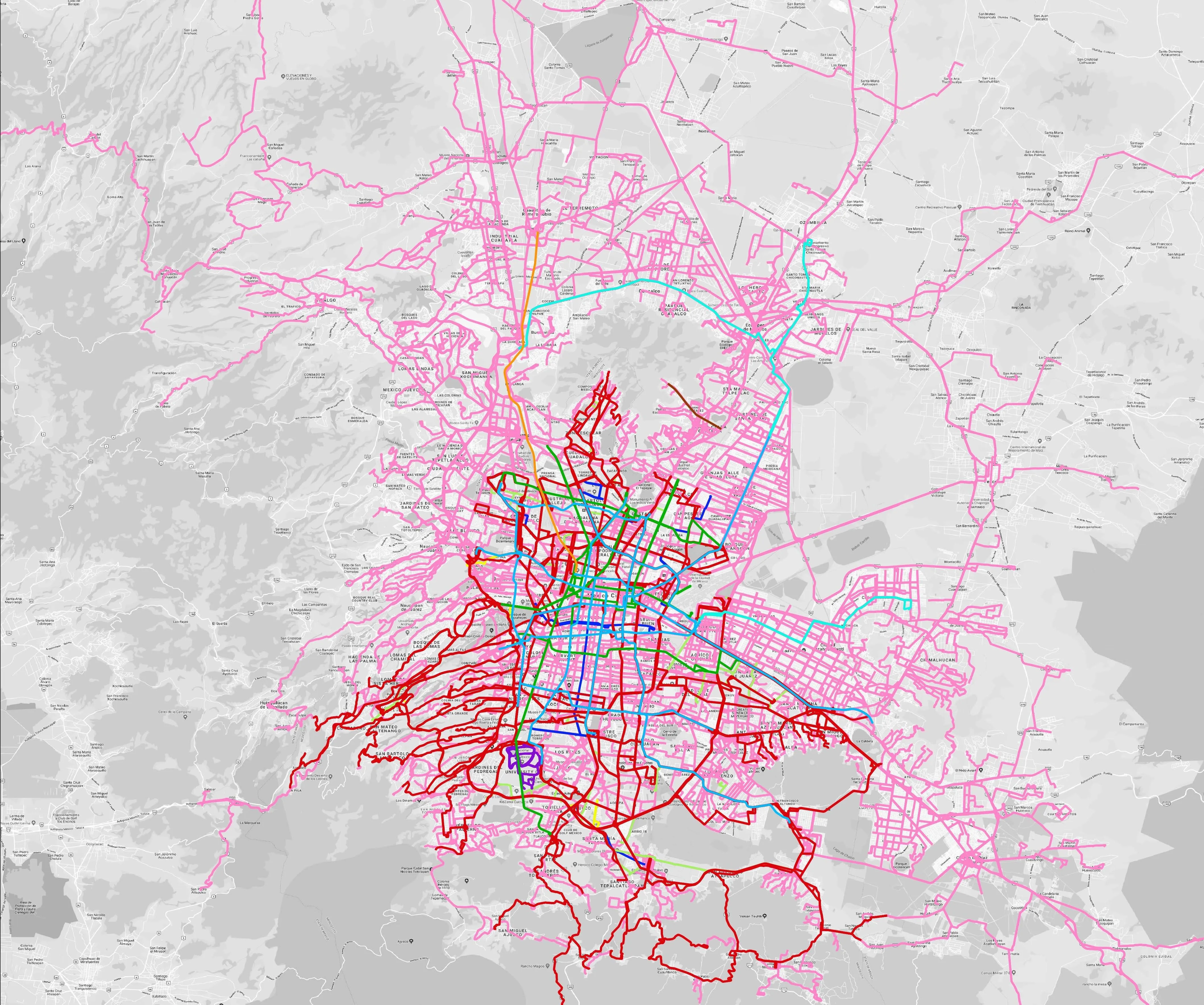
Mexico City is among the conurbations whose networks have been mapped (© WhereIsMyTransport)

WhereIsMyTransport says it is on course to map public transport networks in 30 of the world's biggest cities over the next three years.

The tech start-up, which received funding from both Google and Toyota Tsusho this year, has mapped one million kilometres of formal and informal networks worldwide so far.

Digitalising transport - particularly the 'informal' networks such as commuter minibuses which are vital in many cities - will be of considerable benefit to local economies.

CEO Devin de Vries says: "The production and maintenance of this mobility data is a fundamental first step towards transforming the public transport experience for hundreds of millions of people, and with it the social, cultural and economic landscape of these cities."

The firm began collecting public transport data in emerging markets in 2015, concentrating on the thousands of routes and vehicles owned and run by independent operators, which are effectively unmapped and offline. 

Most recently, WhereIsMyTransport mapped - and now maintains datasets for - the public transport networks in Mexico City, Dhaka (capital of Bangladesh), and the province of Gauteng in South Africa - metro areas with a combined population of more than 55 million. 

The company will collect public transport information in another 27 cities, of which 19 are megacities with populations greater than 10 million, including Bangkok and Rio de Janeiro.

To do this, it uses local teams of data collectors on the ground who map entrances, exits, stairs, gates and platforms at stations and interchanges. 

“We manage and maintain our data, updating it weekly, and integrating it with consumer products and planning tools that support a better public transport experience for everyone, everywhere," insists de Vries.

For more information on companies in this article

Related Content

  • NYC extends Brooklyn bus lane enforcement 
    February 27, 2020
    MTA New York City Transit, one of the main operating agencies of New York’s Metropolitan Transportation Authority (MTA), has extended its bus-mounted lane enforcement cameras to Brooklyn’s busiest bus route.
  • Navteq powers Garmin devices In Romania
    March 23, 2012
    Navteq has been chosen by Garmin as map data supplier for Romania and . The Navteq map of Romania is now available not only on Garmin’s new nüvi 40 LM Romania but also as an optional download for existing Garmin portable devices. In Romania, Navteq says its map is built by a team of geographic analysts based in Bucharest and well placed to create and maintain local map coverage and to provide updated information throughout the year.
  • Vehicle ownership - a thing of the past?
    May 22, 2012
    Convergence of electron-powered vehicles with connected vehicle technologies could mean that only a few decades from now the idea of owning a vehicle will be entirely alien to the road user. By Technolution chief scientist Dave Marples with Jason Barnes Even when taken individually, many of the developments going on and around vehiclebased mobility will bring about major changes in transportation. Taken collectively, the transformations we might expect are nothing short of profound. Enumeration of the influ
  • Integrating traffic systems improves management and control
    April 25, 2012
    Following a successful trial in 2007, VicRoads has adopted Streams Motorway Management from Transmax as its primary traffic management and control system Throughout the world, the avoidable social cost of traffic congestion continues to rise each year with increased motorisation, urbanisation and population growth. Traffic congestion is responsible for an increase in travel times, vehicle operating costs and carbon emissions. In 2007, VicRoads commissioned Streams Motorway Management for the M1 Monash Freew