WhereIsMyTransport maps out urban future

Tech start-up says it will be emerging world's 'citymapper' by 2023
By Adam Hill September 17, 2020 Read time: 2 mins
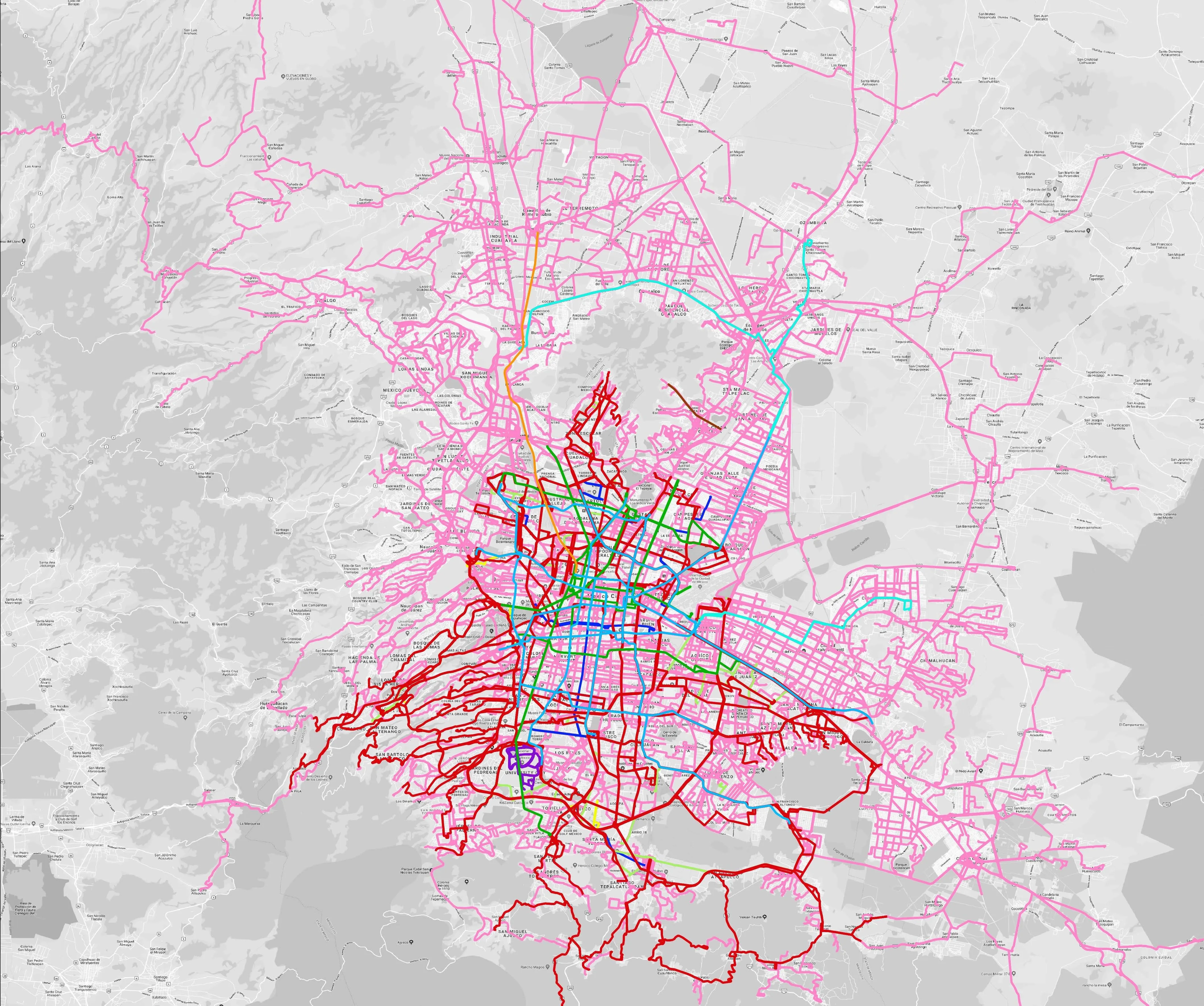
Mexico City is among the conurbations whose networks have been mapped (© WhereIsMyTransport)

WhereIsMyTransport says it is on course to map public transport networks in 30 of the world's biggest cities over the next three years.

The tech start-up, which received funding from both Google and Toyota Tsusho this year, has mapped one million kilometres of formal and informal networks worldwide so far.

Digitalising transport - particularly the 'informal' networks such as commuter minibuses which are vital in many cities - will be of considerable benefit to local economies.

CEO Devin de Vries says: "The production and maintenance of this mobility data is a fundamental first step towards transforming the public transport experience for hundreds of millions of people, and with it the social, cultural and economic landscape of these cities."

The firm began collecting public transport data in emerging markets in 2015, concentrating on the thousands of routes and vehicles owned and run by independent operators, which are effectively unmapped and offline. 

Most recently, WhereIsMyTransport mapped - and now maintains datasets for - the public transport networks in Mexico City, Dhaka (capital of Bangladesh), and the province of Gauteng in South Africa - metro areas with a combined population of more than 55 million. 

The company will collect public transport information in another 27 cities, of which 19 are megacities with populations greater than 10 million, including Bangkok and Rio de Janeiro.

To do this, it uses local teams of data collectors on the ground who map entrances, exits, stairs, gates and platforms at stations and interchanges. 

“We manage and maintain our data, updating it weekly, and integrating it with consumer products and planning tools that support a better public transport experience for everyone, everywhere," insists de Vries.

For more information on companies in this article

Related Content

  • 3D lane geometry for TomTom Orbis Maps
    January 7, 2025
    New development uses AI, including fundamental vision models
  • Data exploits parking potential
    March 11, 2015
    David Crawford parallel parks with innovations in two continents. Surveys of US cities indicate that drivers searching for parking can account for up to 37% of all urban traffic congestion. A 2011 study by IBM of 20 cities around the world found that nearly six out of ten drivers had abandoned their search for a parking space at least once; while motorists generally spent on average 20 minutes looking for a sought-after spot.
  • Egis selected as project consultant for Bangkok monorail contract
    February 14, 2018
    Thai Mass Rapid Transit Authority has chosen Egis as a project consultant for Bangkok’s Pink Line monorail along with its local partner Team Consult. The estimated ฿53.5bn (£1.2bn) scheme will deploy 42 trains with a maximum speed of 80 km / h with the intention of carrying more than 28,000 passengers per hour in each direction and increasing everyday journeys to more than 400,000 people. This venture is part of the Mass Rapid Transit Master Plan which intends to develop the public transport network in the
  • Considering accessibility costs little and pays dividends for all travellers
    August 8, 2017
    Catering for those with disabilities can be cost-effective and improve services for all travellers, as David Crawford discovers. Clearer understanding of the economic value of accessible transport is essential if we are to speed up the current slow deployment levels, according to the Paris-based International Transport Forum (ITF), which staged a 2016 round table on the ‘Benefits and Costs of Inclusion in Transport’. It wants to see greater availability of data on levels of actual and unmet demand for acces