WhereIsMyTransport maps out urban future

Tech start-up says it will be emerging world's 'citymapper' by 2023
By Adam Hill September 17, 2020 Read time: 2 mins
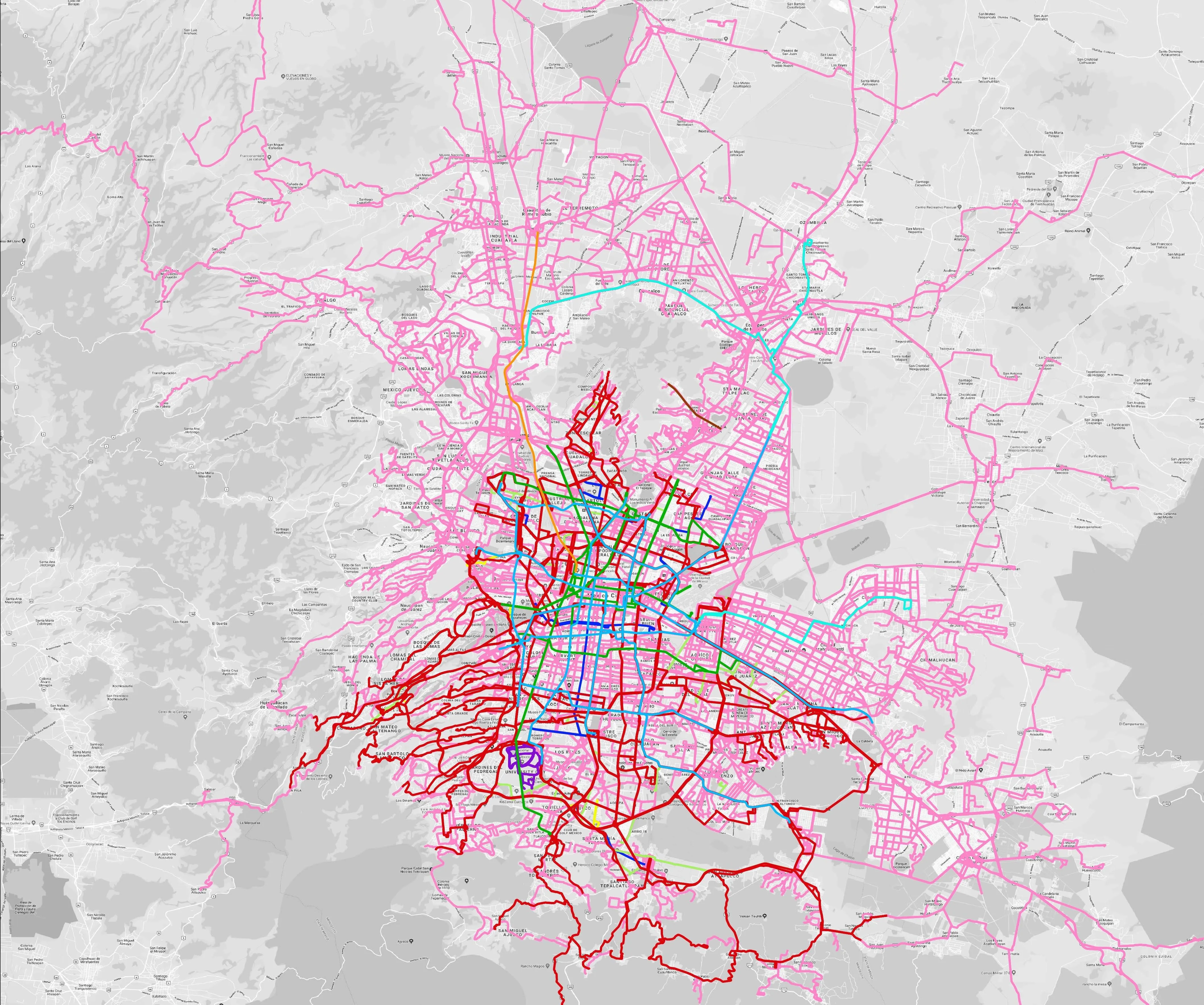
Mexico City is among the conurbations whose networks have been mapped (© WhereIsMyTransport)

WhereIsMyTransport says it is on course to map public transport networks in 30 of the world's biggest cities over the next three years.

The tech start-up, which received funding from both Google and Toyota Tsusho this year, has mapped one million kilometres of formal and informal networks worldwide so far.

Digitalising transport - particularly the 'informal' networks such as commuter minibuses which are vital in many cities - will be of considerable benefit to local economies.

CEO Devin de Vries says: "The production and maintenance of this mobility data is a fundamental first step towards transforming the public transport experience for hundreds of millions of people, and with it the social, cultural and economic landscape of these cities."

The firm began collecting public transport data in emerging markets in 2015, concentrating on the thousands of routes and vehicles owned and run by independent operators, which are effectively unmapped and offline. 

Most recently, WhereIsMyTransport mapped - and now maintains datasets for - the public transport networks in Mexico City, Dhaka (capital of Bangladesh), and the province of Gauteng in South Africa - metro areas with a combined population of more than 55 million. 

The company will collect public transport information in another 27 cities, of which 19 are megacities with populations greater than 10 million, including Bangkok and Rio de Janeiro.

To do this, it uses local teams of data collectors on the ground who map entrances, exits, stairs, gates and platforms at stations and interchanges. 

“We manage and maintain our data, updating it weekly, and integrating it with consumer products and planning tools that support a better public transport experience for everyone, everywhere," insists de Vries.

For more information on companies in this article

Related Content

  • Detection analysis technology successfully predicts traffic flows
    February 3, 2012
    David Crawford investigates new detection analysis technology from IBM. Locations on both the East and West Coasts of the US are scheduled for early deployments of IBM's new Traffic Prediction Tool (TPT) statistical analysis model for the fine-time resolution and near-term prediction of road flow conditions. Developed by IBM's Watson Research Laboratories, TPT is designed to analyse data from the the key detection indicators - average vehicle volumes and speeds passing a location in a given time interval -
  • How ITS helped Coachella get its groove back
    November 15, 2024
    California’s Coachella Valley attracts visitors to myriad music and sports events. But now an ambitious traffic management initiative aims to cut travel times and reduce emissions. Adam Hill talks to the engineers involved in the massive CV Sync project
  • High hopes for Detroit streetcar system
    June 12, 2013
    Detroit, the historic home of the US automotive industry, is to get a new streetcar rail system to help drive the economic revival of Motor City. M-1 Rail, the organisation overseeing the US$140 million project, has been pursuing an aggressive timetable toward a late 2015 service launch. “We are now jumping out of the gate,” says Heather Carmona, M-1 Rail’s chief administrative officer. Final design could be completed by mid-August and, depending on when the necessary permits are secured, construction coul
  • Economic crisis needs non-partisan perspectives to stimulate growth
    February 2, 2012
    Kary Witt, President of the IBTTA and Pat Jones, Executive Director and CEO, talk about the need to put aside partisan perspectives in order to deal with the current economic crisis