WhereIsMyTransport maps out urban future

Tech start-up says it will be emerging world's 'citymapper' by 2023
By Adam Hill September 17, 2020 Read time: 2 mins
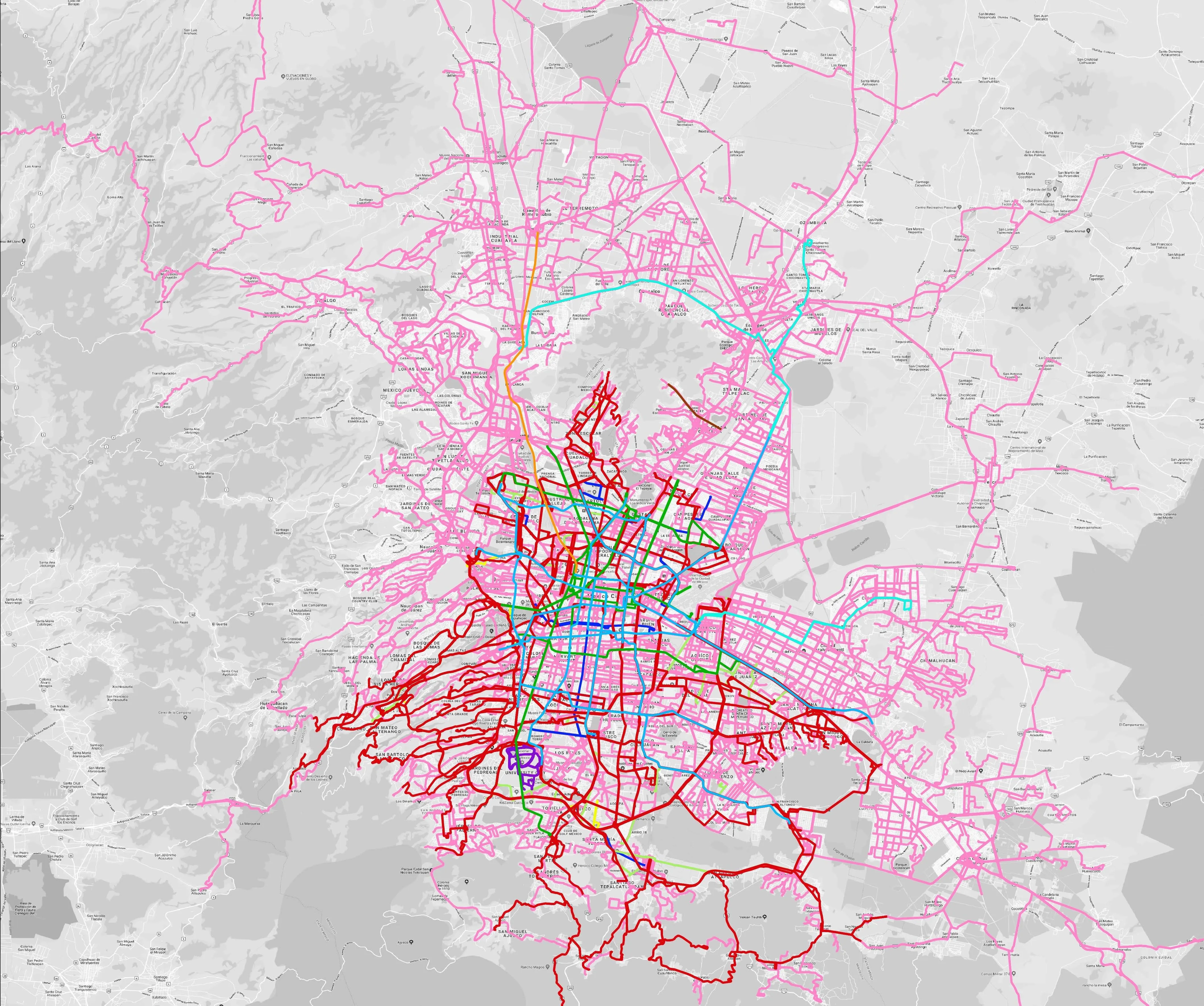
Mexico City is among the conurbations whose networks have been mapped (© WhereIsMyTransport)

WhereIsMyTransport says it is on course to map public transport networks in 30 of the world's biggest cities over the next three years.

The tech start-up, which received funding from both Google and Toyota Tsusho this year, has mapped one million kilometres of formal and informal networks worldwide so far.

Digitalising transport - particularly the 'informal' networks such as commuter minibuses which are vital in many cities - will be of considerable benefit to local economies.

CEO Devin de Vries says: "The production and maintenance of this mobility data is a fundamental first step towards transforming the public transport experience for hundreds of millions of people, and with it the social, cultural and economic landscape of these cities."

The firm began collecting public transport data in emerging markets in 2015, concentrating on the thousands of routes and vehicles owned and run by independent operators, which are effectively unmapped and offline. 

Most recently, WhereIsMyTransport mapped - and now maintains datasets for - the public transport networks in Mexico City, Dhaka (capital of Bangladesh), and the province of Gauteng in South Africa - metro areas with a combined population of more than 55 million. 

The company will collect public transport information in another 27 cities, of which 19 are megacities with populations greater than 10 million, including Bangkok and Rio de Janeiro.

To do this, it uses local teams of data collectors on the ground who map entrances, exits, stairs, gates and platforms at stations and interchanges. 

“We manage and maintain our data, updating it weekly, and integrating it with consumer products and planning tools that support a better public transport experience for everyone, everywhere," insists de Vries.

Related Content

  • January 26, 2015
    Funding for São Paulo, Rio de Janeiro urban mobility
    Brazil's national development bank BNDES has earmarked US$15.2bn for urban mobility works in the metropolitan regions of São Paulo and Rio de Janeiro from 2015-18. The works include the construction of metro, monorail, bus rapid transit (BRT) and light rail transit (LRT) systems. The investments are part of urban mobility projects planned by the federal government under its growth acceleration plan, many of which will be carried out through public-private partnerships. Approximately US$10 billion is e
  • March 16, 2012
    Google maps the future of traffic and travel information?
    Will the relentless growth of Google lead to it becoming the ultimate provider of travel information services? Huw Williams investigates Google’s strategy and David Crawford discovers what two principal rivals are doing to keep pace. In the first weeks of 2012 one company staked two divergent claims on the future of transport. One is the science fiction of only a decade ago, turned into reality: the driverless car. The other seems more prosaic, yet in its own way is just as significant a marker of the futur
  • May 4, 2016
    Priority boosts ridership and cuts congestion
    Transit priority is proving a win-win in Europe and Australia. David Crawford reports. Technology that integrates with the Australian-originated Sydney Coordinated Adaptive Traffic System (SCATS) is driving bus signal priority and performance analysis initiatives on both sides of the world; in its homeland, with a major deployment in 2015, and in the capital of the Republic of Ireland.
  • December 20, 2024
    Overture Maps releases its transportation dataset
    Open-map dataset includes 86 million kilometres of roads worldwide