WhereIsMyTransport maps out urban future

Tech start-up says it will be emerging world's 'citymapper' by 2023
By Adam Hill September 17, 2020 Read time: 2 mins
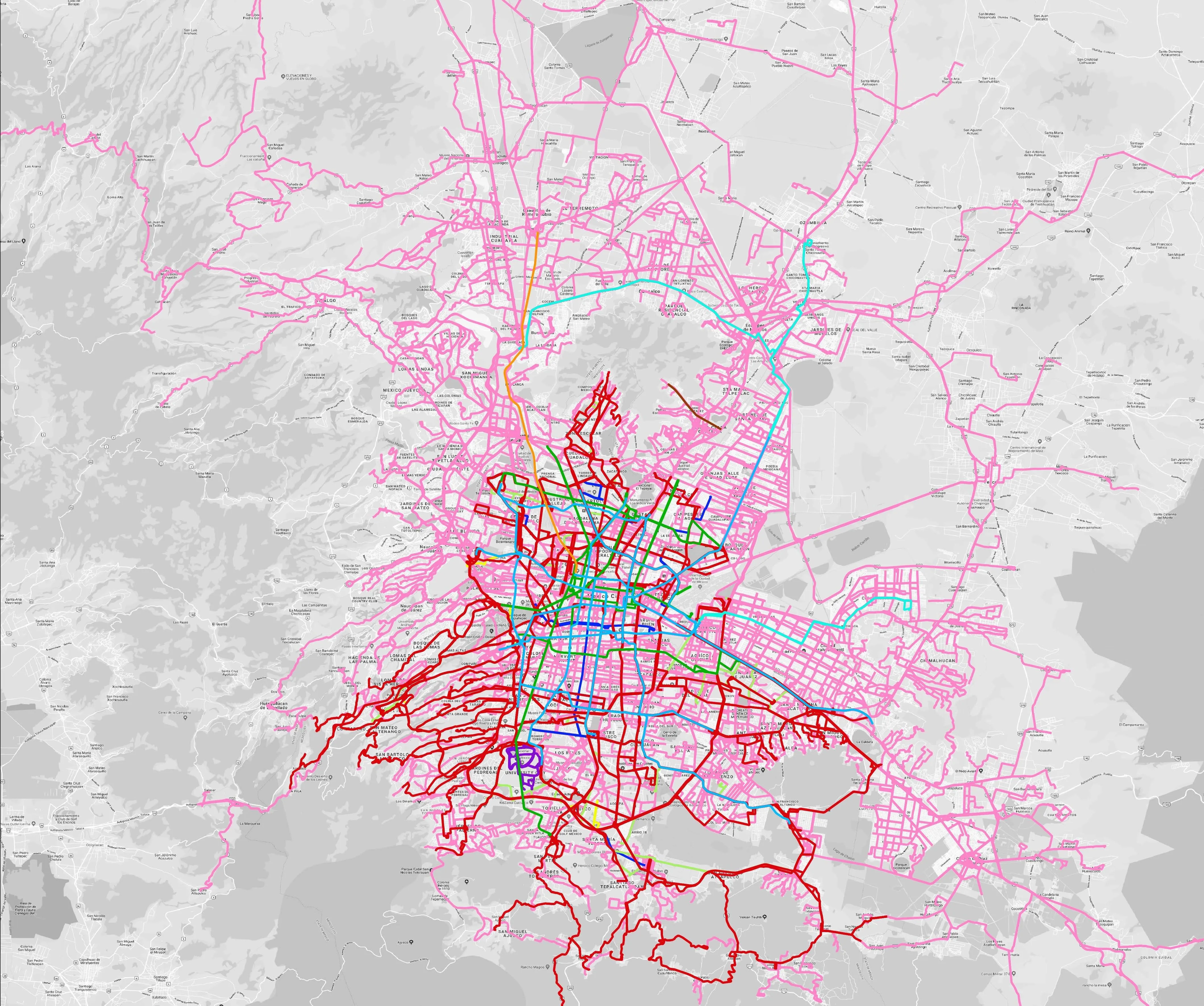
Mexico City is among the conurbations whose networks have been mapped (© WhereIsMyTransport)

WhereIsMyTransport says it is on course to map public transport networks in 30 of the world's biggest cities over the next three years.

The tech start-up, which received funding from both Google and Toyota Tsusho this year, has mapped one million kilometres of formal and informal networks worldwide so far.

Digitalising transport - particularly the 'informal' networks such as commuter minibuses which are vital in many cities - will be of considerable benefit to local economies.

CEO Devin de Vries says: "The production and maintenance of this mobility data is a fundamental first step towards transforming the public transport experience for hundreds of millions of people, and with it the social, cultural and economic landscape of these cities."

The firm began collecting public transport data in emerging markets in 2015, concentrating on the thousands of routes and vehicles owned and run by independent operators, which are effectively unmapped and offline. 

Most recently, WhereIsMyTransport mapped - and now maintains datasets for - the public transport networks in Mexico City, Dhaka (capital of Bangladesh), and the province of Gauteng in South Africa - metro areas with a combined population of more than 55 million. 

The company will collect public transport information in another 27 cities, of which 19 are megacities with populations greater than 10 million, including Bangkok and Rio de Janeiro.

To do this, it uses local teams of data collectors on the ground who map entrances, exits, stairs, gates and platforms at stations and interchanges. 

“We manage and maintain our data, updating it weekly, and integrating it with consumer products and planning tools that support a better public transport experience for everyone, everywhere," insists de Vries.

For more information on companies in this article

Related Content

  • Toyota enters partnership to build HD maps for AVs from space
    May 3, 2019
    Toyota Research Institute-Advanced Development (TRI-AD), technology company Maxar Technologies and NTT Data are working together to build high-definition (HD) maps for autonomous vehicles (AV) using satellite imagery. TRI-AD carried out an analysis, saying that current HD maps cover less than 1% of the global road network and there is a need to broaden the coverage of urban areas and local roads before AVs can become a mainstream mobility technology. A HD map created from satellite imagery would all
  • Panasonic in Colorado: Rocky mountain way
    December 3, 2018
    Panasonic is at the heart of a C-V2X project which began last year in Colorado. The company’s smart mobility boss Chris Armstrong tells Adam Hill how it is working out Colorado needs traffic and transport solutions – and fast. The US state’s population has grown 50% in the last 20 years and another 50% hike is predicted in the next 20. It also spends more than $13 billion in roadway crash costs each year. In 2015, 546 people died in traffic-related crashes, and more than 3,000 were seriously injured.
  • Conduent modernises Helsinki fares
    August 8, 2022
    Finnish capital's regional transport authority saw 238 million passenger boardings in 2021
  • Mobility itself is moving says cubic
    June 9, 2015
    Cubic’s Chris Bax looks at the challenges and benefits of implementing transport as a service. Imagine paying for travel in exactly the same way you buy your phone service. For example, you would pay a set amount in exchange for a monthly travel package covering up to 100km of free taxi journeys in your home city (including a guaranteed 15 minute pickup) and public transport usage within a 1,500km radius of your home. Not only would this option be cheaper than owning and maintaining your own car, you would