WhereIsMyTransport maps out urban future

Tech start-up says it will be emerging world's 'citymapper' by 2023
By Adam Hill September 17, 2020 Read time: 2 mins
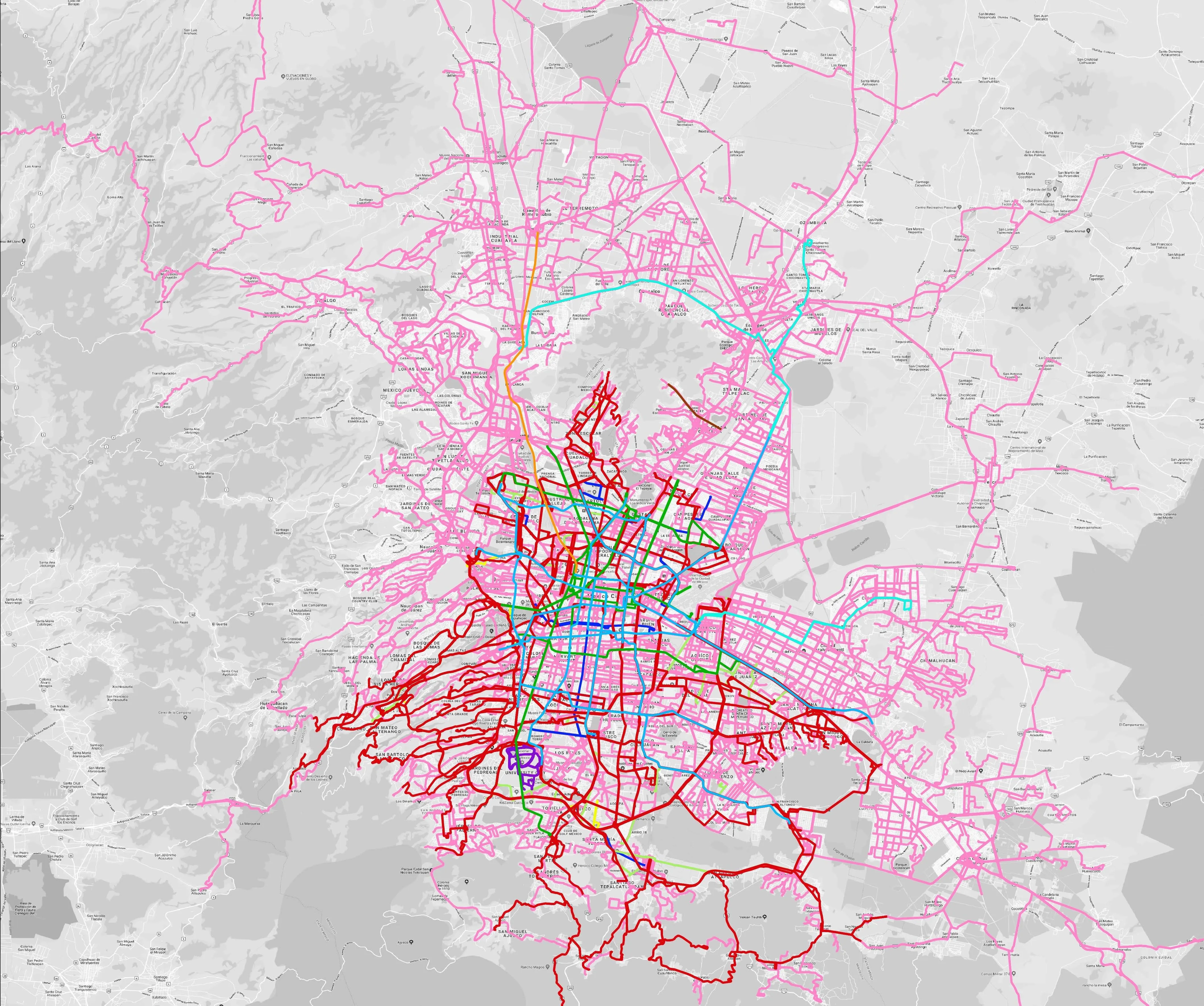
Mexico City is among the conurbations whose networks have been mapped (© WhereIsMyTransport)

WhereIsMyTransport says it is on course to map public transport networks in 30 of the world's biggest cities over the next three years.

The tech start-up, which received funding from both Google and Toyota Tsusho this year, has mapped one million kilometres of formal and informal networks worldwide so far.

Digitalising transport - particularly the 'informal' networks such as commuter minibuses which are vital in many cities - will be of considerable benefit to local economies.

CEO Devin de Vries says: "The production and maintenance of this mobility data is a fundamental first step towards transforming the public transport experience for hundreds of millions of people, and with it the social, cultural and economic landscape of these cities."

The firm began collecting public transport data in emerging markets in 2015, concentrating on the thousands of routes and vehicles owned and run by independent operators, which are effectively unmapped and offline. 

Most recently, WhereIsMyTransport mapped - and now maintains datasets for - the public transport networks in Mexico City, Dhaka (capital of Bangladesh), and the province of Gauteng in South Africa - metro areas with a combined population of more than 55 million. 

The company will collect public transport information in another 27 cities, of which 19 are megacities with populations greater than 10 million, including Bangkok and Rio de Janeiro.

To do this, it uses local teams of data collectors on the ground who map entrances, exits, stairs, gates and platforms at stations and interchanges. 

“We manage and maintain our data, updating it weekly, and integrating it with consumer products and planning tools that support a better public transport experience for everyone, everywhere," insists de Vries.

For more information on companies in this article

Related Content

  • $150m World Bank investment for Lima transportation systems
    October 21, 2024
    Cash injection aims to improve Peruvian capital's traffic management and road safety
  • MaaS by any other name
    February 6, 2020
    Has the roll-out of Mobility as a Service stalled - or could it just be that multimodal travel is simply happening under a variety of different names?
  • Advances in real time traffic and travel information
    March 16, 2012
    David Crawford admires TomTom’s flying start to 2012. Gobal location and navigation equipment supplier TomTom rang in 2012 with two strategically important announcements. First was the signing of a deal with Korean electronics giant Samsung, representing an important consolidation of its position in the consumer market. Under this agreement, TomTom maps and location content will power the Samsung Wave3 smartphone, launched in autumn 2011. TomTom data will support navigation and search-and-find applications
  • Solar studs a cost-effective alternative to street lighting?
    July 30, 2012
    Road traffic accidents have an enormous impact on society in terms of human loss, pain and suffering and a significant cost to the economy, the individual and their families. Accident rates on South Africa's roads are among the highest in the world and cost the country in the region of $163 million each year. The former head of the Department of Transport (DoT), Dr Kwazi Mbanjwa, described the situation as "carnage on our roads", with over 500,000 accidents and 10,000 fatalities per annum and the number of