WhereIsMyTransport maps out urban future

Tech start-up says it will be emerging world's 'citymapper' by 2023
By Adam Hill September 17, 2020 Read time: 2 mins
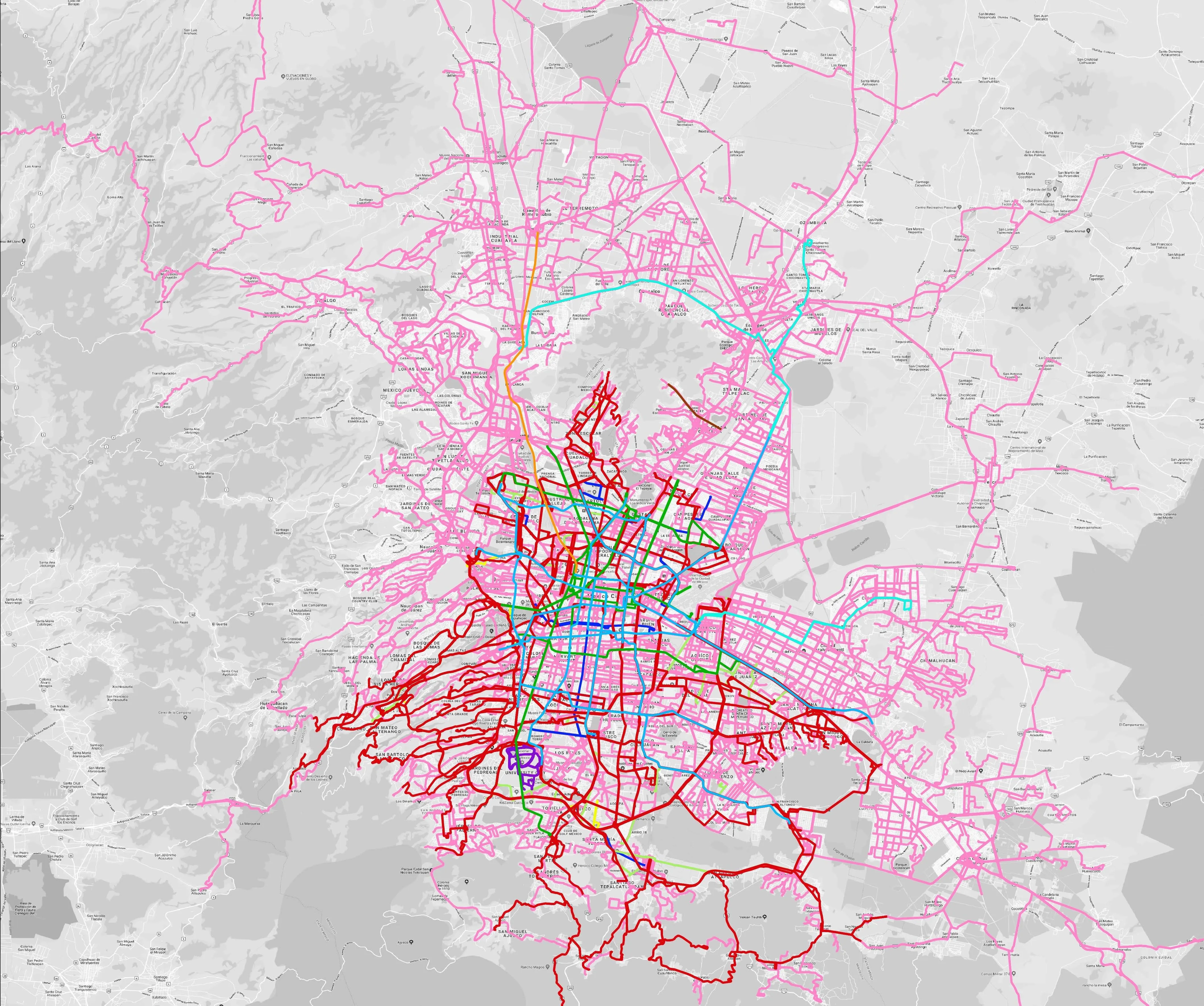
Mexico City is among the conurbations whose networks have been mapped (© WhereIsMyTransport)

WhereIsMyTransport says it is on course to map public transport networks in 30 of the world's biggest cities over the next three years.

The tech start-up, which received funding from both Google and Toyota Tsusho this year, has mapped one million kilometres of formal and informal networks worldwide so far.

Digitalising transport - particularly the 'informal' networks such as commuter minibuses which are vital in many cities - will be of considerable benefit to local economies.

CEO Devin de Vries says: "The production and maintenance of this mobility data is a fundamental first step towards transforming the public transport experience for hundreds of millions of people, and with it the social, cultural and economic landscape of these cities."

The firm began collecting public transport data in emerging markets in 2015, concentrating on the thousands of routes and vehicles owned and run by independent operators, which are effectively unmapped and offline. 

Most recently, WhereIsMyTransport mapped - and now maintains datasets for - the public transport networks in Mexico City, Dhaka (capital of Bangladesh), and the province of Gauteng in South Africa - metro areas with a combined population of more than 55 million. 

The company will collect public transport information in another 27 cities, of which 19 are megacities with populations greater than 10 million, including Bangkok and Rio de Janeiro.

To do this, it uses local teams of data collectors on the ground who map entrances, exits, stairs, gates and platforms at stations and interchanges. 

“We manage and maintain our data, updating it weekly, and integrating it with consumer products and planning tools that support a better public transport experience for everyone, everywhere," insists de Vries.

For more information on companies in this article

Related Content

  • Utah Department of Transportation: How we’re using traffic analytics software
    February 4, 2025
    Our use of Iteris ClearGuide lets our traffic operations engineers interpret critical probe traffic data without the need for statisticians and software developers
  • Healthy prospects for floating vehicle data systems
    February 3, 2012
    Elmar Brockfeld, Alexander Sohr and Peter Wagner from the German Aerospace Center's Institute of Transport Systems look at the prospects for floating vehicle data systems. Although Floating Vehicle Data (FVD) or probe vehicle fleets have been around for about a decade, the idea behind them is of course much older: from probe vehicles that flow with the traffic it should be possible to get a precise, fast and spatially near-complete picture of the prevailing traffic flow conditions in an area under surveilla
  • Venkat Sumantran: ‘Smart cities are more hype than reality’
    November 23, 2018
    For all the talk of smart cities, investment in systems lags significantly behind organic expansion in most places. Andrew Stone talks to Venkat Sumantran, who has been looking at how to create a coherent framework which could help authorities answer multiple mobility questions Two megatrends are posing unprecedented challenges to those trying to keep people moving around the world’s urban areas now - and in the years and decades to come. The first is rapid urbanisation. One in six of us lived in urban a
  • Why keeping count is so important for traffic management
    November 21, 2023
    Traffic engineers need to have multiple solutions in their toolbox to complete the most accurate and safe data collection programmes possible, explains Wes Guckert of The Traffic Group