WhereIsMyTransport maps out urban future

Tech start-up says it will be emerging world's 'citymapper' by 2023
By Adam Hill September 17, 2020 Read time: 2 mins
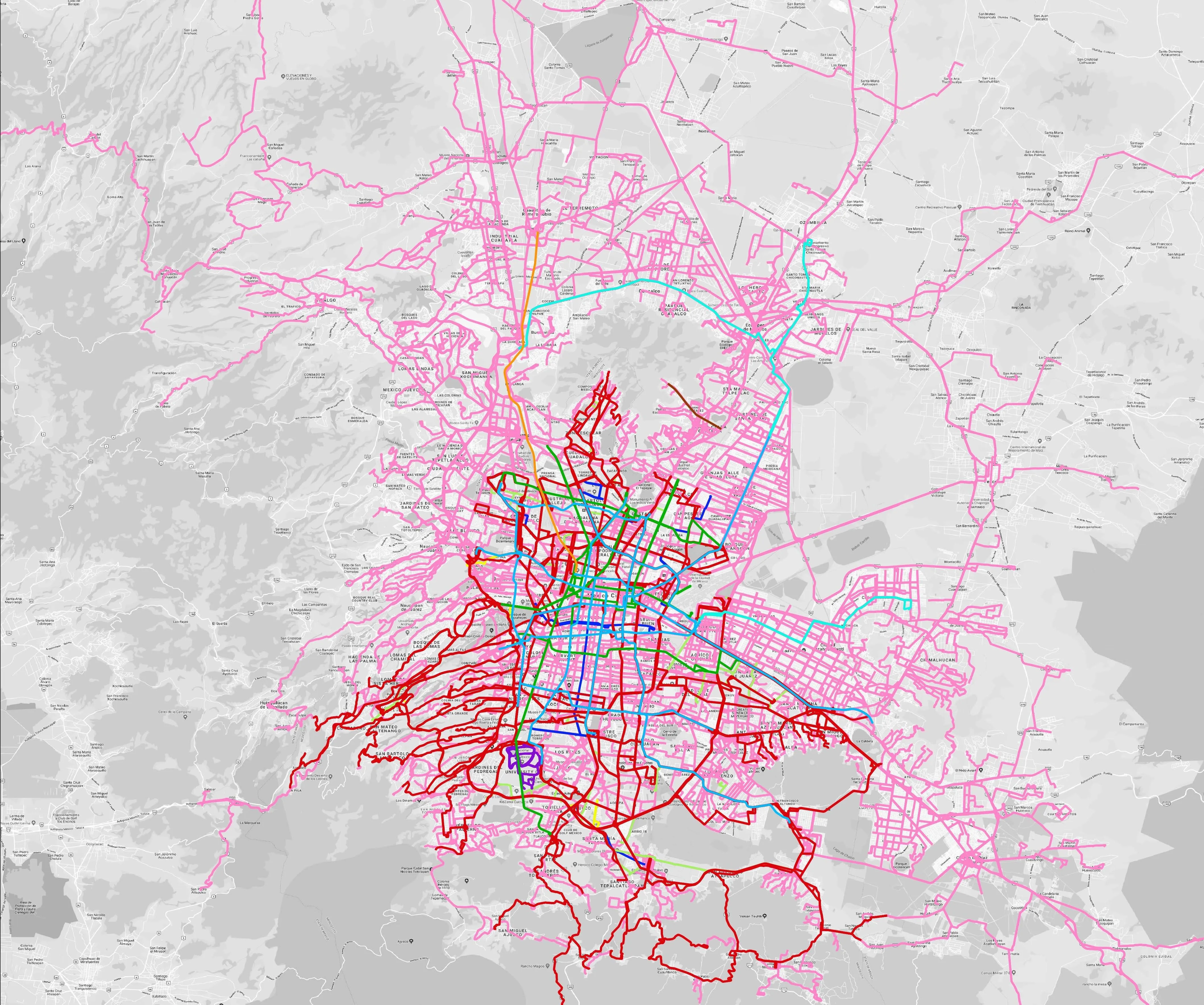
Mexico City is among the conurbations whose networks have been mapped (© WhereIsMyTransport)

WhereIsMyTransport says it is on course to map public transport networks in 30 of the world's biggest cities over the next three years.

The tech start-up, which received funding from both Google and Toyota Tsusho this year, has mapped one million kilometres of formal and informal networks worldwide so far.

Digitalising transport - particularly the 'informal' networks such as commuter minibuses which are vital in many cities - will be of considerable benefit to local economies.

CEO Devin de Vries says: "The production and maintenance of this mobility data is a fundamental first step towards transforming the public transport experience for hundreds of millions of people, and with it the social, cultural and economic landscape of these cities."

The firm began collecting public transport data in emerging markets in 2015, concentrating on the thousands of routes and vehicles owned and run by independent operators, which are effectively unmapped and offline. 

Most recently, WhereIsMyTransport mapped - and now maintains datasets for - the public transport networks in Mexico City, Dhaka (capital of Bangladesh), and the province of Gauteng in South Africa - metro areas with a combined population of more than 55 million. 

The company will collect public transport information in another 27 cities, of which 19 are megacities with populations greater than 10 million, including Bangkok and Rio de Janeiro.

To do this, it uses local teams of data collectors on the ground who map entrances, exits, stairs, gates and platforms at stations and interchanges. 

“We manage and maintain our data, updating it weekly, and integrating it with consumer products and planning tools that support a better public transport experience for everyone, everywhere," insists de Vries.

For more information on companies in this article

Related Content

  • Will the European Electronic Tolling System serve its purpose?
    February 3, 2012
    ASECAP's Kallistratos Dionelis asks whether, despite the best intentions at the policy level, the European Electronic Tolling System can ever hope to serve the customer in the way it is intended to. Reality doesn't just happen. In many ways, reality is created. We first create or produce a reality and then we consume it; this takes time and has a cost that needs to be covered.
  • Ford Mobility: analytics aids transport proactivity
    April 2, 2020
    Ford Mobility has demonstrated how data analytics can help implement London's transport strategy in areas such as traffic re-timing and in eliminating all road fatalities (Vision Zero) by 2041.
  • Data collection becoming a crowded market
    October 26, 2017
    New ways of gathering data can revolutionise traffic and travel management, so is the writing on the wall for the traditional methods? Jon Masters reports. There are two big industries that stand to be revolutionised by massive increases in data – healthcare and transportation, says Finlay Clarke, the UK managing director of the smartphone sat nav traffic app, Waze. “At present we’re really only at the start of how cities, in particular, will be transformed,” he says.
  • Rio’s commuters welcome contactless Visa application
    March 6, 2019
    Transit authorities could soon be seeing the benefits of contactless payments – without having to replace expensive turnstiles or terminals. That, at least, is what Visa is suggesting as the company launches its own secure access model (SAM), which is set to be put into service in Brazil. Metro Rio will be the first transit operator to launch contactless payments using the Visa SAM in late April. Visa and Planeta Informatica say the new technology “makes it easy for transit organisations and operators to