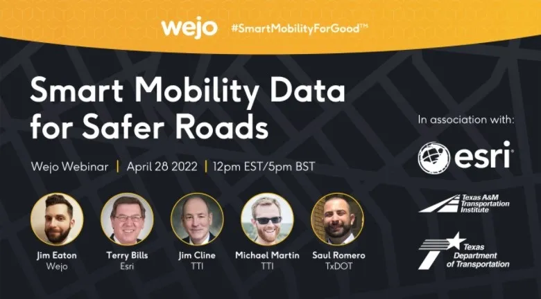
Webinar: how smart mobility data leads to safer roads

Free webinar on 28 April features Wejo, Esri, TxDoT & Texas A&M Transportation Institute
By Adam Hill April 19, 2022 Read time: 2 mins
The free webinar takes place on 28 April at midday EST / 5pm BST

The use of smart mobility data in improving road safety is the subject of a new webinar from Wejo.

Click here to register.

The free event takes place on 28 April at midday EST / 5pm BST with Texas Department of Transportation (TxDoT), Texas A&M Transportation Institute and Esri.

It will show how data enables transportation departments to improve roadway safety and access, and how to efficiently implement data-driven road safety initiatives to curb crashes.

L‍ast year, TxDoT enlisted Texas A&M Transportation Institute to help solve the problem of heightened public safety risks on roads within the Permian Basin.

Speakers from all four organisations will explain how they worked together to examine trends on how the region’s roads and driveways located near oil/gas leases were being used and to recommend improvements.

To find a solution, Texas A&M Transportation Institute uses innovative technologies, such as Wejo's smart mobility insights via the Esri ArcGIS Online platform in its research.  

With Wejo's data, Texas A&M Transportation Institute is able to provide data-driven recommendations to TxDoT, including where to install new driveways or retrofit existing ones along the corridors in the Permian Basin region to improve accessibility, mobility and public safety.  

Content produced in association with Wejo

For more information on companies in this article

Related Content

  • Esri and Here sign multi-year map data licensing agreement
    July 11, 2017
    Esri has signed a multi-year licensing agreement with Here Technologies, which will provide its ArcGIS users with access to global, accurate and fresh geospatial content, including dozens of new and rich map attributes.
  • Hikvision offers faster and better traffic management decisions
    April 8, 2021
    In today’s crowded cities, effective traffic management is critical for reducing congestion and preventing accidents. With the Hikvision Traffic Visualisation Dashboard, traffic managers can view historical and real-time traffic information, helping them make the best decisions and improve outcomes for road users and residents.
  • Inrix aids authorities in dealing with data
    August 18, 2015
    New traffic data products and services have been launched to aid transport and urban planners and business with detailed intelligence on journey patterns, reports Jon Masters. Manual travel surveys ought soon to become a thing of the past for transport planners and the business community. The technology now exists for getting sophisticated levels of traffic and trip data from connected vehicles. Cars and commercial fleets carrying a GPS device, or a mobile phone or smartphone are the sources of the informat
  • USDOT transportation T3 webinars 2013
    December 24, 2012
    Sponsored by the US Department of Transportation's ITS Professional Capacity Building (PCB) Program. T3 webinars are interactive online meetings where subject matter experts present on a wide range of topics related to Intelligent Transportation Systems (ITS) planning, design, procurement, deployment, operations, noteworthy practices, and lessons learned. Recently added webinars include: