Viva drives NYCDoT road safety data collection pilot

Viva sensors installed at 12 locations in Brooklyn, Bronx, Manhattan and Queens
By Adam Hill April 19, 2023 Read time: 2 mins
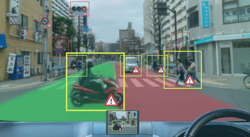
The pilot will help NYCDoT understand how people on different modes use the streets (© Leo Bruce Hempell | Dreamstime.com)

Viva sensors are being used in a New York City pilot to improve road safety.

New York City Department of Transportation (NYCDoT) has put Viva (the US name for UK firm VivaCity) sensors on streetlight poles in 12 locations in Brooklyn, Bronx, Manhattan and Queens to see if they are cheaper and more accurate than manual traffic counts.

The technology collects street activity data via camera, then classifies and counts road users in real time.

This will help "to generate detailed reports that will allow planners to better understand the uses of city streets and inform future street redesigns", NYCDoT says.

The Viva sensors identify and count up to nine different modes of travel, including pedestrians, cyclists, cars, buses, trucks and e-scooters.

They can see seasonal changes in travel patterns, show path and speed of travel, and detect near-miss incidents and turning movements.

Viva will provide street activity count data by analysing video footage from temporarily installed cameras or existing live feeds.

The agency will use the data to analyse the effectiveness and safety of its initiatives and street designs, and to prioritise projects for areas most in need of street improvements.

The sensor information will also help NYCDoT to better understand how people use the streets themselves - for instance, accessing bus stops or loading zones, visiting businesses, or preferred places to cycle.

NYCDoT insists: "The pilot prioritises privacy, identifying data-collection methods that protect privacy by removing identifying information of roadway users and discarding video frames after counts are collected on the device."

The project is a partnership between NYCDoT, New York City’s Office of Technology and Innovation and City University of New York.

It was funded primarily by a grant from the New York State Empire State Development Corporation, with support from Federal Raise and Safe Streets For All grants.

For more information on companies in this article

Related Content

  • InDriver’s ride-hailing app allows NYC users to negotiate fares
    March 19, 2019
    InDriver has launched its ride-hailing app in New York City (NYC) which allows the driver and passenger to negotiate lower fares. The app allows users to set a fare for a selected route. Nearby drivers receive the destination and fare and can either accept or bargain for more money. The passenger receives multiple offers from drivers, allowing them to make a choice based on fare amount, driver ratings, estimated time of arrival and vehicle make/model. The service is available to communities in Brooklyn,
  • Atlanta launches Smart Corridor demonstration project
    September 15, 2017
    The City of Atlanta, Georgia, in partnership with the Georgia Department of Transportation (GDOT) and Georgia Tech, has launched a smart city project on a major east-west artery in the city. The North Avenue Smart Corridor demonstration project, funded by the Renew Atlanta Infrastructure Bond, will deploy the latest technology in adaptive signal systems for a safer, more efficient flow of transit, personal vehicles, cyclists and pedestrians
  • Qualcomm: V2X enhances safety, adding cloud connectivity informs services
    September 29, 2023
    Many of the fatalities that occur on roadways are preventable. The application of technology could eliminate or mitigate the severity of up to 80% of non-impaired crashes. Jim Misener Senior Director and V2X Ecosystem Lead of Qualcomm Technologies, Inc. explains how
  • Cellint measures speed and travel time without roadside infrastructure
    April 10, 2014
    Collecting speed and travel time data without using roadside infrastructure could offer new possibilities to cash-strapped road authorities. Streaming video may be useful for traffic controllers to monitor incidents and automatic number plate recognition may be required for enforcement, but neither are necessary for many ITS functions. For instance travel times, tailbacks, percentage of vehicles turning, origin and destination analysis can all be done using Bluetooth and/or WI-Fi sensors and without video o