XYZT.ai adds time to the mobility equation

Timestamps on critical ITS data allow organisations to drive additional insights
By Andrew Bardin Williams April 29, 2024 Read time: 2 mins
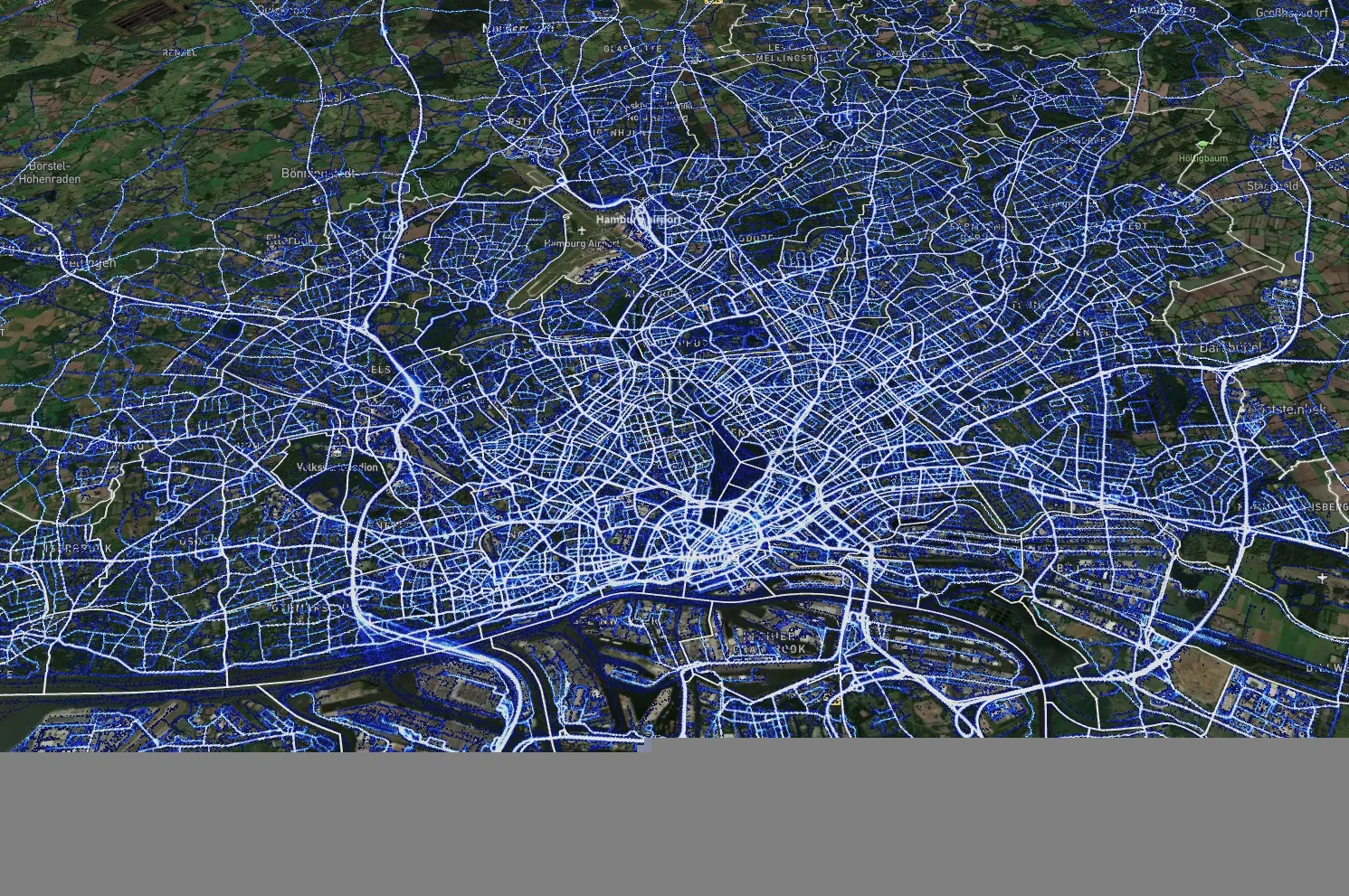
Data from Hamburg (image: XYZT.ai)

Location information has revolutionised the transportation industry, giving organisations pinpoint accuracy of vehicles, hazards and other road users across a variety of ITS applications dealing with traffic monitoring, autonomous driving, collision avoidance, pedestrian safety and others.

Belgian company XYZT.ai has taken this visibility one step further by adding timestamps to critical ITS data, allowing organisations to drive additional insights that take travel time and time of day into account. The company then presents this data in a visually appealing way that makes it easier for users to understand and work with the data in a meaningful way.

The City of Hamburg, for example, uses XYZT.ai for mobility analytics with floating vehicle data from Inrix.

According to Bart Adams, the company’s CTO, most companies look at data in the aggregate to identify trends and patterns - but it’s also important to be able to look at individual events that take place at a certain time. This includes a fleet manager tracking delivery timeframes, a delivery service optimising routes during the morning rush hour or a traffic engineer auditing travel times displayed on variable message signs. Adding time on top of location data and then presenting it in a way that is easy to consume makes this possible.

“There are billions of data points generated across a city every day,” said Lida Joly, XYZT.ai CEO, at last week's ITS America Conference & Expo 2024 in Phoenix, AZ. “It’s important that people are able to visualise this data in an effective way that allows them to make cities safer and better.”

For more information on companies in this article

Related Content

  • Women driving innovation in mobility
    March 9, 2022
    Transportation was built through the lens of men: that ecosystem needs to change
  • Big data bonus for Dublin’s buses
    August 19, 2014
    Dublin’s smart research partnership speeds buses More than 50% of people travelling into and across the Irish capital rely on public transport, and four out of 10 these use buses meaning Dublin Bus carries some 120 million passengers a year.
  • Data crunching ‘can prevent cars crashing’
    March 25, 2013
    Having already cut traffic collisions resulting in injuries and deaths by nearly forty per cent in five years by analysing patterns from data it has collected, the city of Edmonton, Canada, is using predictive technologies to increase road safety even more. The city’s Office of Traffic Safety (OTS) has installed as many as 200 digital signs as just one element of an innovative traffic safety program that has dramatically reduced vehicle collisions in the Edmonton region since OTS launched in late 2006. Unde
  • Success of Transport for London’s real time bus information service
    October 18, 2012
    Since its launch a year ago, the UK’s Transport for London (TfL) Countdown real time bus information service has dealt with more than 620 million requests and, according to TfL, the service has made millions of journeys easier, dealing with an average of 1.6 million requests via the internet and smart phones and 36,000 requests via text each day. TfL has also recently completed the installation of 2,500 new and improved bus information roadside signs across the capital. These provide clearer amber text on