XYZT.ai adds time to the mobility equation

Timestamps on critical ITS data allow organisations to drive additional insights
By Andrew Bardin Williams April 29, 2024 Read time: 2 mins
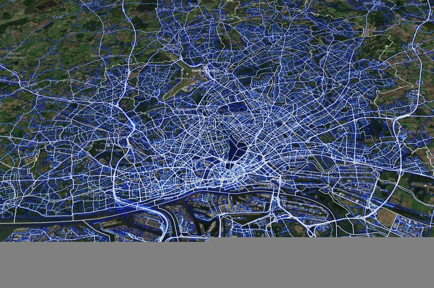
Data from Hamburg (image: XYZT.ai)

Location information has revolutionised the transportation industry, giving organisations pinpoint accuracy of vehicles, hazards and other road users across a variety of ITS applications dealing with traffic monitoring, autonomous driving, collision avoidance, pedestrian safety and others.

Belgian company XYZT.ai has taken this visibility one step further by adding timestamps to critical ITS data, allowing organisations to drive additional insights that take travel time and time of day into account. The company then presents this data in a visually appealing way that makes it easier for users to understand and work with the data in a meaningful way.

The City of Hamburg, for example, uses XYZT.ai for mobility analytics with floating vehicle data from Inrix.

According to Bart Adams, the company’s CTO, most companies look at data in the aggregate to identify trends and patterns - but it’s also important to be able to look at individual events that take place at a certain time. This includes a fleet manager tracking delivery timeframes, a delivery service optimising routes during the morning rush hour or a traffic engineer auditing travel times displayed on variable message signs. Adding time on top of location data and then presenting it in a way that is easy to consume makes this possible.

“There are billions of data points generated across a city every day,” said Lida Joly, XYZT.ai CEO, at last week's ITS America Conference & Expo 2024 in Phoenix, AZ. “It’s important that people are able to visualise this data in an effective way that allows them to make cities safer and better.”

For more information on companies in this article

Related Content

  • Watch your step: the sidewalk robots are here
    March 14, 2023
    The way we order and pay for goods has changed radically – but what about how those goods are delivered? Gordon Feller looks at how sidewalk robots might reshape the urban landscape
  • Making ITS connections requires leadership
    January 23, 2020
    From making the commute more bearable to saving the planet, Jim Alfred of BlackBerry Certicom believes that ITS has the capacity to drive a range of transformational opportunities – but leadership is required, he warns
  • In vehicle systems allow drivers to provide travel information
    July 27, 2012
    The use of a Vehicle Data Translator will allow every vehicle on a given segment of road to contribute to a highly accurate, readily accessible source of localised weather information, thus improving safety in all conditions. Sheldon Drobot and William P. Mahoney III, US National Center for Atmospheric Research, Paul A. Pisano, USDOT/Federal Highway Administration, and Benjamin B. McKeever, USDOT/Research and Innovative Technology Administration, write. On the morning of June 10 2009, under the cover of den
  • Cloud computing technology benefits GIS
    July 17, 2012
    Geographic Information Systems are a relatively late adopter of cloud computing,but the benefits of host services for geospatial data and analysis are becoming clear. Jason Barnes reports Both the concept and the reality of cloud computing have been around for some time. More and more industry sectors are entrusting external service providers with the provision of their computing services via the internet. However, the Geographic Information System (GIS) industry has been slow to embrace the trend. This is