XYZT.ai adds time to the mobility equation

Timestamps on critical ITS data allow organisations to drive additional insights
By Andrew Bardin Williams April 29, 2024 Read time: 2 mins
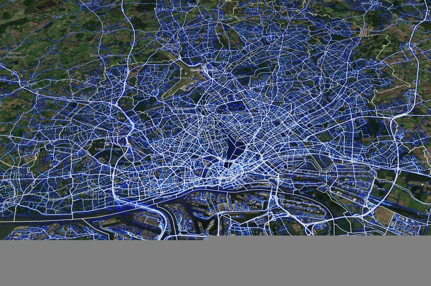
Data from Hamburg (image: XYZT.ai)

Location information has revolutionised the transportation industry, giving organisations pinpoint accuracy of vehicles, hazards and other road users across a variety of ITS applications dealing with traffic monitoring, autonomous driving, collision avoidance, pedestrian safety and others.

Belgian company XYZT.ai has taken this visibility one step further by adding timestamps to critical ITS data, allowing organisations to drive additional insights that take travel time and time of day into account. The company then presents this data in a visually appealing way that makes it easier for users to understand and work with the data in a meaningful way.

The City of Hamburg, for example, uses XYZT.ai for mobility analytics with floating vehicle data from Inrix.

According to Bart Adams, the company’s CTO, most companies look at data in the aggregate to identify trends and patterns - but it’s also important to be able to look at individual events that take place at a certain time. This includes a fleet manager tracking delivery timeframes, a delivery service optimising routes during the morning rush hour or a traffic engineer auditing travel times displayed on variable message signs. Adding time on top of location data and then presenting it in a way that is easy to consume makes this possible.

“There are billions of data points generated across a city every day,” said Lida Joly, XYZT.ai CEO, at last week's ITS America Conference & Expo 2024 in Phoenix, AZ. “It’s important that people are able to visualise this data in an effective way that allows them to make cities safer and better.”

Related Content

  • August 18, 2015
    Inrix aids authorities in dealing with data
    New traffic data products and services have been launched to aid transport and urban planners and business with detailed intelligence on journey patterns, reports Jon Masters. Manual travel surveys ought soon to become a thing of the past for transport planners and the business community. The technology now exists for getting sophisticated levels of traffic and trip data from connected vehicles. Cars and commercial fleets carrying a GPS device, or a mobile phone or smartphone are the sources of the informat
  • April 2, 2020
    Ford Mobility: analytics aids transport proactivity
    Ford Mobility has demonstrated how data analytics can help implement London's transport strategy in areas such as traffic re-timing and in eliminating all road fatalities (Vision Zero) by 2041.
  • February 1, 2012
    Advanced in-vehicle user interface - future developments
    Dave McNamara and Craig Simonds, Autotechinsider LLC, look at human-machine interface development out to 2015. The US auto industry is going through the worst crisis it has faced since the Great Depression. But it has embraced technologies that will produce the best-possible driving experience for the public. Ford was the first OEM to announce in-car internet radio and SYNC, its signature-branded User Interface (UI), is held up as the shining example of change embracement.
  • October 25, 2021
    What will MaaS look like in 2031?
    The next decade will see the humble trip planning app transformed by machine learning and AI, revolutionising the way we move around and interact with each other, says John Nuutinen of SkedGo