PTV provides precise data on Paris traffic

GPS location of vehicles travelling around French capital will be used to ease congestion
By David Arminas July 31, 2023 Read time: 2 mins
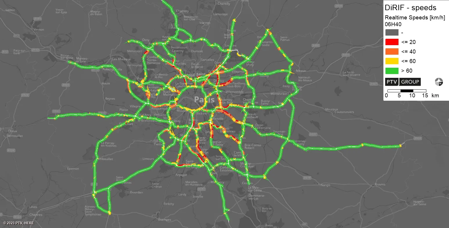
Real-time speeds: floating car data is used by PTV’s real-time software to generate real-time information that integrates with DiRIF's traffic platform, Sytadin (image: PTV Group)

The Paris region highway authority has adopted PTV technology, including PTV Flows to enhance traffic management such as live traffic updates.

The aim of the contract – following a public invitation to tender - is to supply real-time speed data derived from the GPS location of vehicles travelling on the road network managed by DiRIF - Direction des Routes d'Île-de-France - as well as on certain sections of the Île-de-France region's main road network. The data provided complements and enriches the traffic data available to DiRIF, based on its own detectors.

The Paris metropolitan area has 1,300km of highways used by more than four million travellers on average daily. To address numerous bottlenecks and traffic challenges and provide traffic information to road users, DiRIF is offering the online platform sytadin.fr. To further improve the quality of traffic information and effectively monitor the main road network, DiRIF uses real-time data analytics powered by PTV technology.

DiRIF gathers floating car data (FCD) sourced from TomTom, a Dutch multinational developer of location technology that released its first satellite navigation system in 2004. The data is used by PTV’s real-time software to generate highly accurate real-time information in a four-step process that seamlessly integrates with DiRIF's traffic platform, Sytadin.

PTV says that its comprehensive solution significantly enhances the reliability of live traffic updates, allowing DiRIF to inform road users about current traffic conditions, congestion and road closures across the entire metropolitan Paris region. This is especially important in light of upcoming major international events such as the upcoming 2023 Rugby World Cup in the autumn and the Olympic games next year.

PTV's solution equips DiRIF with the tools to handle the increased demands on the road network effectively, said Frédéric Reutenauer, vice president, southern Europe region for PTV Group, which is part of Umovity. “Precise data not only reduces delays and enhances safety but also improves the overall efficiency of the transportation system."

The real-time data analytics solution provided to DiRIF is part of PTV’s real-time portfolio which also includes PTV Flows, which the group says is a cost-effective and hassle-free SaaS-Tool for real-time-traffic management that was recently released.

For more information on companies in this article

Related Content

  • Asking drivers what information they need: radical but effective
    March 19, 2014
    When Texas A&M Transportation Institute was asked to devise a temporary traveller information system for work zones, it started by asking drivers what they need. Robert Brydia explains the thinking, implementation and results. US Interstate 35 (I-35) runs roughly north–south originating in Laredo, Texas and ends 1,500 miles away in Duluth, Minnesota having passed through Oklahoma, Kansas, Missouri and Iowa. Within Texas the I-35 splits into I-35E and I-35W passing through Dallas and Fort Worth respectiv
  • Vehicle manufacturers and local authorities seek satnav solutions
    December 5, 2013
    The increasing capability of satellite navigation is helping vehicle manufacturers and local authorities as well as individual drivers and fleets. In comparison to the physical ITS infrastructure in towns and cities and on motorways and highways, satellite navigation (satnav) systems have come a long way in a short time. Many (if not the majority) individual drivers and fleets use or have access to a satnav and now the vehicle manufacturers and even local authorities are beginning to utilise satnav derived
  • Monitoring during construction reveals benefits of new expressway
    June 6, 2014
    David Crawford reports on how the authorities in New Zealand are using Bluetooth technology to monitor the effects of a new expressway as it is being constructed. New Zealand Highway Agency (NZHA) is using Bluetooth-based vehicle detection to assess the impact of its biggest road building project as the various sections are completed. The large-scale deployment of a Bluetooth-based vehicle detection system is making substantial contributions to traffic data needs in progressing the new Waikato Expressway, a
  • One.network launches North Carolina WZDx 
    January 28, 2022
    The workzone information specialist says it is ready to deliver agency data at no cost