Teledyne positions itself with Ladybug6

Camera captures 360° images from moving platforms for HD mapping and asset inspection
By Adam Hill February 21, 2023 Read time: 1 min
Ladybug6: 360° view

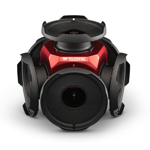
Teledyne Flir is now shipping its new Ladybug6 camera for high accuracy 360° spherical image capture.

The high-resolution unit is designed to capture images from moving platforms in all weather conditions. Applications include panoramic street image production, road and asset inspections, and feature extraction for HD map generation.

Mike Lee, senior product manager at Teledyne Flir, says: “For applications that require high accuracy imaging like high-definition mapping, road surveying and asset inspection, the Ladybug6 gives users precision trigger control and resolution in a field-proven format.”

The manufacturer says support for Global Navigation Satellite Systems (GNSS) and advanced APIs, combined with hardware inputs, enable precise camera settings and trigger control.

Ladybug6's industrial-grade design and out-of-the-box factory calibration produce 72 Megapixel (MP) images with pixel values that are spatially accurate within +/- 2 mm at a 10m distance.

For more information on companies in this article

Related Content

  • TRL Software opens up iRoads to third parties
    May 18, 2023
    Update of road asset management software allows developers to access more data
  • Iteris focuses on improved video detection
    March 3, 2014
    Iteris participates at Intertraffic Amsterdam 2014 following an exciting year for the company with the release of several new detection capabilities and additional ITS products. During the event, Iteris says it will be focusing on the differentiators of its Vantage P10 product and how this highly compact detection camera is perfectly suited for the international market and adaptive control systems. As the company points out, it has developed advanced algorithms to provide optimal vehicle detection and count
  • Bosch and Siemens introduce V2X platform
    March 18, 2021
    Integrated connected vehicle collective perception system combines cameras and RSUs
  • Navigation mapping focuses on more detail, greater accuracy
    March 16, 2012
    Navteq’s business strategy is focusing on more more detail, greater accuracy and added value. Location data provider Navteq has done much to enhance its service offer in recent months, across consumer, commercial and government markets worldwide, and the company reports more to come. Interior destination maps, the most recent addition to Navteq’s pedestrian navigation portfolio, are now being considered for complex transport interchanges to give guidance to transferring passengers, particularly those with m