
Teledyne positions itself with Ladybug6

Camera captures 360° images from moving platforms for HD mapping and asset inspection
By Adam Hill February 21, 2023 Read time: 1 min
Ladybug6: 360° view

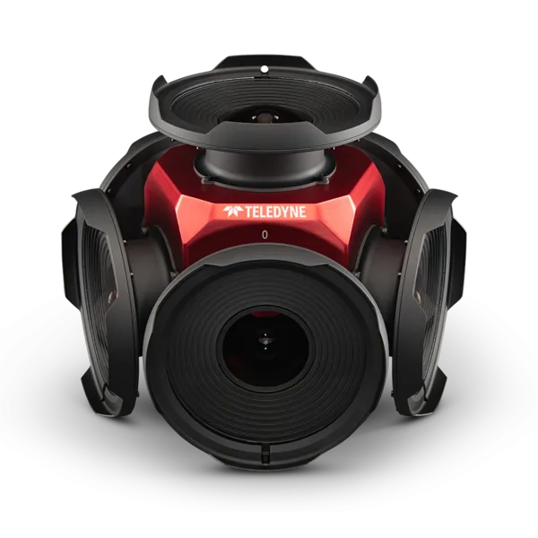
Teledyne Flir is now shipping its new Ladybug6 camera for high accuracy 360° spherical image capture.

The high-resolution unit is designed to capture images from moving platforms in all weather conditions. Applications include panoramic street image production, road and asset inspections, and feature extraction for HD map generation.

Mike Lee, senior product manager at Teledyne Flir, says: “For applications that require high accuracy imaging like high-definition mapping, road surveying and asset inspection, the Ladybug6 gives users precision trigger control and resolution in a field-proven format.”

The manufacturer says support for Global Navigation Satellite Systems (GNSS) and advanced APIs, combined with hardware inputs, enable precise camera settings and trigger control.

Ladybug6's industrial-grade design and out-of-the-box factory calibration produce 72 Megapixel (MP) images with pixel values that are spatially accurate within +/- 2 mm at a 10m distance.

For more information on companies in this article

Related Content

  • Go wireless with Traffic Group
    December 2, 2021
    Wireless temporary traffic light system - Metro Haul Route Crossing System - launched
  • One eye on the future
    December 12, 2013
    Mobileye’s Itay Gat discusses the evolution of monocular solutions for assisted and autonomous driving with Jason Barnes. Founded in 1999, Israeli company Mobileye manufactures and supplies advanced driver assistance systems (ADAS) based on its EyeQ family of systems-on-chips for image processing for solutions such as lane sensing, traffic sign recognition, vehicle and pedestrian detection. Its products are used by both the OEM and aftermarket sectors. The company’s visual interpretation algorithms drive
  • Huawei is accelerating intelligence
    April 9, 2025
    At MWC Barcelona 2025, Huawei released seven new smart transportation solutions and set out its philosophy for the use of AI to support safety and efficiency gains
  • Esri exposes US air pollution impact
    October 6, 2020
    App uses data from AirNow programme, American Community Survey and NOAA wind forecast