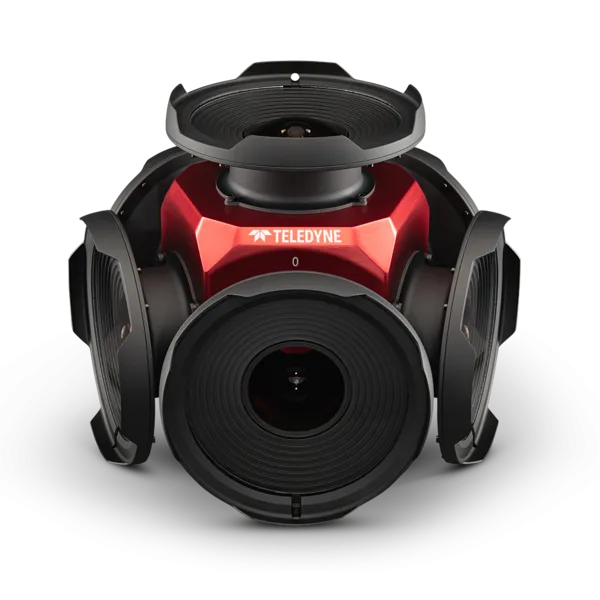
Teledyne positions itself with Ladybug6

Camera captures 360° images from moving platforms for HD mapping and asset inspection
By Adam Hill February 21, 2023 Read time: 1 min
Ladybug6: 360° view

Teledyne Flir is now shipping its new Ladybug6 camera for high accuracy 360° spherical image capture.

The high-resolution unit is designed to capture images from moving platforms in all weather conditions. Applications include panoramic street image production, road and asset inspections, and feature extraction for HD map generation.

Mike Lee, senior product manager at Teledyne Flir, says: “For applications that require high accuracy imaging like high-definition mapping, road surveying and asset inspection, the Ladybug6 gives users precision trigger control and resolution in a field-proven format.”

The manufacturer says support for Global Navigation Satellite Systems (GNSS) and advanced APIs, combined with hardware inputs, enable precise camera settings and trigger control.

Ladybug6's industrial-grade design and out-of-the-box factory calibration produce 72 Megapixel (MP) images with pixel values that are spatially accurate within +/- 2 mm at a 10m distance.

For more information on companies in this article

Related Content

  • Sensor solutions cuts maintenance and emissions
    December 8, 2014
    The new raft of sensor technology can provide cost savings as well as additional functionality, as David Crawford discovers. Austria’s third-largest city, Linz, with a population of around 200,000, is recording substantial savings in its urban tram network within 18 months of introducing a new, high-technology approach to its public transport management. Tram, bus and trolleybus operator Linz Linien forms part of city utilities management company Linz AG, which has been carrying out a wide-ranging Smart Cit
  • Highways asset management system upgraded
    March 1, 2013
    Version 2.3 of Horizons, Yotta DCL’s highways asset management system, provides new features and functionality across three of its modules: Explorer, Analysis and Management. The Horizons web platform integrates GIS, pavement and asset management and is used by highways authorities and agencies to manage their highway assets. Horizons is claimed to clear the IT and data bottlenecks, giving full visibility in graphical format and enabling users to reach informed decisions and make cost-effective recommendati
  • Nokia announcement is game changer for global navigation industry
    June 6, 2012
    Nokia has announced plans to release a new version of Ovi Maps for its smartphones that includes high-end walk and drive navigation at no extra cost, available for download at www.nokia.com/maps. This move has the potential to nearly double the size of the current mobile navigation market.The new version of Ovi Maps includes high-end car and pedestrian navigation features, such as turn-by-turn voice guidance for 74 countries, in 46 languages, and traffic information for more than 10 countries, as well as de
  • Here API aids Siemens congestion tool
    May 19, 2021
    Pollution-busting traffic solution is based on data rather than hardware, Here says