
Ford has Edge on rural driving

Ford has introduced a solution for rural roads which it says can gently steer a vehicle back on track when needed.
By Ben Spencer April 17, 2020 Read time: 1 min
Ford steers drivers from the Edge of rural roads (© Michael Smith | Dreamstime.com)

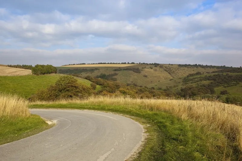
Road Edge Detection is designed for country driving at speeds of 45-70mph and uses a camera located below the rearview mirror to monitor road edges 50m in front of the vehicle and 7m to the side, the company adds. 

Rüdiger Kieneke, Ford driver assistance and safety electronics engineer, says: “Rural roads can be every bit as challenging for drivers as urban streets – especially for those who may be unfamiliar with their route. Road Edge Detection helps alleviate one concern to make journeys more comfortable and easier.”

The system's advanced algorithm is expected to determine when there are clear structural changes from the road to the nearby area while also offering steering support on roads when lane marking is obscured or hidden by leaves, snow or rain. 

According to Ford, the system vibrates the steering wheel if the driver is still close to the edge following initial steering support.

Related Content

  • October 27, 2016
    The downside of driverless vehicles
    Driverless cars will have a detrimental effect on congestion and security while the road safety benefits can be achieved sooner and cheaper using ADAS, argues Colin Sowman. Many Governments are consulting about the introduction of driverless vehicles and even running trials. As 70% or 80% of crashes are caused by human error, the promise of a crash-free future of driverless, self-driving or autonomous vehicles (call them what you will) is alluring, as are the claims of reduced congestion and lower emissions
  • November 20, 2013
    Bluetooth and Wi-Fi offer new options for travel time measurements
    New trials show Bluetooth and Wi-Fi signals can be reliably used for measuring travel times and at a lower cost than an ANPR system, but which is the better proposition depends on many factors. Measuring travel times has traditionally relied automatic number plate (or licence plate) recognition (ANPR/ALPR) cameras capturing the progress of vehicles travelling along a pre-defined route. Such systems also have the benefit of being able to count passing traffic and have become a vital tool in dealing with c
  • August 5, 2016
    Hartford’s tailors winter maintenance on Esri’s GIS platform
    The in-house winter maintenance and vehicle tracking system built by the Public Works Department in Hartford, Connecticut, coped with record snowfalls and cut costs too. When it comes to dealing with the effects of mother nature, transport agencies can find themselves in a lose-lose situation: criticised if the roads or rail lines are disrupted by snow, ice or floods for more than a few hours and lambasted for wasting money if the equipment and stockpiles put in place for a hard winter remain unused.