
Velodyne develops Lidar sensor for AV mobility

Velodyne has released a Lidar solution which it says utilises surround-view technology to meet specifications for autonomous mobility. 
By Ben Spencer February 13, 2020 Read time: 1 min
Velodyne Alpha Prime (Source: Velodyne)

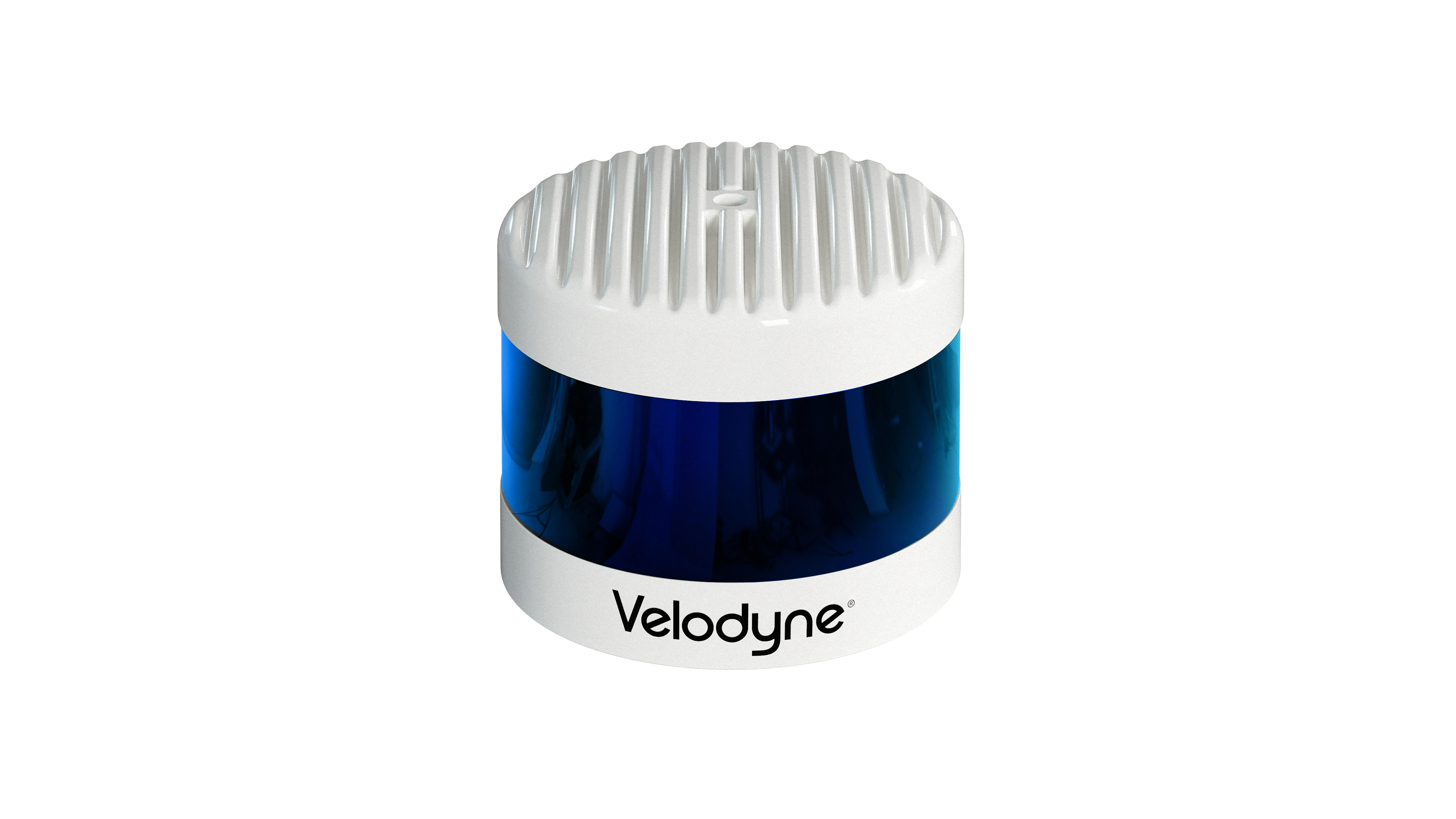
Velodyne claims Alpha Prime provides a 360-degree perception and a 40-degree vertical field of view while also providing capabilities that help improve vehicle safety and enable more precise mapping. 

The solution is expected to detect dark vehicles, low reflectivity pavement and low visibility pedestrians at long distances. The sensor offers advanced negative obstacle detection perception for potholes and cracks in the road as well as high resolution and laser calibration to localise vehicles without a GPS, the company adds. 
 

Related Content

  • February 3, 2017
    SENSKIN project develops first prototype of infrastructure monitoring sensor
    SENSKIN, a 42-month European Horizon 2020 project to develop a sensor for monitoring-based maintenance of the transport infrastructure implemented by 13 partners from seven countries has reported on its first 18 months of work. During this time, the partners derived user requirements and, based on these, designed the prototype of the skin-like sensors and the data acquisition unit. They also provided proof of concept of the communication system and are finishing the prototypes of the communication, structur
  • June 4, 2015
    After two decades of research, ITS is getting into its stride
    Colin Sowman gets the global view on how ITS has shaped the way we travel today and what will shape the way we travel tomorrow. Over the past two decades the scope and spread of intelligent transport systems has grown and diversified to encompass all modes of travel while at the same time integrating and consolidating. Two decades ago the idea of detecting cyclists or pedestrians may have been considered impossible and why would you want to do that anyway? Today cyclists can account for a significant propor
  • November 30, 2016
    Mobile LiDAR technology used to capture traffic signal data across Pennsylvania
    Engineering, planning and consulting services company Michael Baker International recently completed a nearly US$7-million project for the Pennsylvania Department of Transportation (PennDOT) to collect data from more than 8,600 traffic signals across the state. Over a year, the Michael Baker team, working with PennDOT’s Traffic Signal Asset Management System (TSAMS), collected nearly 20 million data fields for each of the 8,623 traffic signals analysed, which populated a centralised database to support Pen
  • September 7, 2020
    Wireless sensor data is saving lives, says Sensys Networks
    ITS World Congress provides a unique opportunity to examine the latest innovative uses of traffic technology. One trend is the increased use of detection data - presence, volume, occupancy, and speed - to power dynamic information for drivers. And the benefits of this data go well beyond traffic information within mapping and navigation systems that are used by motorists to get to their destinations efficiently. This data can help save lives.