
OpenSpace tracks passenger ‘social distancing’

UK start-up OpenSpace has discovered a new use for its passenger movement monitoring tech as Covid-19 public health measures remain into force – tracking social distancing.
By Adam Hill April 3, 2020 Read time: 1 min
OpenSpace has been tracking passengers at London's St Pancras (© Minacarson | Dreamstime.com)

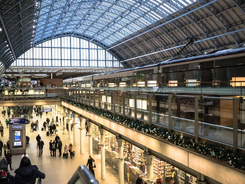
The company’s digital twin platform, currently deployed at St Pancras railway station in London, can monitor social distancing through detecting and visualising the distance between passengers in real-time. 

The company says this will be a useful indicator of public adherence to government guidelines, especially when lockdown measures are lifted in stages – and the authorities will also be able to compare historical weekly and daily information for trend analysis.

The project, funded by the Department for Transport, uses cameras with computer vision technology to measure passenger flow rate and travel patterns. The firm says no facial recognition software is involved.

The platform detected a 90% drop in passenger numbers after lockdown measures were introduced on 23 March, compared with a weekday in January this year. 

“Our technology is designed to detect real-time passenger separation to alert station managers to current and future overcrowding, and suggest interventions,” said OpenSpace CEO Nicolas LeGlatin.

“But the unexpected events of the past few months have revealed a new application - monitoring social distancing. If our data can help better inform government strategy on Covid-19 to help save lives, then we want to do our bit.”

Watch the video here.

For more information on companies in this article

Related Content

  • Improving traffic flow with automated urban traffic control
    April 25, 2012
    Alterations to traffic signals and variable message signs are being activated to reduce congestion as soon as it occurs, through a pioneering fully automatic UTC system. Jon Masters reports In the South Yorkshire town of Barnsley in England, strategies for dealing with traffic congestion have been devised from analysis of queue data, then made to work automatically: “This represents the future of ITS for urban traffic control,” says Siemens Consultancy Services senior engineer David Carr. Over a career span
  • Statistical improvement for short-term travel time predictions
    June 2, 2014
    Researchers at Imperial College in London have developed a generic three-stage short-term travel prediction model that promises to give greater accuracy under both normal and abnormal conditions. As travellers do not like the randomness of non-recurrent traffic congestion and delays, it is particularly useful for network managers to know how the ongoing traffic situation will develop when an atypical event occurs.
  • Jacobs buys StreetLight Data
    February 8, 2022
    Mobile data specialist marked out by Jacobs as useful player in changing transport sphere
  • Here’s HD AV map prepared for 5G
    June 17, 2019
    The emergence of 5G may not be necessary to provide a high-definition map for autonomous driving, says Matt Preyss from Here Technologies. Ben Spencer asks why 5G is a hot topic worldwide, with the potential for faster transfer of information eagerly awaited by those convinced that it will be a game-changer for the ITS industry. High-definition (HD) maps are essential to allow autonomous vehicles (AVs) to understand their environment, and operate safely within it in relation to other road users and p