
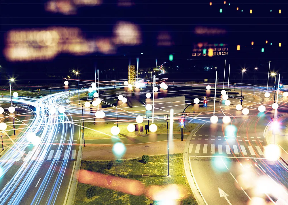
Iteris launches VantageLive! to collect, process and analyse intersection data

Iteris has launched the latest addition to its Vantage roadway sensors product range, VantageLive!, a cloud-based transportation analytics service that allows users to view intersection activity by automatically collecting and analysing vehicle, bicycle and pedestrian data on a continuous basis, with data availability 24/7/365 from their existing Iteris detection infrastructure. By accessing connected intersection systems within an agency’s network, VantageLive! collects data provided from Iteris Vantage p
May 2, 2017 Read time: 1 min
73 Iteris has launched the latest addition to its Vantage roadway sensors product range,  VantageLive!, a cloud-based transportation analytics service that allows users to view intersection activity by automatically collecting and analysing vehicle, bicycle and pedestrian data on a continuous basis, with data availability 24/7/365 from their existing Iteris detection infrastructure.


By accessing connected intersection systems within an agency’s network, VantageLive! collects data provided from Iteris Vantage platforms and securely sends it to the Iteris advanced analytics engine in the cloud for processing. Multiple agency personnel including traffic engineers and planning departments can then simultaneously access data and insights via a web browser.

Iteris believes VantageLive! Will significantly improve how agencies optimise and plan their transportation networks. By providing multimodal data percentages and peak hour summary reports, traffic engineers will be able to better optimise signal timing to ensure maximum signal efficiency and help improve intersection safety conditions for pedestrians and cyclists.

Related Content

  • March 22, 2024
    Iteris to show state-of-the-art sensor and virtualised workzone management in Phoenix
    At ITS America 2024, Iteris will host demonstrations showcasing how its software, sensor and consulting solutions help agencies bring revolutionary technologies to scale for improved mobility and safety. Visitors to its booth will be able to see how its AI-powered ClearMobility Platform offers a complete portfolio of end-to-end solutions to monitor, visualise and optimise mobility infrastructure around the world. The company applies AI tools across multiple levels of its ecosystem, including neural networks that enable machine learning based on real-time and historical data to support predictive analysis within the ClearMobility Platform.
  • January 30, 2012
    Road safety systems on show at ITS World Congress
    A vast array of new products and systems for aiding road safety were displayed at the ITS World Congress in October. David Crawford assesses a selection of safety initiatives exhibited in Orlando. Vital roles for ITS applications in road traffic safety emerge clearly from a new report from the US Transportation Safety Advancement Group. The report has been carried out for the Next Generation 911 What's Next Forum, which is preparing the way for future development of the US national 911 emergency single call
  • June 17, 2016
    Less travel aggravation to blunt Aggieland fans’ motivation
    Returning travel times to normal within two hours of the end of a major football game was the challenge facing College Station, Adam Lyons explains how this was achieved. College Station, TX, also known as ‘Aggieland’, is located right in the middle of the Dallas/Fort Worth, San Antonio and Houston triangle making the city accessible to over 14 million Texans within less than a four-hour drive. One of the biggest draws to this area is Texas A&M University (TAMU) and the Aggie football games in the fall, mea
  • November 18, 2022
    NCDoT mobilises with Iteris ClearGuide
    ClearGuide smart mobility infrastructure system will help identify traffic problems statewide