Esri and Mobileye offer real-time blind-spot detection data

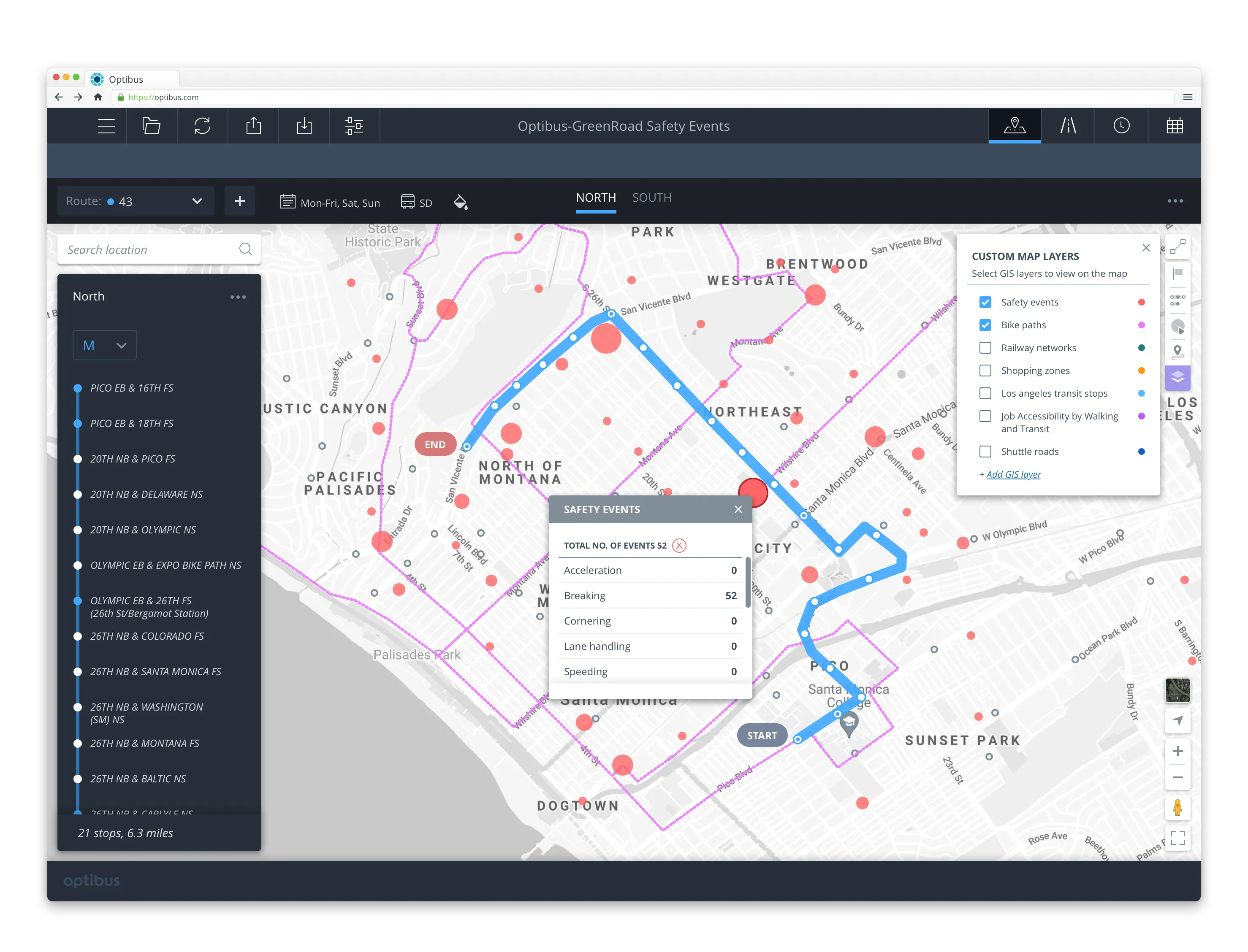
Geographic information system specialist Esri is to collaborate with advanced driver-assistance systems software provider Mobileye in a venture aimed at improving safety for road users in urban environments. This will see Esri’s mapping, analysis and visualisation integrated with Mobileye’s Shield+ product. Shield+ will stream road safety data retrieved from city fleets into Esri’s ArcGIS platform meaning incidents of pedestrians and cyclists being detected in blindspots can be viewed on the Mobileye
November 16, 2017 Read time: 2 mins

Geographic information system specialist 50 Esri is to collaborate with advanced driver-assistance systems software provider 4279 Mobileye in a venture aimed at improving safety for road users in urban environments. This will see Esri’s mapping, analysis and visualisation integrated with Mobileye’s Shield+ product. 

Shield+ will stream road safety data retrieved from city fleets into Esri’s ArcGIS platform meaning incidents of pedestrians and cyclists being detected in blindspots can be viewed on the Mobileye Smart Mobility Dashboard. Shield+ alerts will be updated to the dashboard in real time, providing a city-wide view of pedestrian and cyclist safety.

This will allow users such as municipal bus drivers to receive alerts about imminent hazards seconds before a potential collision, and to have a better, safer awareness of the roads they travel. Mobileye director Nisso Moyal, said the direct uploading of geospatial events from Shield+ fitted to municipal vehicles will enable cities to anticipate and help prevent the next collision and managing their assets more efficiently.

As a part of this collaboration, Mobileye will give municipalities entering into new contracts with it the option to incorporate the analytics-based capability.

Related Content

  • January 20, 2012
    Pioneering sensors collect weather data from moving vehicles
    ITS International contributing editor David Crawford foresees the vehicle as 'sentinel being'
  • March 1, 2023
    TRL aligns with Flare VRU data
    Adding micromobility hazard detection to iMAAP platform will improve road safety
  • February 3, 2012
    Embedded connectivity delivers real time travel information
    Ton Brand describes the GSM Association's Embedded mTelematics programme. As the world's roads become increasingly crowded, consumers and businesses are demanding better real-time information to help them both avoid traffic congestion and make smarter use of public transport. Embedding mobile connectivity directly into vehicles can enable drivers and passengers to see live traffic flows in their localities, as well as the expected arrival time of the next bus, ferry or tram
  • April 10, 2014
    Columbia goes intermodal to support sustainability
    David Crawford on the ups and downs of a Latin metropolis. Medellín, Colombia’s second city and a recognised leader in sustainable transport thinking, is rapidly extending its substantial existing investment in modern mobility. It is deploying both an enhanced integrated traffic management array and the country’s first intermodal public transportation management system. The supplier of both, under separate €9 million (US$12.3 million) contracts, is Spanish engineering company Indra, a major exporter