SPx-Radar Image Server

Cambridge Pixel, a developer of primary radar, acquisition, processing and display solutions, has extended its product offering in radar display with the introduction of the SPx Radar Image Server (SPx-RIS). Developed to provide a cost-effective single-licence solution for point to multipoint radar display applications, it can distribute up to four scan-converted images to multiple display clients including standard web browsers or custom-written applications in Linux or Windows. No client license is requir
February 2, 2012 Read time: 2 mins
1990 Cambridge Pixel, a developer of primary radar, acquisition, processing and display solutions, has extended its product offering in radar display with the introduction of the SPx Radar Image Server (SPx-RIS). Developed to provide a cost-effective single-licence solution for point to multipoint radar display applications, it can distribute up to four scan-converted images to multiple display clients including standard web browsers or custom-written applications in Linux or Windows. No client license is required to see the radar video.

As David Johnson, managing director, Cambridge Pixel, explains, "The SPx Radar Image Server is designed for use in cost-sensitive security and traffic management applications, where, as a consequence of commodity pricing of radars, there is growing interest in integrating radar sensor data as part of any monitoring system." The Radar Image Server works by receiving the radar video in a server application and then creating up to four scan converted images for the radar coverage. This can be used to provide one image for full coverage of the radar and up to three additional images representing zoom views of selected areas.

For more information on companies in this article

Related Content

  • San Francisco plans express lane network across Bay Area
    February 25, 2015
    Colin Sowman looks at plans to convert 240km (150 miles) of HOV/car pool lanes. While some authorities have debated the conversion of high occupancy vehicle lanes (HOV) into express or managed lanes allowing toll paying single-occupant vehicles to avoid congestion, San Francisco’s Bay Area Metropolitan Transportation Commission (MTC) has acted. It is converting 240km (150 miles) of HOV/car pool lanes to express lanes and last fall the MTC’s Bay Area Infrastructure Financing Authority selected TransCore to d
  • Connected vehicle data promises advanced weather warning
    August 29, 2012
    Connected vehicle research and development is being aimed at improving driver safety and mobility, but is also promising advanced weather monitoring and warning systems. Sheldon Drobot reports. Over the last few years, the United States’ Federal Highway Administration (FHWA) and Research & Innovative Technology Administration (RITA) have joined forces to promote safety, mobility and the environment through a new connected vehicle initiative. This aims to enable wireless communication between vehicles, infra
  • Esri highlights benefits of a state-wide data-rich environment
    September 7, 2020
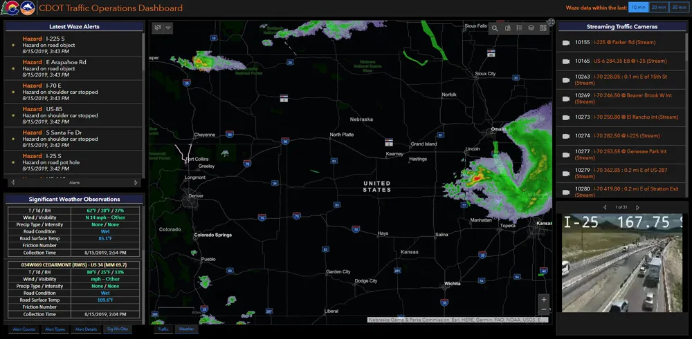
    Walk into virtually any traffic operations centre and you will be confronted by people flipping between different screens and CCTV monitors, and individually viewing a large number of stand-alone applications to try to understand a comprehensive picture of their live traffic, weather, incident, and snow conditions from these disparate sources.
  • Asecap Days 2024: Getting used to the new normal
    August 27, 2024
    Asecap Days 2024 in Milan focused on environmental protection of road infrastructure, digital twin-based maintenance and monitoring of highways as well as the impact of electric vehicles, reports David Arminas