Outsight introduces 3D Lidar simulator

New tool allows customers to work out what kit and coverage - and cost - they require
By Adam Hill November 17, 2022 Read time: 2 mins
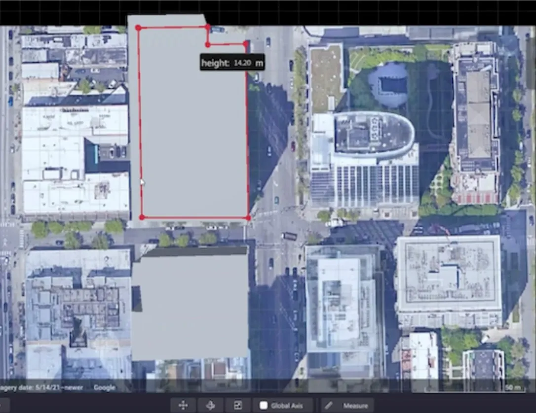
Users can insert their own scenes as a background by using built-in tools for modifying 3D shapes

Lidar specialist Outsight has launched a 3D Lidar simulation tool to help customers answer fundamental questions about deployment.

Deciding which and how many Lidars to use, and working out the best locations for them in terms of height, position and orientation, are among the issues the new tool is designed to overcome.

Users can make up their own simulation and environment to choose the best setting for achieving your performance and functionality goals, anticipating performance depending on each set-up and use case.  .

Outsight sought feedback on its beta version "from more than 300 early customers from various contexts, applications and countries".

It points out there is no need to install any software - users simply connect to their Outsight Cloud account, or request access if they do not already have one. 

Users can browse a list of compatible Lidars and select the right model or combination of models from different manufacturers (e.g. 360º FoV, Narrow Field of View, Dome).

You can find the optimal Lidar coverage by testing different options and coverage levels, establishing the best trade-off between performance, hardware cost and complexity, Outsight says.

It is possible to insert your own scenes as a background by using built-in tools for modifying 3D shapes.

For more information on companies in this article

Related Content

  • Numo launches micromobility data tool
    October 27, 2020
    Solution will help cities address how services function within transportation systems
  • Lidar technology wins big in China’s autonomous vehicle challenge
    November 26, 2013
    China’s fifth annual Future Challenge earlier this month pitted eleven unmanned intelligent vehicles against each other on a course designed to test their capabilities in suburban and urban road tests, over a 23-kilometre course. All of the first eight cars to finish were equipped with Velodyne’s 3D Lidar vision technology which provides active sensing for crash avoidance, driving automation and mobile road survey and mapping. Velodyne HDL-64E and HDL-32E sensors deliver 360-degree views of the car’s env
  • Asecap prepares for ‘interoperability on steroids’
    March 31, 2023
    The gathering of Europe’s toll professionals offers a chance for views to be exchanged by senior people on a number of big issues: and there’s currently an awful lot to think about, reports Geoff Hadwick
  • ITS World Congress Melbourne app now available
    September 21, 2016
    ITS Australia has announced the introduction of the ITS World Congress Mobile App, powered by Here Maps which will allow delegates to experience the benefits of real-time location services and customised journey planning as they navigate their way around the event venues, as well as across the city of Melbourne. With a constant stream of plenary sessions, executive forums, exhibitions, demonstrations and technical tours taking place across multiple sites and times throughout the four day ITS World Cong