Outsight introduces 3D Lidar simulator

New tool allows customers to work out what kit and coverage - and cost - they require
By Adam Hill November 17, 2022 Read time: 2 mins
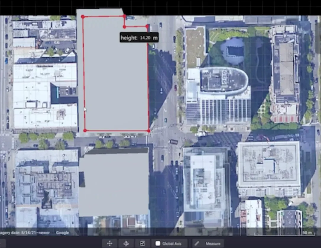
Users can insert their own scenes as a background by using built-in tools for modifying 3D shapes

Lidar specialist Outsight has launched a 3D Lidar simulation tool to help customers answer fundamental questions about deployment.

Deciding which and how many Lidars to use, and working out the best locations for them in terms of height, position and orientation, are among the issues the new tool is designed to overcome.

Users can make up their own simulation and environment to choose the best setting for achieving your performance and functionality goals, anticipating performance depending on each set-up and use case.  .

Outsight sought feedback on its beta version "from more than 300 early customers from various contexts, applications and countries".

It points out there is no need to install any software - users simply connect to their Outsight Cloud account, or request access if they do not already have one. 

Users can browse a list of compatible Lidars and select the right model or combination of models from different manufacturers (e.g. 360º FoV, Narrow Field of View, Dome).

You can find the optimal Lidar coverage by testing different options and coverage levels, establishing the best trade-off between performance, hardware cost and complexity, Outsight says.

It is possible to insert your own scenes as a background by using built-in tools for modifying 3D shapes.

For more information on companies in this article

Related Content

  • Digitalisation and equity in focus at ITS America 2023
    March 21, 2023
    Plenary sessions at ITS America Conference & Expo highlight two of ITS's biggest challenges
  • AIT showcases services for urban planning and future mobility at Smart City Expo, Barcelona
    February 9, 2018
    The latest software tools from the Austrian Institute of Technology (AIT) are designed to help authorities create a sustainable mobility system for cities. AIT uses smartphones to track the distances travelled and transport modes used by their owners which can be used for mobility surveys and ticketing solutions or automated calculation of travel times. Experts have also developed tools to analyse pedestrian flows for the planning and optimisation of public transport infrastructure. Virtual 3D models of
  • PTV opens software to Ukraine aid
    March 9, 2022
    Firm is giving free route planning expertise to humanitarian convoys after Russia invasion
  • Awards finalists for 2024
    April 16, 2024
    The wait is over! This morning, at the end of the official opening of Intertraffic Amsterdam 2024 from 08:30 to 10:15 in Intertraffic Summit Theatre 1, the winners of the Intertraffic Awards will be announced. The three Intertraffic Awards up for grabs are: the Green Globe Award, which symbolises innovation that delivers significant environmental benefits; the Inspiration Award, which highlights groundbreaking products inspiring the industry in new directions; and the User Experience Award, which recognises excellence in control systems for the end user. There are five nominees in each of the three categories, representing mobility solutions manufacturers from 11 different countries.