Outsight introduces 3D Lidar simulator

New tool allows customers to work out what kit and coverage - and cost - they require
By Adam Hill November 17, 2022 Read time: 2 mins
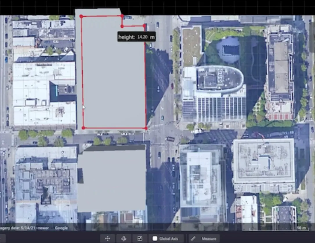
Users can insert their own scenes as a background by using built-in tools for modifying 3D shapes

Lidar specialist Outsight has launched a 3D Lidar simulation tool to help customers answer fundamental questions about deployment.

Deciding which and how many Lidars to use, and working out the best locations for them in terms of height, position and orientation, are among the issues the new tool is designed to overcome.

Users can make up their own simulation and environment to choose the best setting for achieving your performance and functionality goals, anticipating performance depending on each set-up and use case.  .

Outsight sought feedback on its beta version "from more than 300 early customers from various contexts, applications and countries".

It points out there is no need to install any software - users simply connect to their Outsight Cloud account, or request access if they do not already have one. 

Users can browse a list of compatible Lidars and select the right model or combination of models from different manufacturers (e.g. 360º FoV, Narrow Field of View, Dome).

You can find the optimal Lidar coverage by testing different options and coverage levels, establishing the best trade-off between performance, hardware cost and complexity, Outsight says.

It is possible to insert your own scenes as a background by using built-in tools for modifying 3D shapes.

Related Content

  • Complimentary IRF certified training courses open to all Intertraffic visitors
    March 21, 2016
    The International Road Federation (IRF) will have a stand (01-604) at Intertraffic Amsterdam and will also be hosting Complimentary Training Workshops during the event on April 6 and 7, 2016. IRF also will be conducting an ITS Committee Meeting on Wednesday April 6, 2016 from 8:30am to 10:00am and a Road Safety Committee Meeting on Thursday April 7 from 8:30am to 10:00am. Everyone is welcome to attend.
  • Cepton Lidars deployed in Austria
    February 26, 2021
    Partnership with local test alliance ALP.Lab will create real-life, complex traffic data
  • GridMatrix maximises power of existing infrastructure
    August 5, 2023

    GridMatrix’s breakthrough software platform for multimodal data collection and analytics is revolutionising transportation planning and decision making across the US. 

    Powered by artificial intelligence and combining the latest advances in cloud computing, machine learning and advanced sensing, GridMatrix’s platform is deployed in New York City on the world’s busiest bridges and tunnels, trusted by multiple state departments of transportation, and in a fast-growing number of American towns and cities. 

  • AEye: Benefits of Lidar for Intelligent Transportation Systems
    March 14, 2022

    Lidar, the next big step in sensor technology, complements radar and cameras to ensure better, more accurate traffic information for cities and municipal authorities.

    Lidar specialist AEye outlines the ways in which 3D-precision will keep all road users – including cyclists and pedestrians – safer while reducing congestion and improving quality of life.

    Sponsored content produced in association with AEye