Outsight introduces 3D Lidar simulator

New tool allows customers to work out what kit and coverage - and cost - they require
By Adam Hill November 17, 2022 Read time: 2 mins
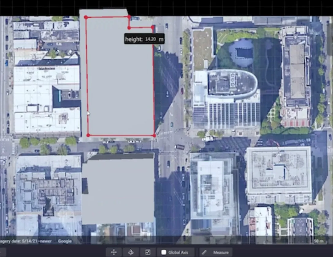
Users can insert their own scenes as a background by using built-in tools for modifying 3D shapes

Lidar specialist Outsight has launched a 3D Lidar simulation tool to help customers answer fundamental questions about deployment.

Deciding which and how many Lidars to use, and working out the best locations for them in terms of height, position and orientation, are among the issues the new tool is designed to overcome.

Users can make up their own simulation and environment to choose the best setting for achieving your performance and functionality goals, anticipating performance depending on each set-up and use case.  .

Outsight sought feedback on its beta version "from more than 300 early customers from various contexts, applications and countries".

It points out there is no need to install any software - users simply connect to their Outsight Cloud account, or request access if they do not already have one. 

Users can browse a list of compatible Lidars and select the right model or combination of models from different manufacturers (e.g. 360º FoV, Narrow Field of View, Dome).

You can find the optimal Lidar coverage by testing different options and coverage levels, establishing the best trade-off between performance, hardware cost and complexity, Outsight says.

It is possible to insert your own scenes as a background by using built-in tools for modifying 3D shapes.

For more information on companies in this article

Related Content

  • U-blox GSM module verified eCall and ERA Glonass ready
    April 18, 2012
    U-blox and Rohde & Schwarz, a leading supplier of test and measurement equipment, have successfully concluded tests of u-blox’ Leon GSM modem for eCall / ERA Glonass readiness.
  • PTV manages Strasbourg’s traffic flow to improve air quality
    February 21, 2018
    PTV Group's signal control system has helped Strasbourg’s Eurométropole reduce nitrogen oxide emissions by 8% and particulate matter by 9% in a project which set out to slash emissions by decreasing stop-and-go traffic along one of the city’s main arterial roads. The simulation also cut vehicle stops by 9%. Called PTV Epics, the software tool controlled the waiting times for all road users at the traffic lights, reducing 85% of all cases to 45 seconds, which would otherwise only apply to 35% of road
  • Drone captures map of EastLink tunnel for self-driving car trials
    April 9, 2018
    EastLink has used an aerial drone from Telstra to capture a Lidar map for its Mullum Mullum tunnel in Australia to help support safe trials of fully self-driving cars. Doug Spencer-Roy, EastLink’s corporate affairs and marketing manager, said that trial sites need to be mapped in high resolution to allow self-driving car prototypes to be conducted under controlled conditions to test their safe operation. Additionally, the process can also support the company’s maintenance activities, by allowing the deta
  • PTV Group retains TfL modelling software contract
    October 8, 2015
    PTV Group has been appointed as one of the framework contractors for three years to provide tactical and microsimulation operational modelling software to Transport for London (TfL). TfL uses PTV Visum operational software for the development of the Operational Network Evaluation (ONE) model, a tactical highway assignment model for London, said to be the largest of its type in the world. An earlier version of the ONE model, covering the central London road network, was successfully used for the operatio