Outsight introduces 3D Lidar simulator

New tool allows customers to work out what kit and coverage - and cost - they require
By Adam Hill November 17, 2022 Read time: 2 mins
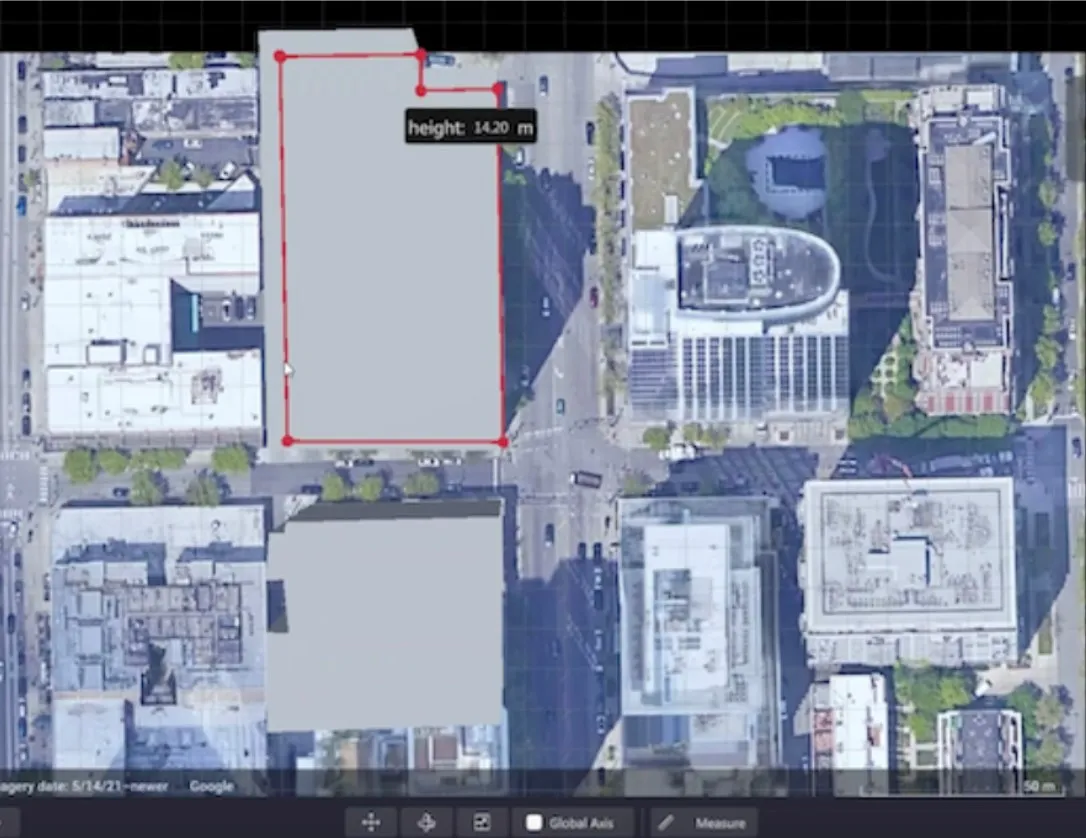
Users can insert their own scenes as a background by using built-in tools for modifying 3D shapes

Lidar specialist Outsight has launched a 3D Lidar simulation tool to help customers answer fundamental questions about deployment.

Deciding which and how many Lidars to use, and working out the best locations for them in terms of height, position and orientation, are among the issues the new tool is designed to overcome.

Users can make up their own simulation and environment to choose the best setting for achieving your performance and functionality goals, anticipating performance depending on each set-up and use case.  .

Outsight sought feedback on its beta version "from more than 300 early customers from various contexts, applications and countries".

It points out there is no need to install any software - users simply connect to their Outsight Cloud account, or request access if they do not already have one. 

Users can browse a list of compatible Lidars and select the right model or combination of models from different manufacturers (e.g. 360º FoV, Narrow Field of View, Dome).

You can find the optimal Lidar coverage by testing different options and coverage levels, establishing the best trade-off between performance, hardware cost and complexity, Outsight says.

It is possible to insert your own scenes as a background by using built-in tools for modifying 3D shapes.

For more information on companies in this article

Related Content

  • Closer cooperation between ASECAP and the GSA
    May 30, 2012
    ASECAP (the European Association of Operators of Tolled Road Infrastructures) and the European GNSS Agency (GSA) have announced they are stepping up their cooperation and will examine together the potential and the use of GNSS applications in motorway operations. The 40th ASECAP Study and Information Days, which ends today in Turin, Italy, provided an important opportunity to examine the common ground between the GSA’s support for the use of European GNSS in road transport to improve traffic management and
  • GM pledges 40,000 EV chargers in US & Canada
    November 10, 2021
    Meanwhile Connected Kerb says it will deploy £1.9bn worth of chargers across UK by 2030
  • Otonomo and AWS aid CV data transfer
    December 3, 2021
    New customer cloud services build on Otonomo's membership of AWS partner network
  • Econolite introduces cloud-based signal performance solution
    July 31, 2017
    Econolite has launched Centracs Signal Performance Measures (SPM), a cloud-based high-resolution traffic data collection and analytics software solution designed to improve traffic signal optimisation and continuous monitoring. It has been developed in support of the fourth round of the Every Day Counts (EDC-4) program of the US Federal Highway Administration (FHWA) that encourages implementation of automated traffic signal performance measures as a means to optimise traffic signal coordination and programm