Outsight introduces 3D Lidar simulator

New tool allows customers to work out what kit and coverage - and cost - they require
By Adam Hill November 17, 2022 Read time: 2 mins
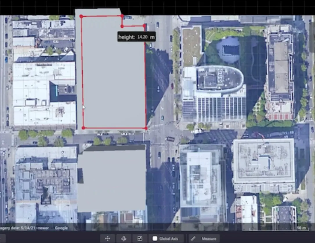
Users can insert their own scenes as a background by using built-in tools for modifying 3D shapes

Lidar specialist Outsight has launched a 3D Lidar simulation tool to help customers answer fundamental questions about deployment.

Deciding which and how many Lidars to use, and working out the best locations for them in terms of height, position and orientation, are among the issues the new tool is designed to overcome.

Users can make up their own simulation and environment to choose the best setting for achieving your performance and functionality goals, anticipating performance depending on each set-up and use case.  .

Outsight sought feedback on its beta version "from more than 300 early customers from various contexts, applications and countries".

It points out there is no need to install any software - users simply connect to their Outsight Cloud account, or request access if they do not already have one. 

Users can browse a list of compatible Lidars and select the right model or combination of models from different manufacturers (e.g. 360º FoV, Narrow Field of View, Dome).

You can find the optimal Lidar coverage by testing different options and coverage levels, establishing the best trade-off between performance, hardware cost and complexity, Outsight says.

It is possible to insert your own scenes as a background by using built-in tools for modifying 3D shapes.

For more information on companies in this article

Related Content

  • What's Next for Aimsun?
    October 4, 2023
    Aimsun is switching strategy from being a pure software firm to one that is focused on outcomes. The company’s CEO Alexandre Torday talks to Adam Hill and explains why
  • Esri ArcGIS Online and Data Appliance to use Navteq North America and Europe maps
    March 23, 2012
    Navteq has announced that North America and Europe coverage is now available on Esri ArcGIS Online and Data Appliance. Last summer, Esri launched Navteq map coverage for Australia, New Zealand, Brazil, Colombia, Venezuela, Chile and Argentina on ArcGIS Online.
  • Internet-connected cars their functionality and safety challenges
    February 27, 2013
    Internet-connected cars are poised to flood the market in the near future. Pete Goldin considers the functionality they offer, the technology they use and the challenge they represent in terms of driver safety. Many vehicles on the road today offer some sort of inter­net connectivity and experts agree that this capability will become a competi­tive differentiator in the automotive industry in the next few years. The era of the digital vehicle, it seems, has started. “We clearly see that cars in the near f
  • Cloud computing technology benefits GIS
    July 17, 2012
    Geographic Information Systems are a relatively late adopter of cloud computing,but the benefits of host services for geospatial data and analysis are becoming clear. Jason Barnes reports Both the concept and the reality of cloud computing have been around for some time. More and more industry sectors are entrusting external service providers with the provision of their computing services via the internet. However, the Geographic Information System (GIS) industry has been slow to embrace the trend. This is