Openvia deploys Valerann traffic platform in Virginia

Lanternn by Valerann monitors arterials leading to Pocahontas Parkway near Richmond
By Adam Hill June 14, 2023 Read time: 2 mins
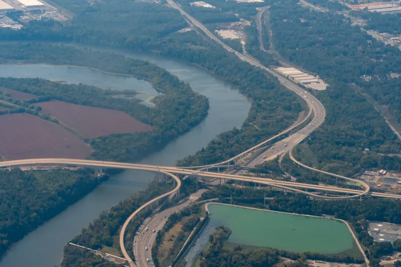
I-95 and the Vietnam Veterans Memorial Bridge on Pocahontas Parkway I-895 (© John Mcadorey | Dreamstime.com)

Openvia, part of Globalvia Group, has deployed Valerann's AI traffic monitoring system on the Pocahontas Parkway in Virginia, US.

Lanternn by Valerann (LbV) is being used on the 10-mile toll road which runs south-east of Virginia's state capital, Richmond, connecting Interstate 95, State Route150 and Richmond International Airport.

The companies say it will "help increase traffic safety and efficiency on the Vietnam Veterans Memorial Bridge, which is prone to high winds and fog, and manage motorway congestion by monitoring the arterials leading to Pocahontas Parkway".

The deal - part of Openvia’s NeoRoads programme - includes the installation of 25 mobile and 20 fixed cameras and integration with existing ITS in the concession.

LbV is designed to provide real-time traffic information beyond the cameras' vision coverage - taking data from multiple sources including Waze, Google Maps, concessionaire units, cameras and GPS - and thus boost safety, improve traffic flow and cut response times in the event of an incident.

Michael Vardi, CBO and co-founder of Valerann, says "Our cutting-edge technology will enable the concessionaire to efficiently manage traffic congestion, improve safety on this vital road network and inform users of relevant information during the trip. We are excited to see the positive impact it will have on the community." 

Fernando Vallejo, Openvia CEO, says: "Our commitment to innovation in the transportation sector is unwavering, and this deployment is a testament to our dedication to improving the driving experience for motorists."

For more information on companies in this article

Related Content

  • Travel data critical to traffic management, traveller information
    January 31, 2012
    The ability to bundle together travel data from several discrete sources and fuse it to give a more comprehensive overview of events to stakeholders is the key aim of Viajeo, which is conducting trials in several cities around the world. Here, Ertico's Yanying Li writes about the project in more detail
  • Crowd-sourced data feed enhances traffic monitoring
    November 20, 2012
    In the US, NaviGAtor 511, Georgia’s traveller information system, has partnered with Waze to provide enhanced traffic information. Waze, a crowd-sourced social GPS and real-time traffic application for smartphones and Android phones, will provide enhanced traffic data to the current 511 system, and create a special 511 user group, specifically for Georgia travelers, within the existing Waze mobile app. The arrangement was provided for under an existing marketing contract with Iteris, the firm that has opera
  • Intergraph to design traffic monitoring system for US highway 407 concession
    May 29, 2015
    Information technology provider Intergraph has been awarded a contract by the 407 ETR Concession Company (407 ETR), the concessionaire of Highway 407 ETR in Toronto, Ontario, to design and implement an integrated traffic monitoring system to provide the Highway Operations group with real-time spatial information of incidents on the Ontario highway.
  • ITS UK Awards 2023: and the winners are...
    November 2, 2023
    Schemes and products included Software as a Service, active travel and urban air mobility